Collaboration Advances Cumulative Effects Management on North Coast

Warren Bolton, photo credit Quinton Ball

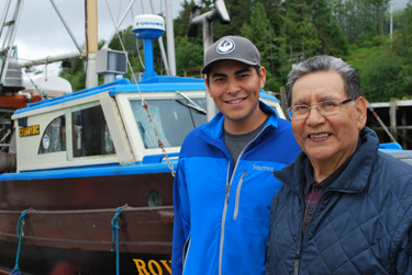
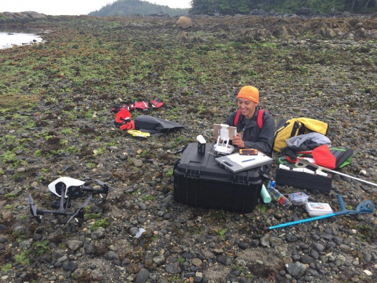
DEVELOPING LOCAL EXPERTISE: Warren Bolton, a Kitsumkalum band member, GIS technician, and drone operator, undertakes eelgrass survey work near Ridley Island on the North Coast. Bolton’s involvement with MaPP’s CE project dovetailed perfectly with formal studies in the sciences. Photo credit: Quinton Ball

Marine plan implementation on the North Coast is getting a boost thanks to collaboration between the Marine Plan Partnership (MaPP) and the North Coast Environmental Stewardship Initiative (ESI) —a B.C. government initiative that was created to address First Nations’ environmental concerns around resource development.

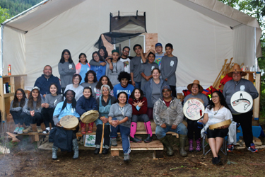
In 2017, the two groups informally merged into one team to accomplish a shared goal: Technically build out and fully implement a cumulative effects framework to monitor, assess, and manage the impacts of industrial and non-industrial development on the North Coast. Cumulative effects are the changes in environmental, social, economic, health and cultural values as a result of the combined effect of present, past and reasonably foreseeable human actions or natural events (MaPP, 2016). The project team includes representation from North Coast First Nations (Gitga’at, Gitxaala, Haisla, Kitselas, Kitsumkalum, and Metlakatla) and the Province of B.C.

A convergence of MaPP and ESI work on cumulative effects on the North Coast began in 2015. MaPP had already begun implementing its North Coast Marine Plan. Federal agencies (such as Environment and Climate Change Canada, Fisheries and Oceans Canada, and the Impact Assessment Agency of Canada) and provincial resource ministries (such as the Ministry of Energy, Mines and Low Carbon Innovation and the Ministry of Forests, Lands, Natural Resource Operations and Rural Development) were responding to the need for cumulative effects monitoring and deeper involvement of First Nations in decisions about coastal development projects—particularly, liquefied natural gas. With so many of the same people involved in related discussions, it made sense to bring them together.

Maya Paul, Program Director of Cumulative Effects Strategic Initiatives for the North Coast-Skeena First Nations Stewardship Society, co-manages the integrated MaPP and ESI North Coast Cumulative Effects Program. According to Paul, a key consideration for the North Coast Nations’ engagement in monitoring and assessment projects was their desire for the work to lead to decision-making and action. “North Coast First Nations knew cumulative effects were important but were approaching it independently. They knew they needed to work together, and with other governments, to achieve stronger and more meaningful outcomes.”

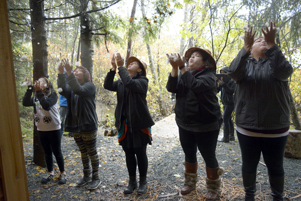
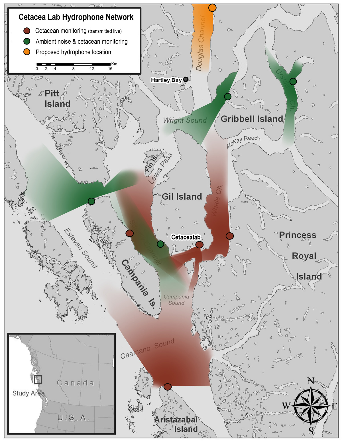
Team members are thoughtfully incorporating relevant learnings to support monitoring, assessment, and management of cumulative effects on core values of common importance. They’re currently focused on four values that were prioritised as a starting point: Aquatic Habitats (Estuaries, with a focus on the Skeena Estuary); Salmon; Food Security (with a focus on harvested foods); and Access to Resources (for social and cultural uses). Rebecca Martone, a provincial marine biologist on the North Coast Cumulative Effects project team, notes how important it is to assess interconnected indicators for the values they’re working on. “By developing and selecting indicators in parallel for habitats, key species, cultural values, and human wellbeing, we really start to understand the complexities in the methodologies required to assess cumulative effects, and how indicators can inform more than one value and thus create efficiencies for how those factors are considered in decision-making.”

Marine biodiversity photo credit Maya Paul

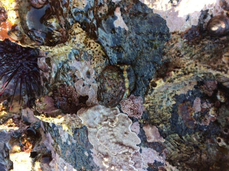
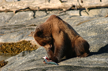
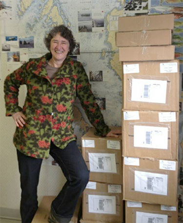
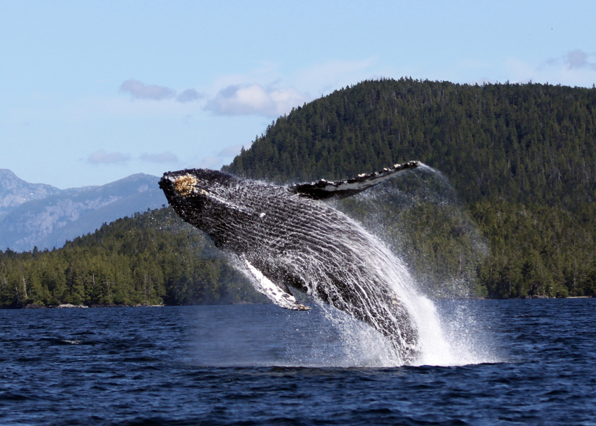
MARINE BIODIVERSITY IN THE NORTH COAST: Abalone, otherwise known as sea snails, are a species at risk of extinction and are just one of many marine species that rely on healthy kelp forests in the North Coast. Photo credit: Maya Paul

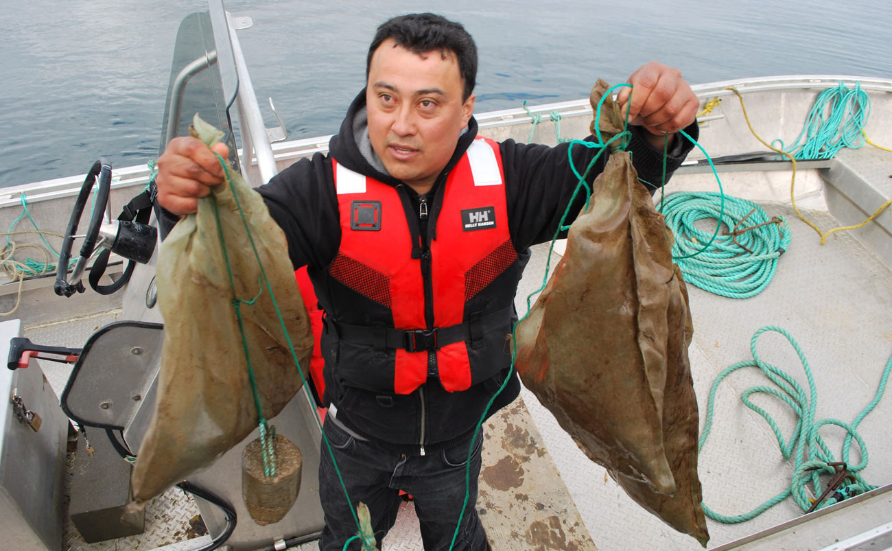
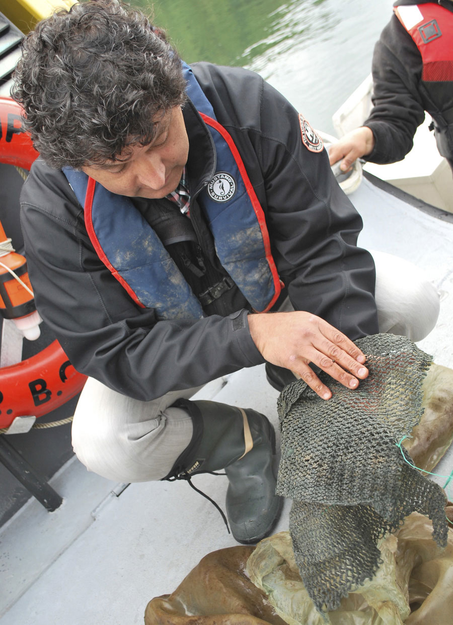
Continued effort and dedication of team members has resulted in steady progress on each of the values. For example, a North Coast data management system has been developed to enable project team members to contribute, house, aggregate, analyze, and visualise a wide range of regional monitoring data to support decision-making. In addition to identifying a suite of indicators for the Aquatic Habitats (Estuaries) and Food Security & Access to Resources values, the Project Team has developed protocols that will set the procedures and standards for conducting assessments of the condition of the value now and in the future. They’ve developed a suite of indicators and implemented a survey to gather insights from North Coast First Nations community members on the Food Security & Access to Resources values. Quinton Ball, a Terrace-based environmental scientist contracted by Kitsumkalum Nation, explains: “Good indicators should serve as meaningful metrics that can be used to measure and understand change and enable affordable collection of standardised data that are useful for a variety of purposes.” Adds Ball, “Good indicators reveal important changes before we notice them.”

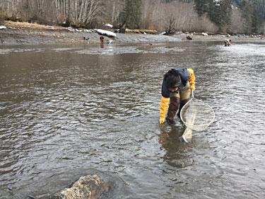
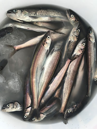
A current condition assessment of the Skeena Estuary value and a cumulative effects assessment of Food Security & Access to Resources values were completed in early 2021, which led to the development of a suite of interim recommendations that the team has begun to implement this year. A field monitoring project, designed to support assessment of the Skeena estuary, is now into its fifth year. The field program has realized many accomplishments, including training and engaging First Nations technicians in the marine environment, leveraging and building capacity in First Nations’ stewardship offices and improving the effectiveness of monitoring by utilising local knowledge in the design of the program. This has resulted in the collection of four years of data to serve as a beginning baseline for assessments. The team has also framed the scope of the initial assessment of the salmon value and began work on it at the end of 2020.

Heather Johnston, with the Environmental Stewardship Initiative Branch of the Ministry of Energy, Mines, and Low Carbon Innovation, co-manages the integrated Cumulative Effects program. She feels the project’s value extends far beyond the North Coast region. “It’s part of implementing the UN Declaration on the Rights of Indigenous Peoples, where First Nations have a real say in what’s going on in their traditional territories.”

Members of the North Coast Cumulative Effects Project team speak highly of each other’s qualifications and commitment to the work. “The level of professionalism and desire among agencies to collaborate—I just don’t think it’s been done at this level before,” says Ball. And Ball loves seeing new passions for science ignited among First Nations community members who get involved in monitoring work and then go on to explore science-related careers.

Development in NC photo credit Maya Paul

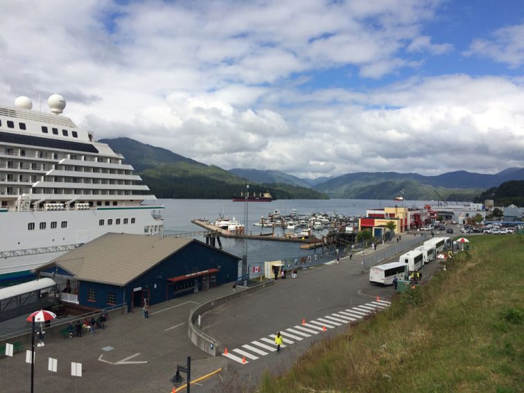
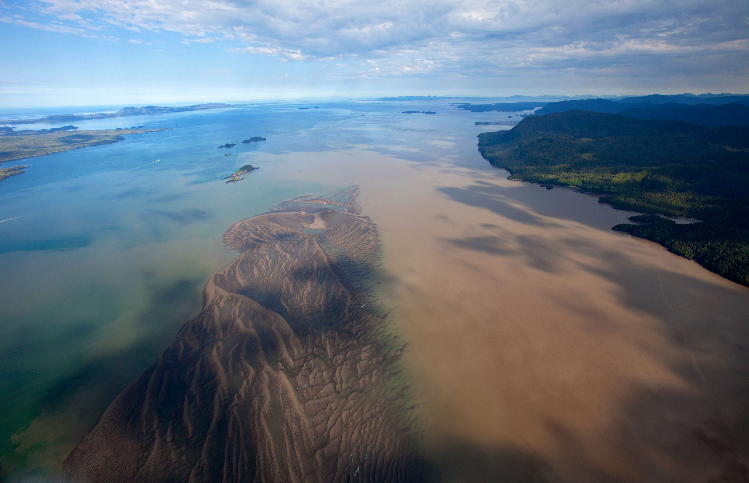
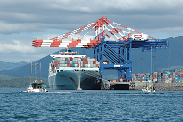
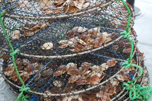
DEVELOPMENT IN THE NORTH COAST: Sustainable economic development in the North Coast is just one of the priorities being addressed through collaborative efforts between the Province of B.C. and several North Coast First Nations, through the Marine Plan Partnership (MaPP) and the North
Coast Environmental Stewardship Initiative (ESI). Photo credit: Maya Paul

First Nations Students in the North Coast Help Rehabilitate a Lost Creek, Learn to Fish, and Jar Salmon

Two students and three staff from ‘Na Aksa Gyilak’yoo School blow eagle down to bless a new smokehouse.

Two students and three staff from ‘Na Aksa Gyilak’yoo School blow eagle down to bless a new smokehouse. The smokehouse is used to preserve food such as eulachon, a traditionally important fish. In the background, two media arts students record the event, and a once-dry creek bed teems with water.

In the midst of cultural revitalization program for First Nations students near Terrace, B.C., a dry, trash-ridden creek bed was transformed into a stream of fresh mountain run-off. As part of the program funded in part by the Marine Plan Partnership (MaPP), students from ‘Na Aksa Gyilak’yoo School in Kitsumkalum, B.C., cleared garbage from the creek bed next to their school and led a traditional blessing of a nearby new smokehouse.

Immediately following the blessing, a surge of water came down from the mountains, recalled school principal Colleen Austin. She said water filled the creek that empties into the Skeena River, one of B.C.’s major salmon migration routes.

“It wasn’t even a trickle” said Austin. “It was an absolutely incredible rush of water.”

There had never been significant water in ‘Na Aksa Gyilak’yoo Creek in the 14 years she’s been at the school, Austin said. People used to hang out in the forest next to it, she said, and the rocky bed was strewn with litter.

“We believe, and we’ve always maintained, that when we respect the land, the water, the air, the trees, and everything around us, that we will be blessed,” said Austin, when asked how she explained the creek’s revival. Austin, whose Tsimshian name is ‘Wii Goot, which means Big Heart, said the creek continued to run with water for several months, and despite being dry in October 2018, she believes the creek is likely to run again, and one day may be viable enough for salmon to spawn up it, as they traditionally did before the area became polluted.

Sixty students from the school, ranging from kindergartners to Grade 12, participated in the Youth Cultural Revitalization Program, a $10,000 project funded by MaPP. The students’ backgrounds included Tsimshian, Nisga’a, Haida, and several other First Nations ancestries. The program was divided into four seasonal units, and included lessons on environmental stewardship and Sm’algyax, a critically endangered Tsimshian language. The school’s language co-ordinator, Mique’l Dangeli, who is fluent in Sm’algyax, led the programming, with others, including Nisga’a elder Larry Derrick, and John Blumhagen, a Tsimshian education assistant at the school.

The first unit of study in the summer of 2017 focused on salmon, including the decline of local species with environmental changes, how to ensure the return of salmon, as well as its cultural significance. Students fished for salmon on the Skeena River, and cleaned, filleted, and jarred the fish.

The second unit of study, in October 2017, was centred on the school’s recently built smokehouse, where food is traditionally preserved. The students cleared debris from the woods around the smokehouse and from the adjacent then-dry creek bed. They learned how to lead a blessing of the smokehouse, including with singing, dancing, and traditional uses of cedar branches, eagle down, and fire. About 90 members of the school’s larger community, including parents, grandparents, teachers, and local residents joined the event.

“It was pouring rain the day before and up until the blessing. The rain completely stopped and the sun was shining for actual blessing. Then it poured again afterwards,” Austin said, laughing. When the water began rushing over the rocks that day, the adults in attendance were all in shock and disbelief, Austin said, adding some are still in disbelief. “And obviously we were thrilled.”

The third unit, in January and February of 2018, focused on Tsimshian and Nisga’a astronomy, including reading the relationship between ocean tides and the position of the moon to predict a season’s bounty.

And, in March of 2018, students dip-netted in the Skeena River for eulachon, oily smelt that are about the length of one’s hand and traditionally vital to coastal First Nations. Eulachon populations have declined coast-wide, and are listed as a species of ‘special concern’. While the students were not successful catching them, they received some as a gift and learned how to smoke the fish in the school’s smokehouse.

“The students loved being part of this project,” Austin said, noting that it helped build mentorship between students of different ages, build skills, and it connected students to their elders. She said students who may have run ATVs over the forest or thrown litter on the ground, are now working with elders to pick tea and berries, clean fish, and properly dispose of fish remains.

“They wanted more,” Austin said of the students in the program, who comprised most of the student body of ‘Na Aksa Gyilak’yoo School.

Haisla Camp Connects Youth with their Culture

A new camping area was cleared and platforms built for the 2017 Haisla Cultural Camp. Photo credit: Brenda Bouzane.

A new camping area was cleared and platforms built for the 2017 Haisla Cultural Camp. Photo credit: Brenda Bouzane.

Located just half an hour from Kitimat, Weewanie Hot Springs Park is a completely different world than most of us inhabit. Accessible only by water, it is a remote wilderness destination where Xbox and iPads know no purpose. It was also home to 17 Haisla youth for 10 days last summer as they participated in the Haisla Nation’s revived cultural camp. The focus of the camp, which was made possible by the Haisla Nation Council and funded in part by MaPP, was to teach participants about Haisla culture and to be respectful of Haisla resources.

MaPP’s North Coast Marine Plan encourages capacity building in First Nations and local communities. An important first step for greater participation in stewardship, monitoring and enforcement, and economic development activities is to teach youth the skills they need in order to participate effectively and contribute to sustainable development in their communities.

Bea Wilson teaching the youth how to cut salmon in a way that none of the fish is wasted. Photo credit: Brenda Bouzane.

Bea Wilson teaching the youth how to cut salmon in a way that none of the fish is wasted. Photo credit: Brenda Bouzane.

“We struggle with capacity building in the areas of self-governance and environmental stewardship; we don’t have enough people with those skills right now and there’s a need for more youth recruits,” said Mike Jacobs, the Haisla Nation’s fisheries manager and one of the camp’s organizers. “The camp was an immersive experience and exposed youth to Haisla culture through the traditional use of natural resources.”

Each day participants learned traditional practices such as canoeing, crab fishing and long lining for halibut. They processed fish and ate traditional foods. Daily hikes allowed for exploration including along hereditary trap lines. The community cultural coordinator with the Haisla Nation gave a language lesson while another guest taught cedar weaving.

Another camp highlight was a visit from Shelley Bolton and Terry Nyce from the Spirit of Kitlope dance group, who taught the youth traditional drumming songs and dances.

Guests from Spirit of the Kitlope dance group taught the youth traditional drumming songs. Photo credit: Brenda Bouzane.

Guests from Spirit of the Kitlope dance group taught the youth traditional drumming songs. Photo credit: Brenda Bouzane.

The youth were empowered by learning about their culture. Photo credit: Brenda Bouzane.

The youth were empowered by learning about their culture. Photo credit: Brenda Bouzane.

“Everyone made a drum to keep and all the youth took part in the singing,” said Shelley. “Some dove right into it, while others took a while to come out of their shells. By the end, though, they couldn’t get enough. Nowadays our lives are so full of technology. This camp showed the youth that they can enjoy themselves without TV. It was such a great experience and I hope more youth will embrace opportunities to connect with nature and our culture.”

“We don’t have the opportunities to pull crab traps or to be out on the land like we used to,” said Angie Maitland, an early child education coordinator with the Haisla Nation who was another of the camp’s organizers. “The camp changed that. All 17 participants want to go again and they made long-lasting friendships. Everyone grew from the experience, including staff.”

“It was a life-changing opportunity,” added Mike. “The youth didn’t know these resources were right on their doorstep. Familiarizing them with their territory is a high priority for the Haisla Nation Council. People have become disconnected from resource management. Our intent is to offer more camps and to broaden the age range. We want to reconnect youth in a way that will bring them happiness and prosperity.”

Youth learned how to weave cedar. Photo credit: Brenda Bouzane.

Youth learned how to weave cedar. Photo credit: Brenda Bouzane.

Hanging salmon in the smokehouse. Youth made half-dried salmon and t’los, a fish jerky. Photo credit: Brenda Bouzane.

Hanging salmon in the smokehouse. Youth made half-dried salmon and t’los, a fish jerky. Photo credit: Brenda Bouzane.

Some of the canned salmon the youth prepared. Photo credit: Brenda Bouzane.

Some of the canned salmon the youth prepared. Photo credit: Brenda Bouzane.

A group shot from the Haisla Youth Camp, showing the youth, support staff, and members of the Spirit of Kitlope dance group. Photo credit: Brenda Bouzane.

A group shot from the Haisla Youth Camp, showing the youth, support staff, and members of the Spirit of Kitlope dance group. Photo credit: Brenda Bouzane.

At the mouth of the Skeena: A unique estuary

Tidal mudflats and shallow intertidal passages in the Skeena Estuary provide vital habitat for fish and birds. Photo credit: Brian Huntington.

Tidal mudflats and shallow intertidal passages in the Skeena Estuary provide vital habitat for fish and birds. Photo credit: Brian Huntington.

Originating high in the coastal mountains of northwestern British Columbia, the Skeena is the second largest river in the province and one of the world’s longest undammed waterways. It winds 610 kilometres from its headwaters to its rich estuary near Prince Rupert.

The mouth of the Skeena is a world onto itself. Unlike most estuaries, the Skeena does not have a single distinct intertidal delta. Instead, sediments from the river are deposited in shoals along the lower river and channels that connect the estuary to the open ocean. The result: a region of extensive mudflats and shallow intertidal passages. Here, eelgrass beds and kelp forests so vital to the health of other species flourish. The area supports some of the largest fish populations on the coast and it is a critical waterfowl habitat. All Skeena salmon spend part of their life in the estuary and depend on its health as juveniles and as returning adults. The Skeena Mouth is important to the region’s First Nations and includes ancient village sites, harvesting areas and sacred places. With its natural beauty and abundant wildlife, it is also a great spot for ecotourism.

First Nations harvesting eulachon on the Skeena River. Photo credit: Penny White.

First Nations harvesting eulachon on the Skeena River. Photo credit: Penny White.

To help protect this “super habitat,” the Province of British Columbia and First Nations in the North Coast plan area, represented by the North Coast-Skeena First Nations Stewardship Society (NCSFNSS), identified the mouth of the Skeena River as a protection management zone (PMZ). Land use decisions consistent with the recommendations in the North Coast Marine Plan will help ensure the sustainability of this unusually productive and complex ecosystem that is so important for a number of culturally, recreationally and economically important marine species.

One such species in particular has an important role in nature and culture: eulachon. These small ocean fish return to the estuary at the end of every winter and, while their lack of commercial value means little research has been undertaken, their value to the area’s First Nations people is immeasurable. To this day eulachon are an important part of indigenous communities’ diets.

The eulachon run attracts other species like sea lions and gulls to the Skeena River to feed. Photo credit: Allison Paul.

The eulachon run attracts other species like sea lions and gulls to the Skeena River to feed. Photo credit: Allison Paul.

“The eulachon run is one of the first signs of spring along the Skeena,” says Penny White, a fisheries biologist with NCSFNSS, which helps coordinate the monitoring efforts for the eulachon harvest. “After a long winter, eulachon were often the first fresh food available and were relied upon for their nutritional value.”

She adds, “The run this year was extremely late; we didn’t see any eulachon until March. We were worried they wouldn’t come at all but, when they arrived, life on the river exploded. It’s an amazing sight with thousands of gulls, seals and sea lions all following the fish.”

Penny talks with fishermen and elders along the river to get an estimate of the eulachon run, how much each person harvests, who they are fishing with and how long it takes fishermen to get enough fish for themselves and those they share with.

A bucket of eulachon on ice. Photo credit: Penny White.

A bucket of eulachon on ice. Photo credit: Penny White.

MaPP identifies the importance for First Nations to have access to traditional foods and recognizes the value of protecting the variety and quantity of marine resources for First Nations use. It considers data on food security needs and First Nations use when selecting areas for protection. “Food security is a big issue our Nations are facing and it’s a priority for NCSFNSS,” says Penny.

The best way to understand the cultural, biological and economic importance of the Skeena Estuary is to get to know it. After a short visit, you may become inspired to participate in efforts to enhance stewardship of this truly unique coastal habitat to ensure future generations can enjoy all that it has to offer.

NCSFNSS fisheries biologist Penny White. Photo credit: Penny White.

NCSFNSS fisheries biologist Penny White. Photo credit: Penny White.

Tracking cumulative effects

Maya Paul

Maya Paul, North Coast cumulative effects coordinator. Photo credit: Maya Paul.

Growing up in the rolling savannah of Botswana in southern Africa, Maya Paul could never have imagined that she would one day find herself living amid the rain forests of British Columbia’s north coast. Yet that’s exactly where her expertise in strategic planning and engagement has led her.

In January 2016, Maya was appointed cumulative effects coordinator for the North Coast MaPP sub-region, working on behalf of both the North Coast Skeena First Nations Stewardship Society and the Province of B.C. “My role is to coordinate the collaborative development and implementation of a MaPP cumulative effects framework in the North Coast,” she says.

container ship

Container traffic in Prince Rupert has increased at a faster pace than any other North American port. Photo credit: Maya Paul.

Cumulative effects are changes to environmental, social and economic values that are caused by the combined effects of past, present and reasonable foreseeable actions or events. Maya has the task of coordinating the development of a framework that accounts for changes to core marine values from human activities on a large stretch of coastline in northern B.C. that includes First Nations communities and the bustling hubs of Prince Rupert, Terrace and Kitimat. Development is being proposed at a rapid pace in the region and Paul hopes to pinpoint the major concerns of coastal communities around effects on core values from the rush of new projects, several of which are still in the midst of environmental assessments.

“A key component of the framework we are developing involves defining the core values of people in these communities,” notes Maya. “Once we identify the core values we have to establish indicators for those values, prioritize them, create a monitoring system, and then try to anticipate how those core values might change over time.”

NC bear salmon

Understanding core values is a key component of cumulative effects assessment. Photo credit: Birgitte Bartlett.

Although core values can be basic things like clean water, clean air and healthy food, her work also addresses the effect of development on socio-cultural and economic values, which can be harder to define. “For example, First Nations worry that their access to traditional resources will change from impacts to the health and quality of their seafood, socioeconomic impediments, or access to the harvest areas,” explains Maya. The framework is intended to guide management and regulatory processes in order to improve the stewardship of coastal and marine ecosystems and resources, and the human well-being of coastal communities. “Ultimately, the goal is to sustain the core coastal and marine values over the long run.”

The theme of sustainability has been a major driver in Maya’s life since she left Africa and attended the University of Guelph in Ontario where she earned a Master of Science in Environmental and Resource Economics. She also holds a Bachelor of Science in Environmental Science.

dock net

Calculating cumulative effects in marine ecosystems is challenging because values and impacts often cross jurisdictional boundaries. Photo credit: Allison Paul.

The MaPP governance structure established to implement the North Coast Marine Plan is unique in that it involves a collaborative working arrangement between two governments: provincial and First Nations. Creating clean lines of communications between the two camps is at the crux of Maya’s work. “I love bringing people together to ensure sustainability. It’s all about working collaboratively. You can’t accomplish anything enduring unless you bring the different decision-making groups together to sit in the same room and collaborate.”

“The cumulative effects framework that is developed by the MaPP partners here will inform the partners’ approach to stewardship on the North Coast moving into the future,” explains Maya. “We expect it to be a living document.”

Download A Framework for the Assessment and Management of Cumulative Effects on the North Pacific Coast.

halibut dry

Natural resources of the North Coast have high cultural significance to the residents. Photo credit: Maya Paul.

How First Nations use Cedar in the digital age

Rina Gemeinhardt with boxes of paperwork from one project referral

Rina Gemeinhardt with boxes of paperwork from one project referral

Rina Gemeinhardt’s work towers over her. The eight-foot stack of boxes in the Kitsumkalum First Nation referrals office contains paperwork for just one stage of one project.  It’s only one of some 20 marine- or land-use applications that are referred each month to the Kitsumkalum by the Province of British Columbia and proponents.

With traditional territory that includes Terrace and Prince Rupert, the Kitsumkalum are responding to some 14 major projects underway or proposed in the North Coast region, several of them related to LNG development.

Back in fall 2012, when Gemeinhardt started her job as referrals and consultation specialist, she was shown an empty office with a computer but no digital or hard-copy records. She quickly realized she needed to establish a system to record and catalogue all the new referrals-related activity. With many project proposals in the works, a requirement to track engagement and a wide spectrum of people involved in the process including chiefs, counselors, colleagues and community members, she needed help with information management.

Enter Cedar, a web-based software program spearheaded by Coastal First Nations to address First Nations’ information management related to the referrals process.

Referrals come from provincial ministries or agencies and relate to development applications on Crown land that may have an impact on a First Nation’s territorial land or resources. Areas of impact could involve archeological sites, ecological sensitivities, traditional uses or economic benefits.

A development application could involve anything from a bike trail to marine dredging to a major infrastructure project. First Nations response could be a quick “no concerns here” or could involve commissioning reports from technical experts, conferring with other First Nations with overlapping territories and/or back and forth with the Province or project proponent.

Cedar helps staff log, analyze and respond to Crown land referrals and keeps track of email, mail and phone correspondence. It was developed by GeoMemes and piloted by the Metlakatla First Nation where it has created efficiencies in organization, tracking and filing. The Cedar program continues to evolve to address First Nations’ needs.

“Our chief was obviously hugely busy, especially with this LNG stuff,” explains Gemeinhardt. “So he said, ‘What I really need is a button.’” So the programmers developed a Chief Dashboard. “It helps somebody who is not super tech savvy and who needs condensed, up-to-date information,” she explains. “So, now the Chief’s Dashboard is where our chief can go to easily drill down for information on a specific project, or quickly get a summary.”

In addition, because the program is a collaborative, web-based tool, several people can work on it at the same time with secure access from remote locations.

The latest version of Cedar will include a spatial or mapping component. This will allow referrals offices to produce maps to illustrate data that might be important to an application such as proposed marine protected areas. The MaPP Marine Planning Portal has over 250 data layers the may help to populate this iteration of Cedar.

When Cedar first arrived in her office four months ago, Gemeinhardt was a little overwhelmed at the prospect of learning a new program, getting buy-in from all potential users and hiring and training someone to input the data. But that feeling has passed. “Now it’s just excitement,” says Gemeinhardt. “I’m thinking, oh man, this could be built upon and built upon and totally made to fit us.”

Grandfather Handshake and Big Fish – Two Generations Protect a Way of Life

grandfather1_w375

James Russell (left) and Clarence Nelson

Chief Sm’ooygit Niist’oyx, or “Grandfather Handshake”, is a hereditary chief of the Gitwilgyoots tribe, one of the nine allied tribes of the Coast Tsimshian who live near the lower Skeena River on B.C.’s north coast. His given name is Clarence Nelson. He is a traditional and commercial fisherman, a member of many community committees and a well-read lover of local, First Nations and maritime history. He is also proud to be a mentor of young people who are interested in learning to fish for a living.

Since before contact, Nelson’s people have lived in the region close to what is now known as Prince Rupert. Every summer they travelled to prime fishing and hunting grounds and returned to the village of Metlakatla for the winter. “Metlakatla had its own First Nations name –Tbuunom Galtsap. It means ‘place of plenty’. When you lived there you never ran out of food,” Nelson says.

Today the resources provided by the land and the sea are still very important to the First Nations people of Metlakatla. Nelson says marine planning helps to identify the type and location of the different sea resources and habitats and which ones might require protection. He refers to abalone, which hasn’t been harvested for many years. “My grandchildren haven’t had a taste of abalone. They can only see it in a picture. And if we don’t manage the rest of the resources, that’s what’s going to happen to everything,” he says.

For Nelson marine planning is “… for future generations, my grandchildren, so at least they’ll get an opportunity to eat what I’m eating today.”

Nelson’s grandson, James Russell, recently graduated from Vancouver Island University with a degree in Natural Resource Protection. Now he works with Lax Kw’alaams natural resource department in Port Simpson. His grandfather proudly explains the history of Russell’s First Nations name, Wiihoon, which means ‘plentiful or big fish, abundance’: “He’s from the Nagunaks tribe, the undersea world. He was given the hereditary name because he loves being on the water and fishing all the time.”

It is a challenging and changing time for young people on the North Coast. As new developments bring different opportunities, it’s even more important to remember and protect the traditional way of life.

“We’re trying to find a happy medium where we can take advantage of future opportunities and keep on going with what we’ve been doing for generations,” Russell says.

Hatching a new industry on the North Coast

NC-ShellfishFarmProduction-Manager

Shellfish farm production manager, Leo Vargas, with bags of scallop spats, also known as settled larvae.

Canadian waters, Chilean technology, and First Nations and Chinese investment are all contributing to the success of the Coastal Shellfish Corporation in Prince Rupert.

With a modern shellfish hatchery built in Prince Rupert and a shellfish farm in Metlakatla traditional territory, Coastal Shellfish hatches, grows and harvests scallops with minimal environmental impact.

Originally planned as an economic development opportunity in 2003, the hatchery launched as a pilot project in 2011 and had a few growing pains before its current success. Coastal Shellfish is now on track to becoming one of the biggest shellfish aquaculture operations in B.C.

Operations vice president, Vittorio Venturini, checks scallop spats on setting nets.

Operations vice president, Vittorio Venturini, checks scallop spats on setting nets.

Operations vice president Vittorio Venturini says that the water quality of the North Coast provides a huge advantage. “Up north, conditions are very good for shellfish farming. We have oceanic water coming in so that’s a good reason to have our farm here.” The challenge, he admits, is that logistics are harder to manage far from a large population base. But the company has a state-of-the-art hatchery in Prince Rupert, farm sites in Metlakatla territory, and plans to be processing scallops in Prince Rupert late this year. The scallop production cycle target is 24 months or less.

There’s big demand in the U.S. and Canada for scallops and there’s a shortage of product, according to Venturini. While most of the shellfish industry in the province generally uses rafts for farming, Venturini has perfected the less expensive, more efficient long lines typically used in Chile for large-scale shellfish farms. “A large farm requires an efficient system,” he says. “Lines sit under the water rather than on the surface, being more cost-effective, more environmentally friendly and safer than rafts.”

With its partners – the Metlakatla First Nation, the Coastal First Nations through its Great Bear Initiative and (Chinese) Canada Blossom – Coastal Shellfish expects to create 50 to 60 new jobs within the next few years. Coastal Shellfish plans to farm other species as well – perhaps geoduck and sea cucumber. “We’re already making some trials with other species,” Venturini says.

NC-ShellfishCorpscallopsTHUMBCraig Outhet, who is co-lead of the North Coast MaPP sub-region planning process, says that the goal is to increase economic benefit while, at the same time, managing ecological impacts. “While MaPP supports the idea of shellfish aquaculture, it doesn’t mean the gates are wide open,” he notes. “We need to make sure these farms are managed right.”

But he’s confident the Prince Rupert operation is on the right track so far. “We’re working to find the holistic balance of the ecological, the human well-being and the governance,” he says. “You might think these things are at odds, but they’re not really.”

He particularly likes the way the MaPP process is looking ahead 20 years. “It’s a long-term planning process,” he says. “Regardless of what’s currently happening, we’re planning for the long term.”

The value of listening to the whales

whale-breaching

If biologist Janie Wray could persuade whale-watchers of any one principle, it would be this:

“Understand that while you’re having a whale experience, the whale is also having a human experience.”

The co-director of the Cetacealab, a whale research facility on Gil Island, on the North Coast of B.C., is all too familiar with the mistakes that insensitive whale-watchers make.

“The greatest one is getting in too close with their boat,” she says. “The distance between the boat and the whale should be at least 100 metres. And once you get within 400 meters, you should be going very, very slowly.”

She suggests that tourists observe how whales interact with other whales, to get the right idea. “Whales always make their approaches very slowly,” she says, emphasizing that departures require the same protocol. “Quiet and slow. Whales perceive their environment through sound in the same way humans use sight.”

cetacealab-hyrophone-networkWray and her partner Hermann Meuter have earned their knowledge of whales through years of observation. In the 1990s they worked at Orcalab, a land-based whale research station near Vancouver Island. In 2001, they established their current research station, Cetacea Lab, within Gitga’at territory on the North Coast.

“Chief Johnny Clifton loved the idea of there being a whale research station in their territory,” Wray recalls when describing the early days in which she and Meuter had to camp, in the rain.

Now that the two have built their own facility, along with a place to live, they have eight listening stations set up throughout the area. Each station has a hydrophone – an underwater microphone – allowing them to record the sounds of whales, and just about anything else.

“We also hear fish grunts,” says Wray. “Or shrimps making clicking sounds. Or waves crashing on the shore. If it rains really hard we can hear the sound of rain, and we hear the disturbance of boat noise.”

The hydrophones, which can cost as much as $10,000, are set up to run on solar- and wind-power batteries.

A veritable encyclopedia of whale information, Wray says there are roughly 250 northern resident killer whales, 300 transient killer whales and about 2,000 humpbacks along the B.C. coast, with more than 300 whale observations recorded by Cetacea Lab. But the most exciting development for her has been the relatively recent appearance of fin whales.

“We didn’t see our first fin whale until 2006,” she recalls, “with only a few sightings per year until 2010.” Now, she’s lucky enough to see a fin whale almost daily and she remains awed by their impressive size – up to 70 feet long. This makes them the second largest animal on the planet, next to the blue whale.

A strong believer in marine spatial planning, and a member of the MaPP North Coast Marine Plan Advisory Committee, Wray says her involvement in this group has taught her the importance of listening to others, even those with conflicting views. Her role remains clear: by sharing her knowledge of whale distribution and behaviour, she wants to ensure that whales have good human experiences.

“This coast needs a voice,” she says, “and I think that all of these people coming together right now provide that voice.”

Listen to live whale recordings from Cetacealab on Gill Island on B.C.’s North Coast

A30

Humpback Whale Song

Click here to listen to the whale recordings of the week