New MaPP Study Offers Meta-View of Climate Impacts

map-fisheries-infrastructure

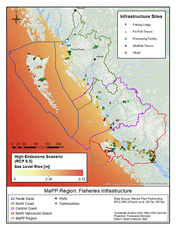
MaPP’s new Regional Climate Change Assessment study offers a bird’s-eye view of current projections of how climate change will play out across MaPP sub-regions. This map – one of dozens in the report – shows locations of First Nations fishing infrastructure in relationship to regional variations (up to 72 cm by the end of this century) in sea-level rise under a “high” scenario of global emissions. Source: “Regional Climate Change Assessment: Projected Climate Changes, Impacts and Recommendations for Assessing Vulnerability and Risk across the Canadian North Pacific Coast.”


A recently completed MaPP study provides the clearest picture yet on how climate change is poised to affect communities and ecosystems.

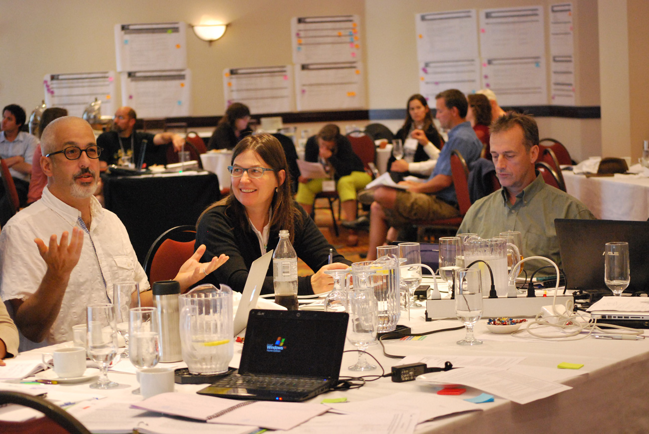
Titled “Regional Climate Change Assessment: Projected Climate Changes, Impacts and Recommendations for Assessing Vulnerability and Risk across the Canadian North Pacific Coast,”  the study was completed in February 2018 by Charlotte Whitney and Tugce Conger, Pacific Institute for Climate Solutions fellows and PhD candidates from the University of Victoria’s School of Environmental Studies and UBC’s Institute for Resources, Environment, and Sustainability.

To do it, Whitney and Conger systematically examined hundreds of peer-reviewed scientific publications and studies undertaken by government, private firms, and environmental non-government organizations. To get a sense of work in progress, they also interviewed other key researchers in B.C. about relevant, ongoing projects.

“I was surprised by how much work has been done, but just not always consistently across the region,” Whitney says of the process. “Pulling it all together like this showed there is a lot we can use to make better management decisions at multiple scales, and a lot of actions that can be really effective in supporting communities within the MaPP region in coming years.”

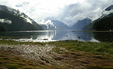
The resulting 135-page synthesis affirms that site-specific changes to ecosystems on the B.C. coast are already underway now, and will deepen in coming decades. Air and ocean surface temperatures will continue to rise, as will sea levels—averaging about 20 to 30 cm by 2100. Ocean water will become less salty, more acidic, and lower in dissolved oxygen. Winds, waves, storms, flooding, and extreme weather events are expected to become more intense. Snowmelt will keep happening earlier and faster, making for more intense freshets (the sudden rise of water level in a river due to melting snow or ice) and hotter, drier summers in some regions.

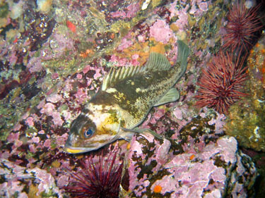
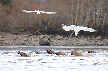
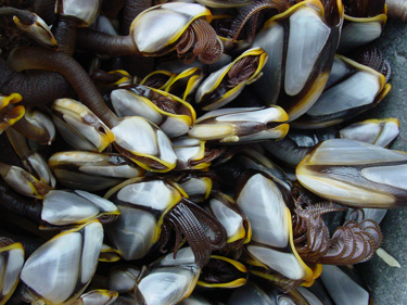
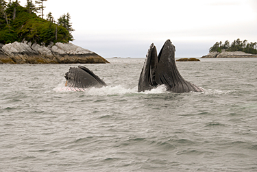
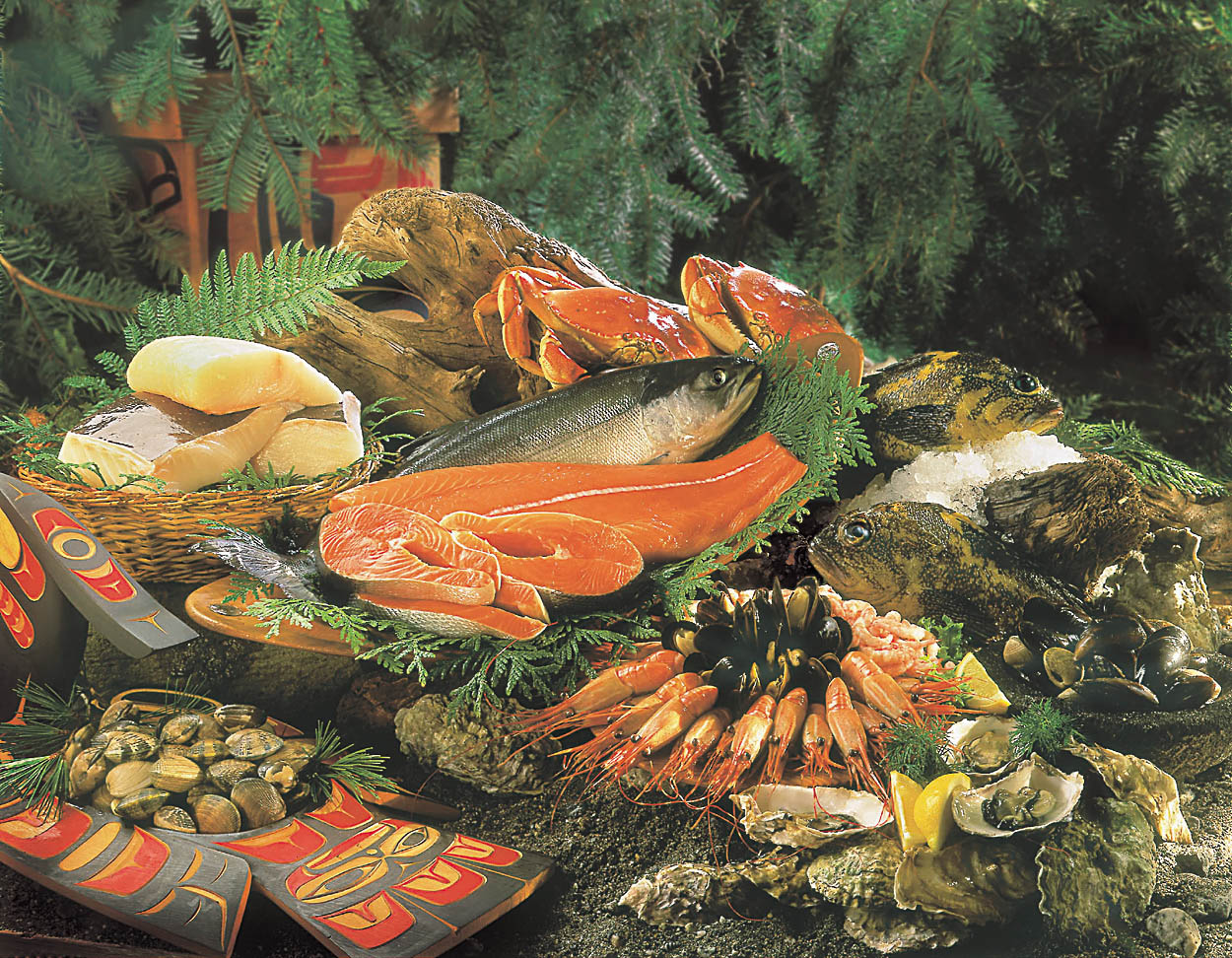
The researchers expect these phenomena to have far-reaching effects on the ecosystems, economies, and cultures of MaPP communities. For example, the geographic ranges of key species of salmon, herring, shellfish, and crustaceans may shift. Communities and critical marine infrastructure will be more vulnerable to sea-level rise and extreme weather events. Many cultural sites, valuable in their own right but also as proof of historical First Nations presence, will be more vulnerable to erosion and loss; though the vulnerability will vary across the sub-regions. Pollutants that have been stored in glacial ice for centuries will be released as glaciers melt, potentially impacting habitat.

One unique aspect of this study—and in line with its intent—is that it drills down into existing data to explore how climate change will play out over the coming decades at regional and sub-regional scales. For example, it indicates that the northeast coast of Graham Island, Haida Gwaii, is especially sensitive to sea-level rise, but that warmer and longer summers may also bring new opportunities in tourism. On the Central Coast, MaPP communities are less vulnerable to sea-level rise than other regions, but have a greater proportion of documented cultural sites at risk and can expect a major decline (32%-49% decline by 2050) in herring—a key source of food, income, and cultural practice.

The study’s appendices offer a treasure trove of practical information. For example, readers can look up key species in a table that lists the climate change factors they are vulnerable to and how they are likely to be affected. A set of colour-coded maps illustrates communities’ varying sensitivities, under different emissions scenarios, to factors such as changing salinity and sea-level rise.

Equally useful is the study’s highlighting of locally relevant but still unanswered climate-change questions—such as the impacts of ocean acidification, and the ways that warming waters, by harbouring new marine diseases and invasive species, will change marine ecosystems. These unanswered questions will help guide future climate change research.

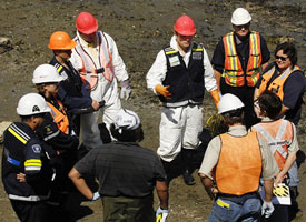
During the research, Whitney and Conger invited feedback from key MaPP team members—like Rebecca Martone, a Victoria-based marine biologist with B.C.’s Ministry of Forests, Lands, Natural Resource Operations and Rural Development.

“This study really helps us to put the puzzle pieces together in a way that hasn’t been done before,” enthuses Martone, who is on the MaPP technical team. “It helps us identify where we have more certainty in projected impacts, so we can prioritize actions to take, and where we need more information. And it really strengthens the scientific foundation for the work of MaPP.”

For John Bones, First Nations co-lead for MaPP implementation in the North Vancouver Island sub-region, the study offers strong motivation for proactive effort. “The most valuable insight from this study for First Nations communities … is probably that climate change impacts on ocean characteristics—like salinity and water temperature—are going to affect ocean-based cultures and traditions,” he reflects. “Each community needs to start developing an ‘action plan’ for both the threats and opportunities that might result.”

Whitney agrees, and emphasizes the wisdom of framing community conversations less in terms of vulnerabilities and more around communities’ adaptive capacity—“the latent potential of people and ecosystems to adapt”—and proactive planning. To that end, the researchers included recommendations for high-level planning principles and an appendix about adaptation measures that communities can start taking now.

“Building on initiatives that are already involving communities in planning, management, and capacity development—like the Guardian Watchmen program—would be really valuable,” adds Whitney. “It could turn this into a story about potential.”

As the MaPP team prepares to share study findings with MaPP communities, Whitney and Conger have gone on to complete a second, complementary literature review, which evaluates frameworks and tools for carrying out vulnerability and risk assessments for the MaPP region—work that will be undertaken next year.

map-arch-sites

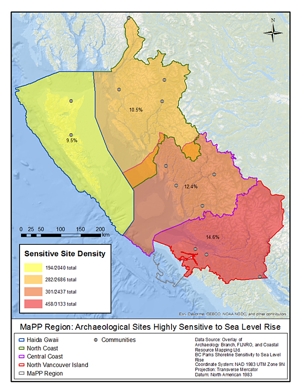
Rising sea level and increased storm surge can subject archeological sites to erosion or inundation. This map shows that some MaPP regions are more vulnerable to this than others. The North Vancouver Island sub-region, for example, has the highest proportion of its documented archeological sites at risk.
Source: “Regional Climate Change Assessment: Projected Climate Changes, Impacts and Recommendations for Assessing Vulnerability and Risk across the Canadian North Pacific Coast.”

Report Citation: Whitney, Charlotte, and Tugce Conger. 2019. “Northern Shelf Bioregion Climate Change Assessment: Projected Climate Changes, Sectoral Impacts, and Recommendations for Adaptation Strategies Across the Canadian North Pacific Coast.” MarXiv. May 3. marxiv.org/rfnk3.

Read the report online here.

Protecting Marine Biodiversity in the Great Bear Sea

Copper rockfish. Photo credit: Tammy Norgard, Heiltsuk Fisheries.

Copper rockfish. Photo credit: Tammy Norgard, Heiltsuk Fisheries.

The next steps in the creation of a Marine Protected Area Network are underway for the Northern Shelf Bioregion. This is a collaboration between MaPP partners, comprised of 17 member First Nations and the Province of British Columbia, and the federal government.

The Marine Protected Area Technical Team (MPATT) – composed of Canada, First Nations and B.C. – is developing recommendations within a network action plan for marine areas to be set aside as part of a network for permanent protection on the north coast of British Columbia. The plan will identify proposed sites and recommend levels of protection.

The new MPA network will build on 114 existing protected areas in the region, as well as the zones recommended in MaPP sub-regional marine plans. The MaPP plans, announced in 2015, include a spatial component identifying: general and special management zones to support sustainable human uses; and protection management zones (PMZ) for the protection of marine biodiversity and First Nations cultural and traditional uses.

Eelgrass estuary. Photo credit: Doug Neasloss.

Eelgrass estuary. Photo credit: Doug Neasloss.

MPATT member Karen Topelko is a senior marine resource specialist with the Ministry of Forests, Lands, Natural Resource Operations and Rural Development, and has been involved in the MaPP initiative since 2014. MaPP went through a long process to identify zones for protection, she acknowledges, so there may be questions about why they’re not automatically adopted for the MPA Network.

That’s because planning for a marine protected area network takes a different approach than choosing individual areas based on local values or interests.

“When you systematically plan a network of protected areas, you want them to work together as a whole to achieve overarching goals,” Topelko explains. “The existing marine protected areas, along with the protected management zones in the MaPP region, were never selected to function together cohesively. Important network design criteria such as representation, size and spacing were not considered.”

Some of the criteria for network design include: selecting sites that will protect a range of habitat for diverse coastal species; including the same habitat type more than once to protect against the impacts of a changing climate and catastrophic events; and, including both big and small protected areas to provide for the long-term survival of species that use different areas for activities such as feeding, resting and breeding.

Sea lions and gulls in the Skeena River. Photo credit: Allison Paul.

Sea lions and gulls in the Skeena River. Photo credit: Allison Paul.

“MaPP identified important cultural and ecological areas for protection, as well as areas suitable for sustainable economic development,” Topelko notes. “These will interplay with the MPA network but the MaPP PMZs will not necessarily become marine protected areas in the network. Those that don’t will live on as PMZs.”

MaPP partners, together with local governments and stakeholders, will continue to implement the management direction described in their sub-regional plans. “We aren’t starting over. We’re building on the results of marine planning initiatives in the region that started with First Nations,” says John Bones, marine co-ordinator for Nanwakolas Council and MPATT member.

Important lessons learned from MaPP are helping guide the network planning process, according to MPATT member Sheila Creighton, oceans planner for Fisheries and Oceans Canada. “The MaPP process involved a series of steps that the MPA network process has been able to build on. These include forming the governance structures required for decision-making, compiling and analyzing data, and engaging stakeholders,” she says.

Pelagic barnacle. Photo credit: Joanna Smith.

Pelagic barnacle. Photo credit: Joanna Smith.

Creighton adds that the MPA network process also benefits from relationships built with communities and stakeholders. “Many of the same MaPP advisory committee members are involved in the MPA network planning process. They’re helping to verify new data and provide local perspectives and knowledge to inform a planning process with a different vision and set of goals.”

John Bones agrees, “The progress to date is a reflection of all three governments being willing to work collaboratively. First Nations are involved and participating vigorously in this network planning process because it’s happening in our territories and we want a big say in how it turns out.

“We wanted to have our zones considered and we’ve been successful in achieving that so far,” says Bones. “We’ve helped shape the MPA process.”

The network action plan, expected by March 2019, will go forward for decision by each of the governing parties. It’s anticipated to include a description of the network design approach, final network design, description of network sites, and results of risk and impact analyses.

For more information on the MPA network planning process, visit www.mpanetwork.ca

Feeding humpback whale. Photo credit: Greg Tamblyn.

Feeding humpback whale. Photo credit: Greg Tamblyn.

MaPP selects indicators to track changes in the health of B.C.’s North Pacific Coast

Eelgrass is a good measure of coastal health because it is both ecologically important and sensitive to its environment, said Karin Bodtker, a manager at the Coastal Ocean Research Initiative. Eelgrass grows in estuaries throughout the MaPP region. In this photo, two locals harvest seafood from an eelgrass meadow in Haida Gwaii. Photo credit: Nusii Guijaaw.

Eelgrass is a good measure of coastal health because it is both ecologically important and sensitive to its environment, said Karin Bodtker, a manager at the Coastal Ocean Research Initiative. Eelgrass grows in estuaries throughout the MaPP region. In this photo, two locals harvest seafood from an eelgrass meadow in Haida Gwaii. Photo credit: Nusii Guijaaw.

The Marine Plan Partnership for the North Pacific Coast (MaPP) has picked 14 pilot regional indicators that, taken together over the long-term, will provide insights into the health of B.C.’s North Pacific Coast and help guide implementation of coastal management recommendations in MaPP sub-regional plans.

Hundreds of potential ecological, economic and human well-being indicators were initially identified by experts at Uuma Consulting and planning team members of the four MaPP sub-regions: Haida Gwaii, the North Coast, the Central Coast and North Vancouver Island.

To select the pilot indicators, MaPP partners and the Coastal Oceans Research Institute (CORI) took feedback from sub-regional workshops and focused on indicators considered high-priority within each sub-region and which made sense to track at a regional scale. As indicators can be expensive and time-consuming to monitor, the team chose indicators that would each provide unique insights without incurring excessive costs.

“It was challenging to narrow the list down,” said MaPP regional projects coordinator, Romney McPhie. “There are many things that are valuable to track, but collectively we came up with a short list that all sub-regions agreed upon to start the monitoring process.”

Eelgrass, the ribbon-like seagrass in estuaries throughout the region, was one of the indicators selected. MaPP personnel will track data on eelgrass distribution and biomass regularly during the 20-year implementation period of the MaPP plans.

“Eelgrass is one of the most ecologically important habitats. It’s also quite sensitive to pollution, sedimentation, sea level rise and even boats anchoring in it,” said Karin Bodtker a manager with CORI, the independent research institute based at the Vancouver Aquarium, that helped refine the list of indicators with MaPP.

“This plant provides habitat for about 80 per cent of marine species of commercial interest,” Bodtker explained. “Juvenile salmon, for example, use eelgrass habitat to find food, hide from predators and as a highway in their migration out to the ocean.” Eelgrass also captures and stores carbon.

Understanding eelgrass losses or gains, alongside changes to other indicators like ocean acidity, will help MaPP understand the state of the marine environment and how it is changing over time. “The information collected will support sustainable decision-making along the coast,” said McPhie.

Indicators are to be monitored from the middle of Vancouver Island through to the Alaskan border. They fall under seven themes: marine species and habitats; climate change and oceanography; water cleanliness; sense of place and wellbeing; seafood; coastal development and livelihoods; and stewardship and governance. These indicators reflect the MaPP commitment to ecosystem-based management, which prioritizes ecological integrity, human wellbeing and collaborative governance. In keeping with an adaptive approach, certain indicators may be changed if compelling reasons to do so arise, McPhie said.

In addition to the pilot regional indicators, sub-regions will have their own unique indicators for which they gather data. The Central Coast, for example, is monitoring crab and Haida Gwaii is monitoring the spread of invasive species, such as tunicates.

With regional indicators chosen, data collection is now underway. An analyst at CORI is assembling existing data on many indicators and identifying sampling gaps.

“This program couldn’t happen without many other organizations that are collecting data: governments, private organizations, the coastal guardian watchmen and the regional monitoring system of the Coastal First Nations, for example,” McPhie said. “We’re ensuring we have reliable data through our collaboration with CORI, as well as through data access agreements we hope to secure with other governments and organizations.”

MaPP partners are also now developing data management tools and public reporting strategies.

“By the end of 2019 we expect a comprehensive report with regional data for all the pilot indicators and how those data relate to MaPP strategies. Analysis of the data will tell us if our strategies are working and if we need to change our strategies because of ecosystem changes,” McPhie said.

“The purpose of indicator monitoring is to lead to better decision making. The Province can use the data to set or affirm priorities, allocate resources and inform policy and decision making,” said Kristin Worsley, manager of B.C.’s marine and coastal resources section and member of MaPP’s secretariat.

Steve Diggon, regional marine planning coordinator for Coastal First Nations-Great Bear Initiative said, “Provincial decision-makers and First Nations will have evidence to inform their views on and decisions about issuing tenures for coastal activities.”

List of MaPP pilot regional indicators. Credit: MaPP.

List of MaPP pilot regional indicators. Credit: MaPP.

Collaborative marine management underway on B.C.’s North Coast: A primer on the Regional Action Framework

MaPP-boundary

The white-bordered area in this satellite image shows the B.C. coastal region addressed by the Regional Action Framework (RAF). Each of the four sub-regions, whose locally-developed marine plans were used to create the RAF, are shown within the RAF boundary.

The Regional Action Framework (RAF) is the result of intensive consultation and planning for marine areas along the North Pacific Coast of B.C., from Campbell River through to the Alaskan border. Its broad view prioritizes both ecosystem and human well-being, as well as collaborative and efficient marine management.

With a 20-year scope, implementation of the RAF is now underway.

The Marine Plan Partnership (MaPP) plan area is comprised of four sub-regions: Haida Gwaii, the North Coast, the Central Coast and North Vancouver Island. As each sub-region has its own unique set of marine environments, local values, governance mechanisms, and socio-economic contexts, the MaPP partners agreed in 2011 that each sub-region would develop its own goals for marine management, in consultation with local stakeholders.

Knowing there would be some overlap among all sub-regional priorities, MaPP partners agreed in the same year to also create a framework that considers the entire region, looking at broad ecosystem issues as a whole.

The result is the RAF, completed in May 2016. It identifies common elements from all four sub-regional marine plans, and supports the sub-regions to work together in addressing common goals. This collaboration on the actions identified in the RAF will benefit the region as a whole, saving time and money. Over the 20-year implementation period the RAF aims to improve both coastal community and ocean health.

Implementation of some shared priorities is already well-underway.

One priority is developing and monitoring indicators for both human well-being in the region, which includes monitoring new economic opportunities and investments, as well as ecological integrity, which includes monitoring ocean conditions, intertidal life and species composition.

“For example, MaPP technicians and community members from all sub-regions identified that monitoring eelgrass abundance and distribution was important, so that will likely become one of our regional indicators,” said Romney McPhie, the regional projects coordinator for MaPP, who helps coordinate MaPP partners across the sub-regions. “Observing these trends in eelgrass beds over time will help MaPP partners assess how their actions on other priorities may be impacting eelgrass”, McPhie noted.

Ecosystem-based management underlies the RAF, where both ecological and human well-being are considered as components of an entire system. It’s an adaptive approach, and in keeping with that, evaluations and adjustments will be made to the RAF every five years.

Planning undertaken by MaPP partners, including creation of the RAF, has demonstrated an unprecedented level of collaboration in marine management for B.C.’s coast. The provincial government and 18 First Nations partnered during the planning phase, and collaboration between the Province and First Nations continues throughout implementation. Traditional knowledge and values of partner First Nations were an integral part of developing the RAF, along with provincial government priorities, and local community values.

The RAF also received input from an advisory committee of marine-based stakeholders, including industry representatives, conservationists, recreationalists, and elected local officials, as well as from a science advisory committee.

Additional RAF actions underway include identifying climate change indicators that will inform response strategies, assessing cumulative effects of overlapping activities in coastal areas, supporting and coordinating pollution responses, coordinating and supporting the development of marine emergency response plans and planned performance monitoring to ensure that the RAF is effectively implemented.

Through the RAF and sub-regional plans, MaPP partners aim to improve coastal ocean health, increase employment in local communities and diversify jobs, and give proponents more certainty concerning their investments in the coastal zone. Over the long-term, the RAF will enable a broader understanding of how the ocean works and ensure all those concerned have a deeper understanding of how to manage the North Pacific Coast of B.C. more holistically and efficiently.

Cumulative effects – Avoiding unintended consequences of our decisions

bowl-of-chips_w375

A little wine with dinner won’t hurt you. But what if you added a glass of scotch before every meal and a bag of chips between meals every day? What might the cumulative effects be on your heart, your liver, your state of mind?

If you knew what this combination of “inputs” would do to your physical, emotional and economic well-being, you might make different decisions – or perhaps regulate your behaviour. Perhaps you would measure your weight, waistline and blood pressure and think ahead 10 years to see what the cumulative effect of your current behaviour might be of your overall health.

With help from consulting biologist Steven Wilson, the MaPP initiative hopes to apply this kind of thinking to decision-making for the marine environment.  Called cumulative effects assessment, the MaPP initiative is looking for ways to capture the combined effects over time of multiple activities and factors on ocean habitats.

Cumulative effects are defined as “changes to environmental, social, and economic values caused by the combined effect of present, past and reasonably foreseeable human actions or natural events.” Or as Wilson says, “The effects of several actions are more than their sum … there’s some sort of interaction of effects that adds up to more than if they were individually applied.”

The Province of British Columbia is working on a broad cumulative effects strategy that will include the marine environment. This strategy, known as the Cumulative Effects Framework, is developing a new approach and tools for assessing and managing cumulative effects in the province.

Jointly led by the Ministries of Environment and Forests, Lands and Natural Resource Operations, the framework approach was defined, tested in regional demonstration projects and evaluated to assess the implications of the provincial implementation. Phased implementation of the Framework began in spring of 2014.

The MaPP initiative is a partner to test the Framework, and is providing valuable input on how the terrestrial and marine cumulative effects frameworks intersect through the inter-relationships between land and sea. To learn more about the Cumulative Effects Framework visit their website.

This dovetails nicely with the broader development of marine plans, where Wilson has helped the MaPP initiative to adapt the Cumulative Effects Framework for the North Pacific coast. Similar to the broader provincial efforts, the goal of the framework is to inform both management and regulatory processes and, in doing so, improve the stewardship of coastal and marine ecosystems and the human well-being of coastal communities.

Wilson explains that there are three major types of challenges related to determining cumulative effects in the marine environment: informational, regulatory and institutional legacy.

Because cumulative effects assessment and management is a relatively new field, there is less information about the interactive effects of various marine activities. So Wilson identifies a regulatory problem, which is linked to the information problem. “If you don’t have the information, it’s hard to set regulations,” he says.

In addition, as Wilson explains, institutional legacy makes it difficult to manage marine resources in an integrated manner. For instance, permits are issued by activity and those activities can come under different jurisdictions, be it First Nations, provincial government or federal government. “What we are realizing,” he says, “Is that everyone can be diligently doing everything right, individually we can all be doing the right thing, but collectively we still run the risk of failing.”

There are no quick fixes to address the challenges associated with identifying and managing cumulative effects in the MaPP study area but the MaPP Cumulative Effects Assessment Framework is a start.

It is a challenging and complex undertaking but for Wilson, the goal is relatively simple. “What we want to do is avoid the unintended consequences of the decisions we make.”

Download A Framework for the Assessment and Management of Cumulative Effects on the North Pacific Coast.

Building emergency response capacity in coastal communities

oilspill_w275It’s hard to plan for something you hope will never happen, and yet being prepared for a crisis increases the chances of managing an emergency efficiently and equitably.

Today on the coast there is significant marine traffic, and with that traffic come risks. Yet at the same time, this traffic helps generate economic activity and jobs up and down the coast. It is critical to ensure that this traffic stays safe and that there are plans in place should an accident happen.

For coastal communities, one way of getting prepared could mean developing a geographic response plan (GRP) – a plan that can kick into action within the first hours of an incident, often well before emergency response agencies can get to the scene.  GRPs consider the multiple priorities of coastal communities – social, cultural, ecological, and economic.

Because GRPs pre-identify priorities such as areas for protection, location of human and equipment resources, and places of refuge for troubled vessels, they can accelerate response time and help to reduce the threat and impacts of an incident.

One deliverable of the MaPP initiative is to help communities in the MaPP study area understand and define the nature and scope of GRPs. The initiative has contracted environmental emergency response planner Stafford Reid to begin the work. “Geographic response plans are part of coastal planning management – a tool for managing the impacts from all types of vessels and all types of cargo,” Reid says.

The tough work in emergency response planning is determining the priorities for first responders. What gets first attention – a cultural heritage site, environmentally sensitive habitat, or a business? The process needs to be collaborative, transparent and considerate of diverse possibilities, since trade-offs are inevitable and difficult decisions have to be made. And in the moment of a crisis, there is little time for discussion.

Graham Knox, director of the Environmental Emergencies Program with the B.C. Ministry of Environment, says, “If we can do this sort of work up front, then the first responders can hit the ground running in that first 24- to 48-hour period, while the cavalry gets mustered and until the Incident Command Post and the incident management teams are in place.”

The Incident Command Post integrates many response teams, including Canadian Coast Guard, Fisheries and Oceans Canada, Environment Canada, Ministry of Environment, First Nations and local government, as well as the ship owner and its contracted response organization.

“In the field of emergency management, all emergencies start at the local level. So, it’s critical that local people are engaged and included in all phases of preparedness through response and recovery,” Knox says. “First Nations and other people living in the coastal communities have a lot of information that more centralized agencies may not have.”

GRPs, which are well developed in the United States, have evolved from hard-copy documents to web-based, multi-media applications that include geographic information systems, databases, documents, images and videos. GRP design and development is new to Canada.

The MaPP initiative has compiled a suite of studies and datasets that could support GRP development, not to mention the wealth of on-the-ground knowledge and expertise in coastal communities. In addition to the draft marine plans, MaPP resources include traditional, local and scientific knowledge, technical expertise and mapping/planning tools such as the marine planning portal with over 300 data layers.

Understanding interdependence to inform marine planning

MaPP workshop participants explore options for an integrated suite of human well-being and ecological indicators.

MaPP workshop participants explore options for an integrated suite of human well-being and ecological indicators.

What does your doctor do if you show up in his or her office complaining of a pain on the left side of your chest? Take your blood pressure? Check out your cholesterol?

In fact, today’s health practitioners are starting to do a lot more than that. They might ask you about your eating habits (too much unhealthy fast food?), your stress levels, and what you’re doing for exercise.

Just as our society has started to adopt a more holistic view of health, we’ve also realized that it might help us to look at other aspects of our lives through a variety of lenses.

That, at least, is the premise of ecosystem-based management, or EBM, the type of approach that’s been adopted by the MaPP initiative. “You can’t look at things in a single box,” says Andrew Day, a natural resource expert and consultant who has been contracted by the MaPP initiative to develop an integrated suite of human well-being and ecological indicators.

“Just one lens is not enough,” he says. “The idea behind EBM is to start looking at things from many different lenses to get a better picture of what’s happening in the system.”

When considering a particular agency’s viewpoint, for example, Day knows it’s just as important to consider the perspectives of First Nations, businesses, scientists, non-profit groups, and the public. Day says all these views are valuable and by acknowledging and respecting them it’s possible to get a better understanding of what’s happening in the system.

It also helps to understand how human well-being indicators (social, economic, cultural, and technological) are interconnected with ecological well-being indicators such as species and habitats. “One of the big questions is understanding how things relate to each other and the consequences of different decisions and actions,” Day says.

As a trained lawyer with a PhD in natural resource management, Day says it’s his job to draw on the expertise of others and then boil down or integrate their knowledge. “I travelled and worked in Africa for almost five years and became involved in community development,” he says. “When I came back to the coast, I connected with a number of First Nations chiefs, mayors, fishermen, agencies, and businesses who could see they needed to start working together and managing things more holistically. They started with the principles of interconnection and respect.”

Day says that one of the keys to success in the 21st century will be understanding interdependence and “trying to understand and respect the ways in which what you do over here, is going to affect what you get over there.” He recognizes this is difficult to do, in part because it is not the way systems, operations, and thinking occurred during the industrial revolution.

But that is changing now.  As an example of one area that’s taken big strides in trying to build partnerships and move towards a more ecosystem approach, he cites the Puget Sound Partnership. Inspired by a governor and many leaders who were determined to make the area healthier, the region developed some ambitious goals and indicator tracking. You can see them at the Puget Sound Vital Signs website. “It’s presented in a way that everyone can understand,” Day says. “It’s not just scientific reports – it’s much more accessible.”

In B.C., the MaPP initiative has hired Day to recommend indicators and options for monitoring the marine area. His team has reviewed indicators from other parts of the world, conducted surveys of more than 200 ecological experts, and facilitated several workshops with businesses, governments, scientists, managers and First Nations.

They have reduced more than 1,000 potential indicators to a suite of about 50.  Team members are now working on guide sheets for the recommended indicators and looking at different monitoring programs and partnerships.

“Canada’s coasts are globally significant and unique, with high ecological values and incredible economic potential,” he says. “It’s important to manage them properly or they could become degraded like so many other coastal areas in the world.”

Seafood delivers a bounty to coastal communities

bcseafoodWhile eating more fish might seem like a simple, healthy dietary decision, in fact, it also offers consumers the chance to make a big difference to coastal communities in British Columbia.

That’s the passionate belief of Jamie Alley, a former director with the B.C. Ministry of Environment, now retired and consulting to government, First Nations and the seafood industry.

“The seafood industry is not in sunset – in fact, it’s in sunrise,” he says. “Seafood is one of the most globally traded commodities. And considering the quality of the resource here, our industry is relatively underdeveloped.

Ironically, Alley says, even though the public sometimes fails to appreciate how valuable seafood really is, “it is the cornerstone of a lot of coastal communities.”

This is because B.C.’s oceans and fresh waters support more than 100 species of fish, shellfish and marine plants. With a combined current wholesale value of more than $1.4 billion, B.C. seafood travels around the world, with some 80 per cent of it being exported. In 2011, it ended up in two billion meals in 74 countries.

A key figure in working with industry to market the B.C. seafood brand for many years, Alley recalls travelling to Europe with the former executive chef from Vancouver’s C Restaurant, Rob Clark, to promote Pacific sablefish, or black cod.  “At the time, we were selling 90 per cent of [the sablefish] catch to Japan and needed to diversify,” he recalls. “But at this event we had dozens of white-tablecloth, European chefs and global seafood traders lined up and down the aisles waiting to try one of the best fish in the world. “ As Alley puts it, marketing efforts like that, “help put money in the jeans of people in small rural communities.”

Sales of B.C. sablefish in Europe have increased dramatically since Alley’s trip, going from only $220,000 in 2007 to well over $3 million in 2012.

Alley believes that the secret to continued success is shifting from a high-quantity fishery with a low value – to a low-quantity fishery with a high value. Stories like the sablefish one have helped convince him that fish are more than simply a delicious food. They are also an economic engine for rural B.C.

According to Alley, jobs in the seafood industry in coastal communities are comparatively more valuable to the social and economic fabric of British Columbia than service sector jobs in the Lower Mainland.

“Seafood-industry jobs pay relatively well,” he says. These jobs tend to be located in smaller, coastal areas where overall unemployment rates can be high. Fisheries-related jobs, like those at seafood processing facilities, are particularly important for First Nations people, many of whom live in remote communities, far from urban centres. “There’s no other part of the coastal economy that has such a high participation of First Nations,” Alley says. First Nations people represent roughly 30 per cent of the workforce in the seafood-processing sector.

B.C. also has some of the best, most sustainably managed fisheries in the world. The global standard for seafood eco-certification, the Marine Stewardship Council (MSC), has developed tough, best-practice standards for sustainable fishing and seafood traceability. The group’s mission? To recognize and reward sustainable fishing practices and thereby improve the health of the world’s oceans.

Six fisheries in B.C. are currently MSC certified and more are in the works. These are British Columbia chum, pink and sockeye salmon, albacore tuna, Pacific hake mid-water trawl, and Pacific halibut. In the MaPP study area, five fisheries are currently MSC certified – north and central coast chum salmon are in assessment. According to the 2011 British Columbia Seafood Year in Review, published by the B.C. Ministry of Agriculture, some 63 per cent of British Columbia’s groundfish harvest and 60 per cent of the salmon harvest was from MSC-certified fisheries. Overall, 47 per cent of B.C.’s wild capture fisheries harvest was from MSC-certified fisheries. Certified fisheries can use the eco-label program to market their products and influence the choices consumers make when buying seafood.

“B.C.’s seafood is healthy and sustainably managed,” says Alley. “You can buy it with confidence and support our fisherman to export it with pride to the world.”