

Author: adminMaPP
North Vancouver Island draft Marine Plan public review begins
The North Vancouver Island draft Marine Plan is now available for public review and comment. To review the draft plan, learn about community meetings in Campbell River, Port McNeil and Port Hardy and provide comments please visit North Vancouver Island Draft Plan for Input. The public review period runs to May 15, 2014. To learn more about the Marine Plan Partnership, watch the MaPP video.
We also welcome comments on the Haida Gwaii draft Marine Plan, which is available for public review until May 7, 2014. Draft marine plans for the North Coast and Central Coast MaPP sub-regions will be made available for public review in the coming weeks.
Haida Gwaii MAC Meeting #11 – September 24-26, 2013
Haida Gwaii draft Marine Plan public review begins
Share your thoughts on the Haida Gwaii draft Marine Plan.
The Haida Gwaii draft Marine Plan is now available for public review and comment. Draft plans for the other three MaPP sub-regions, North Vancouver Island, North Coast and Central Coast, will be available for public review in the coming weeks.
Comments to the proposed Haida Gwaii draft Marine Plan are welcome from members of the public and the Haida Nation from April 2 – May 21, 2014.
The draft plan was prepared by the Council of the Haida Nation (CHN) and the Government of British Columbia, as represented by the Ministry of Forests, Lands and Natural Resource Operations (BC-FLNRO), and reflects substantive input from both the Haida Marine Work Group and the Haida Gwaii Marine Advisory Committee.
Find the Haida Gwaii draft Marine Plan, a 12-page summary document, and supporting documentation on the MaPP and Council of Haida Nation websites.
Public and stakeholders are welcome to comment in one or all of the following ways:
- Attend a community public meeting
- Fill out a response form – online or download a hard copy
- Send an email
Public Meetings
A series of public meetings will be held on Haida Gwaii to introduce the Haida Gwaii draft Marine Plan and to provide an opportunity for discussion and questions.
Times and Agendas
Chat and snacks/Open House: 5:30 – 7:00 pm
Presentation and questions: 7:00 – 8:00 pm
Small discussion groups (depending on interest): 8:00 – 9:00 pm
Dates and Locations
Sandspit – April 14, 2014
Community Hall, 411 Alliford Bay Road
Old Massett – April 15, 2014
Old Massett Community Hall, 348 Eagle Avenue
Skidegate – April 16, 2014
Skidegate Community Hall, Front Street
Port Clements – April 17, 2014
Community Hall, 120 Bayview Drive
Comments to the Haida Gwaii draft Marine Plan are welcome during the public review period April 2, 2014 to May 21, 2014.
North Coast MPAC Meeting #9 – Mar 11-12, 2014
Indicators
Indicators are used to monitor and assess the status or trend of a system. The information can assist decision makers with detecting changes and provide a basis for adjusting decisions or actions.
High Value Fish Habitat
The combined width of forest reserve areas on either side of “high value fish habitat” streams and rivers is roughly the length of a football field. High value fish habitat also includes productive shellfish areas and estuaries.
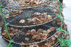
Scallops
Spat is the youngest stage of shellfish life, after larvae. Scallop spats measure about .4 to .6 millimetres.
Haida Marine Traditional Knowledge Study
The Haida Marine Traditional Knowledge Study (click the “Traditional Knowledge” tab) documents Haida culture, traditions and knowledge about the ocean. 56 Haida shared their knowledge, with oral accounts dating back to the 1920s. More than 4000 locations and 150 marine species were recorded.
Public consultation on MaPP draft marine plans
 The MaPP initiative will soon be releasing draft marine plans for public review. Following internal reviews by both partners, each of the MaPP sub-regions – Haida Gwaii, Central Coast, North Coast and North Vancouver Island – will seek public and stakeholder comments on its draft plans.
Once released, you will find downloadable copies of the draft plans, summaries of the plans, details of the public meetings and more background information on the MaPP website.
As a member of the public and/or a MaPP stakeholder, you will be welcome to comment in one or all of the following ways:
- Attend a community public meeting
- Fill out an online response form
- Send an email
More details on the consultation process, including dates and locations of public meetings, will be available on the MaPP website and in subsequent newsletters. If you would like to be on any, or all, of the sub-region mailing lists, please let us know. For the latest information, please subscribe to the MaPP updates and to the MaPP newsletter.
New MaPP video released
Only have a couple of minutes? Discover the “Ten things you need to know about MaPP” in our new video.
Understanding interdependence to inform marine planning
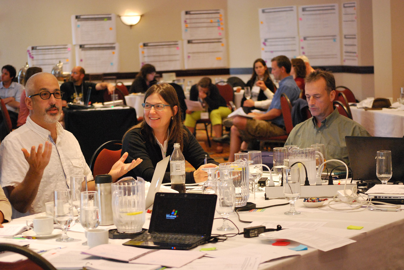
MaPP workshop participants explore options for an integrated suite of human well-being and ecological indicators.
What does your doctor do if you show up in his or her office complaining of a pain on the left side of your chest? Take your blood pressure? Check out your cholesterol?
In fact, today’s health practitioners are starting to do a lot more than that. They might ask you about your eating habits (too much unhealthy fast food?), your stress levels, and what you’re doing for exercise.
Just as our society has started to adopt a more holistic view of health, we’ve also realized that it might help us to look at other aspects of our lives through a variety of lenses.
That, at least, is the premise of ecosystem-based management, or EBM, the type of approach that’s been adopted by the MaPP initiative. “You can’t look at things in a single box,” says Andrew Day, a natural resource expert and consultant who has been contracted by the MaPP initiative to develop an integrated suite of human well-being and ecological indicators.
“Just one lens is not enough,” he says. “The idea behind EBM is to start looking at things from many different lenses to get a better picture of what’s happening in the system.”
When considering a particular agency’s viewpoint, for example, Day knows it’s just as important to consider the perspectives of First Nations, businesses, scientists, non-profit groups, and the public. Day says all these views are valuable and by acknowledging and respecting them it’s possible to get a better understanding of what’s happening in the system.
It also helps to understand how human well-being indicators (social, economic, cultural, and technological) are interconnected with ecological well-being indicators such as species and habitats. “One of the big questions is understanding how things relate to each other and the consequences of different decisions and actions,” Day says.
As a trained lawyer with a PhD in natural resource management, Day says it’s his job to draw on the expertise of others and then boil down or integrate their knowledge. “I travelled and worked in Africa for almost five years and became involved in community development,” he says. “When I came back to the coast, I connected with a number of First Nations chiefs, mayors, fishermen, agencies, and businesses who could see they needed to start working together and managing things more holistically. They started with the principles of interconnection and respect.”
Day says that one of the keys to success in the 21st century will be understanding interdependence and “trying to understand and respect the ways in which what you do over here, is going to affect what you get over there.” He recognizes this is difficult to do, in part because it is not the way systems, operations, and thinking occurred during the industrial revolution.
But that is changing now. As an example of one area that’s taken big strides in trying to build partnerships and move towards a more ecosystem approach, he cites the Puget Sound Partnership. Inspired by a governor and many leaders who were determined to make the area healthier, the region developed some ambitious goals and indicator tracking. You can see them at the Puget Sound Vital Signs website. “It’s presented in a way that everyone can understand,” Day says. “It’s not just scientific reports – it’s much more accessible.”
In B.C., the MaPP initiative has hired Day to recommend indicators and options for monitoring the marine area. His team has reviewed indicators from other parts of the world, conducted surveys of more than 200 ecological experts, and facilitated several workshops with businesses, governments, scientists, managers and First Nations.
They have reduced more than 1,000 potential indicators to a suite of about 50. Team members are now working on guide sheets for the recommended indicators and looking at different monitoring programs and partnerships.
“Canada’s coasts are globally significant and unique, with high ecological values and incredible economic potential,” he says. “It’s important to manage them properly or they could become degraded like so many other coastal areas in the world.”
A wealth of traditional knowledge on Haida Gwaii
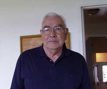
Henry Hageman
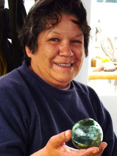
Diane Brown
Marine planning in the MaPP initiative draws from different sources of information, including Western science, local knowledge and traditional knowledge.
A robust source of information on the North Pacific coast – where First Nations communities have lived for thousands of years – is traditional knowledge. This has involved documenting First Nations understanding about marine habitats, life and patterns that date back generations.
Traditional knowledge is a critical resource for marine planning. It includes history, traditions, practical information and ecological knowledge. It also captures how, when and why activities are done in and around the ocean and offers observations and information about trends over time.
For Henry Hageman, who was born in Massett on Haida Gwaii (and delivered by his own grandmother), traditional knowledge came in the form of fishing. When he bought his first boat, he recalls, he had one of his uncles – an experienced halibut fisherman – run the boat. Hageman was both smart and humble enough to serve as deckhand. “I did that for three years, with three different uncles,” he remembers, “and I learned a lot.”
Hageman didn’t just learn how to fish. He also learned when and where. As a result, the first year he ran the vessel on his own, he was the “high boat” taking in more fish than anyone else. “I had an understanding that you don’t get from books,” he says. “It’s the only way you can get local knowledge.”
Passing on knowledge from generation to generation continues today. In addition to traditional activities, Haida are involved in modern forms of resource stewardship such as an enhancement program focusing on Yakoun chinook. The older workers are teaching the teenagers how to catch fish, how to keep them until they’re ready to spawn and how to look after the fry until they become mature. Over time, it is also hoped that traditional Haida fisheries on the river can be reopened.
For provincial marine planner Berry Wijdeven, the longevity of Haida knowledge about Haida Gwaii provides a type of information that is different from, but as important as, scientific knowledge. “The two complement each other,” he says.
Haida Oceans Technical Team planner Cathy Rigg agrees that Haida traditional knowledge has been invaluable to the marine planning process. “Haida traditional knowledge is quite rich and detailed for the planning we’re doing through the MaPP process,” she says. “Our best understanding of what happens in the water comes from the people who have lived here for generations.”
For Skidegate resident Diane Brown, who also goes by the Haida name Gwaaganad, traditional knowledge is her way of life. “It defines me,” she says. “It tells me what to do with each season.” Along with Hageman, Gwaaganad was part of the Haida Marine Traditional Knowledge Study, which has informed the MaPP initiative – in a sense, telling today’s community “what to do” about marine planning.
Gwaaganad grew up speaking Haida because her mother had never learned English. At the age of three she was taught to dig cockle shells and soon after, sea urchin and red chitons. Her mother also took her to the forest and taught her to identify medicinal plants. About a year later her dad had a bleeding ulcer and she was asked to go get one of the curative plants. “My mother said, ‘Don’t you be killing anything by taking the wrong one.’ She didn’t describe this is a lesson in medicine; she just made me do it. It caused me to have a relationship with the plants at a very early age.”
Over the years, Gwaaganad had reason to learn many other types of traditional knowledge. She spent nine years learning from her mother-in-law how to prepare fish. The long apprenticeship was crucial because the species of fish – sockeye salmon, also known as blueback – is so precious. “It’s such a valuable fish that novices aren’t allowed to wreck them,” she says.
The bottom line for Gwaaganad, and other Haida, is respect. “I think it’s critical for whoever does marine planning to have a relationship with the oceans and the rivers,” she says. “You have to have a relationship with and a respect for everything. That was my first lesson from my elders.”
To learn more about Haida Marine Traditional Knowledge, please download a copy of the Haida Marine Traditional Knowledge Study (three volumes).
Hatching a new industry on the North Coast
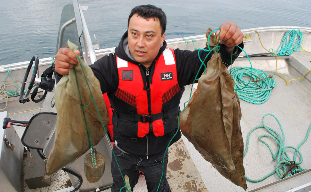
Shellfish farm production manager, Leo Vargas, with bags of scallop spats, also known as settled larvae.
Canadian waters, Chilean technology, and First Nations and Chinese investment are all contributing to the success of the Coastal Shellfish Corporation in Prince Rupert.
With a modern shellfish hatchery built in Prince Rupert and a shellfish farm in Metlakatla traditional territory, Coastal Shellfish hatches, grows and harvests scallops with minimal environmental impact.
Originally planned as an economic development opportunity in 2003, the hatchery launched as a pilot project in 2011 and had a few growing pains before its current success. Coastal Shellfish is now on track to becoming one of the biggest shellfish aquaculture operations in B.C.
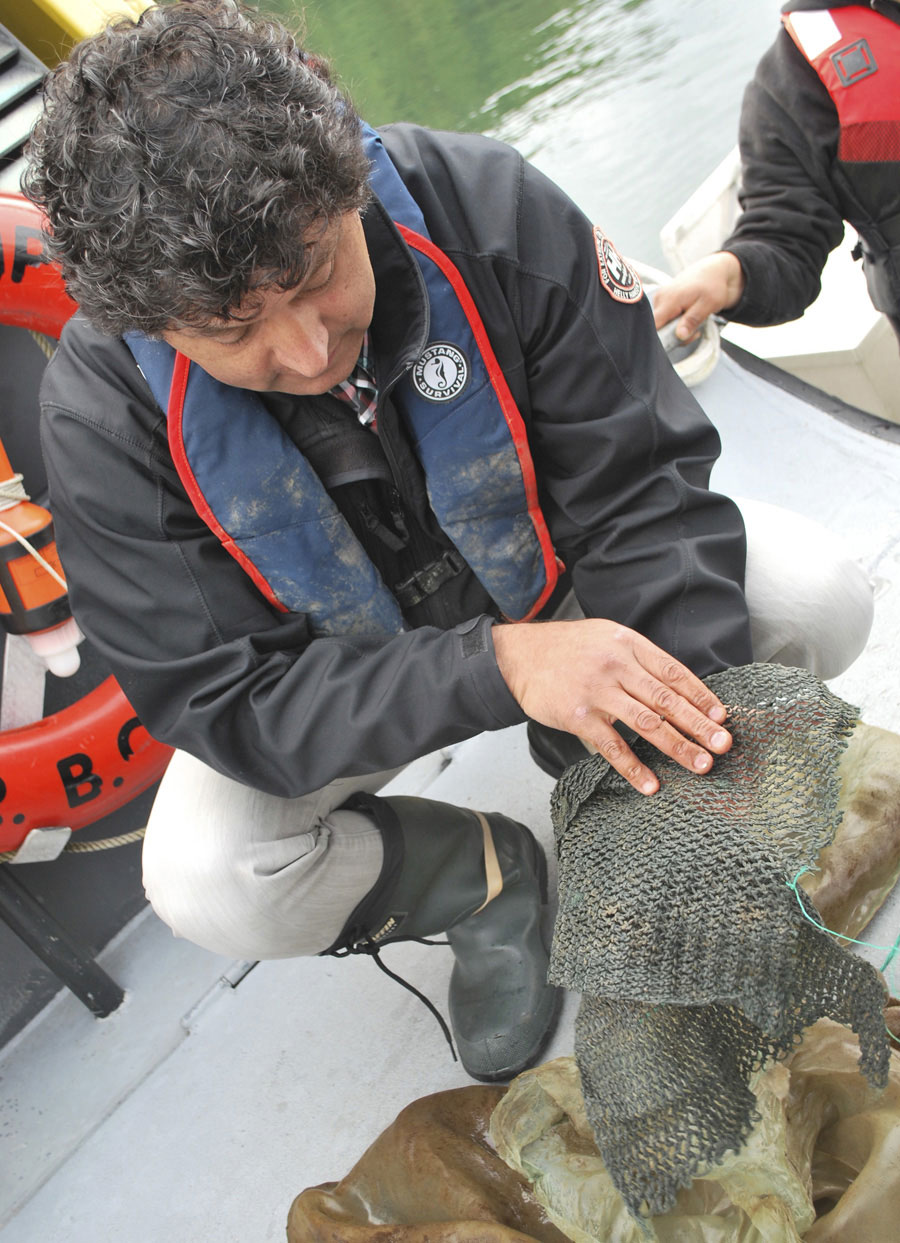
Operations vice president, Vittorio Venturini, checks scallop spats on setting nets.
Operations vice president Vittorio Venturini says that the water quality of the North Coast provides a huge advantage. “Up north, conditions are very good for shellfish farming. We have oceanic water coming in so that’s a good reason to have our farm here.” The challenge, he admits, is that logistics are harder to manage far from a large population base. But the company has a state-of-the-art hatchery in Prince Rupert, farm sites in Metlakatla territory, and plans to be processing scallops in Prince Rupert late this year. The scallop production cycle target is 24 months or less.
There’s big demand in the U.S. and Canada for scallops and there’s a shortage of product, according to Venturini. While most of the shellfish industry in the province generally uses rafts for farming, Venturini has perfected the less expensive, more efficient long lines typically used in Chile for large-scale shellfish farms. “A large farm requires an efficient system,” he says. “Lines sit under the water rather than on the surface, being more cost-effective, more environmentally friendly and safer than rafts.”
With its partners – the Metlakatla First Nation, the Coastal First Nations through its Great Bear Initiative and (Chinese) Canada Blossom – Coastal Shellfish expects to create 50 to 60 new jobs within the next few years. Coastal Shellfish plans to farm other species as well – perhaps geoduck and sea cucumber. “We’re already making some trials with other species,” Venturini says.
 Craig Outhet, who is co-lead of the North Coast MaPP sub-region planning process, says that the goal is to increase economic benefit while, at the same time, managing ecological impacts. “While MaPP supports the idea of shellfish aquaculture, it doesn’t mean the gates are wide open,” he notes. “We need to make sure these farms are managed right.”
But he’s confident the Prince Rupert operation is on the right track so far. “We’re working to find the holistic balance of the ecological, the human well-being and the governance,” he says. “You might think these things are at odds, but they’re not really.”
He particularly likes the way the MaPP process is looking ahead 20 years. “It’s a long-term planning process,” he says. “Regardless of what’s currently happening, we’re planning for the long term.”
Where the forest meets the sea – harvesting logs, protecting habitat

A typical small log dump found today. A protective debris curtain to the right of the float camp is designed to protect the beach habitat.
A two-year old artificial rock reef used to compensate for log dump impacts. Shellfish in foreground is endangered abalone.
How do First Nations, the forest industry and the provincial government work together to manage logging in the Central Coast? And, just as importantly, how do they protect the environment while they’re doing it?
In response, Warren Warttig quotes a university professor: “Forestry isn’t rocket science – it’s much harder than that,” he notes. Warttig is the senior planning biologist with the forest company Interfor, and a member of the Central Coast Marine Plan Advisory Committee. The challenges surrounding forestry are particularly critical in the Central Coast Region, he says, where about 50 per cent of the land is either park or protected and an additional 35 per cent of the productive forest land-base is constrained by some form of protective legislation.
In the old days, when understanding of how to protect the environment was less acute, forest companies typically dumped their logs into well-developed estuaries. “We now recognize those areas as some of the worst places to put log dumps,” Warttig says.
Now there is a ‘no-net-loss-of-habitat’ policy in place, established by the federal department of Fisheries and Oceans (DFO). When forest companies have an impact on habitat they are required to replace it with a compensation habitat. “We’d find an area and build a rock reef which, if done right, can produce some pretty nice habitat – particularly for abalone and rock fish,” Warttig says. Visual impact is a whole additional matter, addressed through forest legislation. Forest companies now have software allowing them to accurately model what an area will look like after logging.
Interfor already has a protocol agreement with the Wuikinuxv First Nation and is currently working on one with the Heiltsuk. Protocol agreements formalize the relationship between industry and First Nations and clarify information sharing, management best practices, and consultation requirements. They may also include employment and economic components. “It’s important to us that we have these agreements,” Warttig says. “We’re aware that we’re operating in the traditional territories of the First Nations and we want to be thought of as a good neighbour.”
From the Heiltsuk point of view, the forest industry has been pretty good in recent years, according to Heiltsuk stewardship director Kelly Brown. “They’ve responded well to having First Nations staff members on their team and we’re working our way to becoming more involved in activities in our territories.”
Six different forestry companies operate in the Heiltsuk territory and the First Nation hopes to make formal agreements with all of them. “We have a fairly vigorous checklist of requirements from industry and the province that we set out in the agreement itself,” Brown says.
“Industry has responded quite positively in moving their projected cut-block areas so they wouldn’t affect Heiltsuk or salmon,” Brown says. “Everything is moving in the right direction and we expect to have agreements in principle very soon.”
The Heiltsuk are also applying for some buffers around old village sites and, in general, they hope to minimize the amount of lumber that’s being taken. “The review’s going on right now,” Brown says. “There are always pros and cons to taking timber,” he says. “We don’t want cutting for the sake of cutting.”
Heilsuk marine planner Julie Carpenter agrees. “We’ve been working with the province and the forest industry through the MaPP process to identify areas of interest for protection,” she says. “We’ve talked quite a bit about cumulative impact of different logging sites and we’re trying to work with the logging companies to limit those impacts.”
North Vancouver Island MPAC Meeting #9 – Feb 19-20, 2014
North Coast MPAC Meeting #8 – Nov 13-14, 2013
Regional RMAC Meeting #4 – February 4-5, 2014
In Memoriam
With sadness the MaPP team acknowledges the passing of Bill Johnson on December 9, 2013. The MaPP initiative is grateful to Bill’s contributions as a representative of the renewable energy sector to the North Coast Marine Plan Advisory Committee and on other advisory committees. The MaPP team sends condolences and deep sympathy to Bill’s family. For more information please visit William Johnson Obituary.