A first in Canada: Indigenous Guardians given same powers as BC Parks rangers

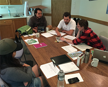
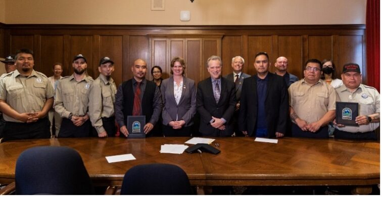
The Memorandum of Understanding signing ceremony.

“It’s something we’ve always been working towards.”

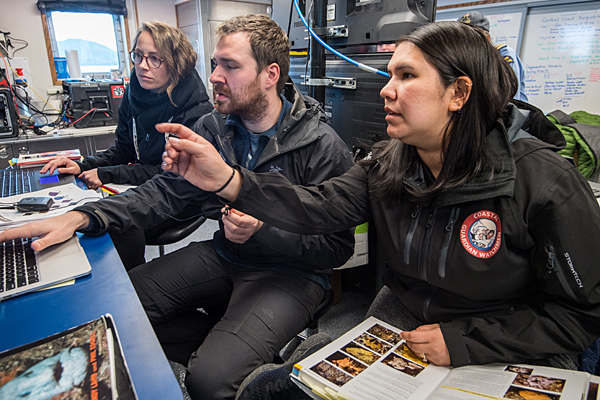
Those are the words of Ernie Tallio, Guardian Watchmen Manager for the Nuxalk Nation on BC’s Central Coast. He’s talking about an agreement between the Nuxalk and Kitasoo Xai’xais First Nations and BC Parks to share compliance and enforcement responsibilities within provincial protected areas in the Nations’ territories. The Shared Compliance and Enforcement Pilot Program officially launched in July 2023 with five Nuxalk and six Kitasoo Xai’xais Guardians receiving park ranger appointments.

“It’s exciting to be part of this initiative… to be part of something that’s a first in Canada,” said Ernie. “It’s taken several years to get to this point and a lot of collaboration with BC Parks. We were often told by government agencies we work with that we didn’t have any authority but now we do.”
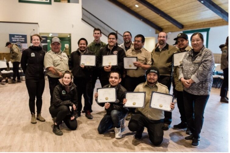
Guardians with their bootcamp certificates.

The 11 Guardians with park ranger appointments have the same powers under the Park Act as park rangers employed by BC Parks in more than 40 protected areas, including Tweedsmuir Park, the Fiordland Conservancy, Kitasoo Spirit Bear Conservancy and Dean River Conservancy. They can give warnings or issue tickets for infringements of the Act. Among other training, each has taken BCIT’s BC Parks Law and Its Administration course and participated in a two-week ranger bootcamp at Manning Park.

The agreement between BC Parks and the Nuxalk and Kitasoo Xai’xais is a recognition that these Central Coast Nations have sustainably managed resources in their territories for thousands of years.
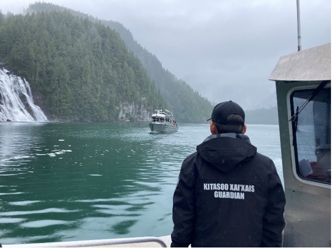
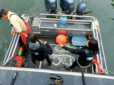
Kitasoo Xai’xais Guardian in the field.

“This is an incredibly important step towards reconciliation,” said Dana Holtby, an advisor with the BC Parks’ Indigenous Relations Team and part of the technical working group for the pilot. “It’s a unique moment when the Crown has recognized the authority, capacity, and capability of the Guardian programs. It’s a recognition of the role Guardians have played in stewarding their territories for generations. People in these communities are incredibly proud of the work the Guardians are doing.”
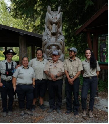
Nuxalk Guardians and BC Parks rangers.

BC Parks has been collaborating with both Nations for two decades, working side by side on park management planning and through joint training and patrols. MaPP has also played an important role in creating space to allow a strong and trusting relationship to grow. The organization hosted a communication workshop for BC Parks operational staff and Guardians in 2018 as well as joint training to foster a more collaborative approach to monitoring the Central Coast. Another communication and collaboration workshop was held in 2019 and MaPP also funded Guardians to take part in BC Parks ranger training in Williams Lake.
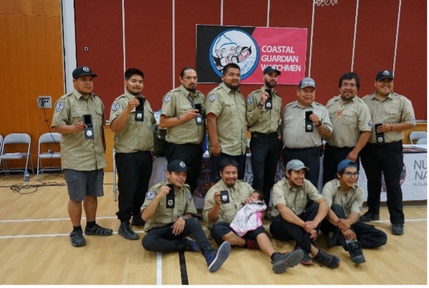
Nuxalk and Kitasoo Xai’xais Guardians with their park ranger badges.

MaPP is committed to providing ongoing coordination and support for compliance and enforcement. This contributes to numerous objectives and strategies of the Central Coast Marine Plan including improving marine-based compliance monitoring, and minimizing current and potential ecological impacts of logging-related activities. Over time, MaPP expects the pilot project will build First Nations’ capacity for compliance and enforcement, increase respect for the authority of First Nations’ Guardian programs, improve understanding, communication, and collaboration between provincial agencies and First Nations, and ensure compliance with marine laws on the Central Coast. Collaborative stewardship will result in improved Central Coast Marine Plan outcomes. MaPP also hopes the program will serve as a path for other Nations seeking greater authority to manage and make decisions regarding their territories.
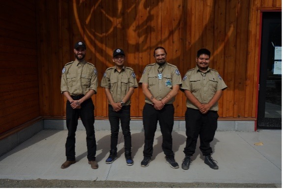
Kitasoo Xai’xais Guardians.

“This work is serving as an inspiration for other Nations,” said Ernie. “I attended an Indigenous Leadership Initiative gathering in Ottawa in spring 2023 and there was definitely interest in what we’re doing.”

“There are a lot of eyes watching this pilot,” added Dana. “We’re excited to continue to build the partnership between BC Parks and the Kitasoo Xai’xais and Nuxalk Nations, and to see where this pilot leads us.”

Getting Their Geoducks in a Row: MaPP-Inspired Research Helps Central Coast Nations Explore Shellfish Aquaculture Potential

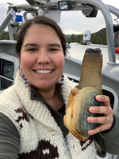
Desiree Lawson, former MaPP Implementation Coordinator for the Central Coast Indigenous Resource Alliance (CCIRA), shows off a robust geoduck harvested near her home in Bella Bella, Haíɫzaqv (Heiltsuk) territory. “The first time I saw one, I was impressed with how heavy and massive it was, and I imagined how many people one geoduck could feed,” she said

A research partnership is helping Central Coast First Nations get the data they need to evaluate opportunities in the vibrant international seafood market for Panopea generosa — or geoduck, as this species of burrowing clam is more commonly known.

A traditional food for coastal Indigenous people, geoduck can live more than 140 years, and a single female geoduck can produce 5 billion eggs over the course of her life. The clams are described as having a sweet, clean ocean taste and a texture that’s squid-like with a bit of crunch. Since the 1970s, B.C.’s geoduck industry has grown into a multi-million-dollar business. Today, about 3 million pounds are harvested annually by divers in waters up to 30 metres deep, and by people digging them up at low tide. More than 90 percent of this harvest is flown fresh to Asia, where it can fetch $30 a pound.

For First Nations that are part of the Marine Plan Partnership (MaPP), the burning question is whether geoduck clams can be profitably cultivated to become a sustainable business.

“It is a very hot commodity right now, and there is a lot of interest in cultivating [geoduck] in both subtidal and intertidal zones,” observes Dr. Myron Roth, an aquaculture and marine fisheries expert at the Ministry of Agriculture & Food. “But we don’t really have the numbers yet to show how lucrative it will be. On paper it looks really good, but nobody grows fish on paper!”

“This industry is very much in its infancy,” adds Sally Cargill, a marine planning specialist at the Ministry of Water, Land and Resource Stewardship, and the provincial co-lead for MaPP implementation. “There’s quite a bit of investment required up front to start a commercial operation, so the feasibility of it needs to be looked at very closely.”

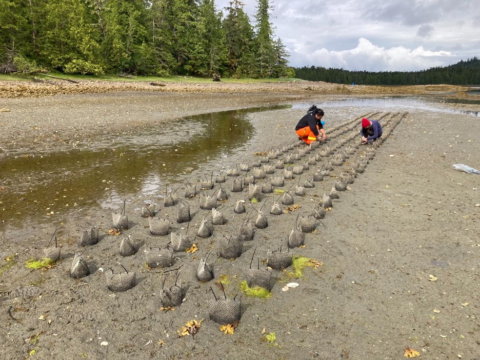
That’s why Central Coast MaPP partners, the Heiltsuk and Kitasoo Xai’xais Nations, have teamed up with North Island College (NIC) on a five-year research project to explore the viability of intertidal geoduck aquaculture in the region. During the summer of 2023, juvenile geoduck were planted at study sites on the Central Coast, selected based on the Nations’ knowledge of geoduck in the area, key habitat parameters, and other factors. “You need that ‘Goldilocks zone’,” explains Logan Zeinert, a research technician from NIC’s Centre for Applied Research, Technology & Innovation and Project Lead. “A good sandy site with a deep enough substrate that the geoduck clams can bury themselves.” Over the next two years, geoduck survival and growth at these sites will be carefully monitored and compared to determine optimal production conditions. The resulting data will be useful both to researchers and the communities evaluating the commercial viability of geoduck aquaculture at these sites.

Out-planting geoduck seeds at low tide at one of four study sites on the Central Coast. The seeds are planted in Vexar mesh tubes to protect them from predation. Photo: Logan Zeinert.

“I hope geoduck aquaculture can deliver financial benefits and employment for our Nations,” says Heiltsuk Nation Aquatics Manager Mike Reid from his home in Bella Bella. “The bigger point is that it could provide more sustainable, low-impact food source, especially as other sources, like salmon, are not doing well.” Reid says the Heiltsuk and other coastal peoples have long harvested geoduck for food, even in subtidal zones, using ingenious methods that predated technologies used by today’s underwater harvesters.

Santana Edgar, Marine Planning Coordinator for the Kitasoo Xai’xais, is also looking forward to research insights. “Can we successfully grow geoduck, and do we have enough suitable intertidal habitat to achieve the economies of scale to create meaningful employment for our people?” she asks. “Kitasoo Xai’xais have been engaged in finfish aquaculture since the 1990s and have always wanted to expand operations into shellfish aquaculture. This can be a low impact way of benefiting from our surrounding ocean.”

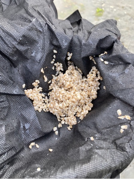
In the right conditions, baby geoduck clams like these can grow to a harvestable size of a few pounds each within six to ten years—but they can live more than 140 years. Photos: Logan Zeinert (left) and Geneviève Reynolds (right).

Core funding for the project comes from the Natural Sciences and Engineering Research Council of Canada (NSERC), and the Rural Economic Diversification and Infrastructure Program (REDIP), with additional funds and in-kind contributions from CCIRA, the Central Coast Commercial Fisheries Association (CCCFA), the Province of B.C, and Fisheries and Oceans Canada (DFO).

Five years into MaPP implementation: Expanded guardian watchmen programs are making a significant difference


Sandie-Ernie-survey

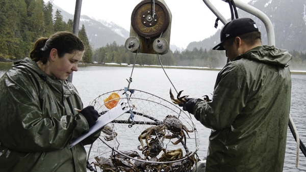
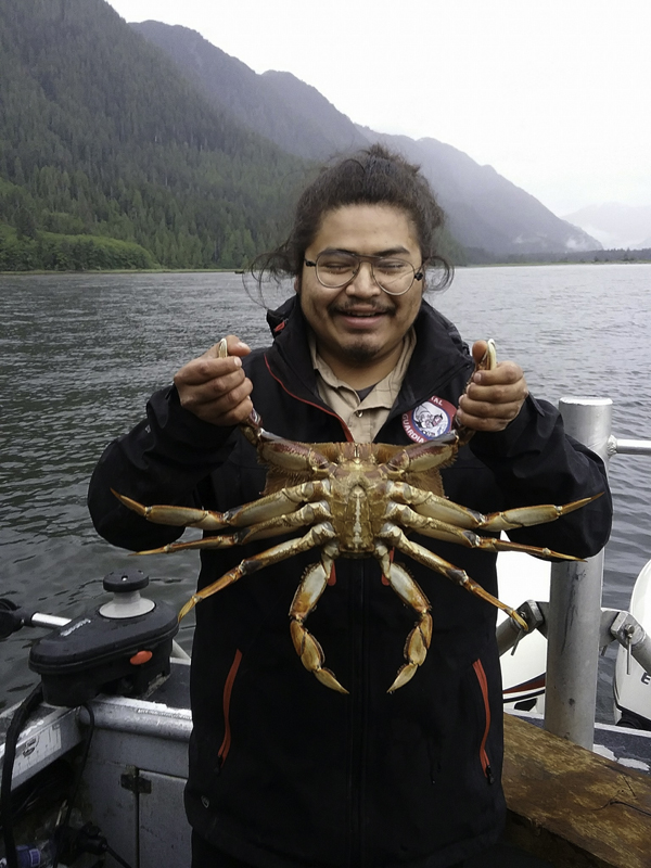
Sandie Hankewich and Ernest Mason (Kitasoo/Xai’xais Fisheries Program) conducting Dungeness crab surveys. (Photo credit: Tristan Blaine, CCIRA)

For many years, guardian watchmen have been stewards for the Heiltsuk, Kitasoo/Xai’xais, Wuikinuxv, and Nuxalk Nations on the Central Coast. And for the past five years, each Nation’s program has been able to accomplish more thanks to MaPP, which funds two positions in each Nation with a specific focus on monitoring key ecosystem-based management (EBM) indicators. Guardians are now collecting data in places and on a scale that no other agency does, and the impacts are changing the way species are managed and biodiversity is protected.

“Funding from MaPP has opened up a whole new set of work and grown our capacity,” says Diana Chan, who works with the Heiltsuk Nation. “These guardians monitor EBM indicators including kelp and Dungeness crab. We’re using the Dungeness crab surveys to inform our collaborative management discussions with Fisheries and Oceans Canada (DFO).”

“Our program is more robust because of MaPP funding,” agrees the Kitasoo/Xai’xais Nation’s Evan Loveless. “It takes time to build capacity and there are ongoing challenges of working in remote communities. But our partnership with MaPP means we have data from across the region that we can use for more strategic management. We’re planning better and we’re moving towards improved stewardship over our marine environment.”

The Central Coast Indigenous Resource Alliance (CCIRA) supports the regional stewardship efforts of guardian watchmen programs within the four Central Coast Nations, and these programs are in turn part of broader regional network supported by the Coastal Stewardship Network. Tristan Blaine trains the MaPP-funded watchmen on how to collect data that informs ecosystem-based management.

“Having everyone collect data the same way means we have uniform information that can be used to make valid comparisons and communicate coast-wide trends,” he says. “This gives the data more power to be used for resource management decisions. And the watchmen are starting to appreciate the importance of their work; I’ve noticed a real shift in their sense of ownership of the territory and its resources.”

The data the watchmen collect are used to inform collaborative management with the provincial and federal governments. Kelp monitoring, for instance, is informing a MaPP regional kelp monitoring program. Observations of vessel traffic provide data for marine park management and use permits. Data collection assists with determining if forestry activities in the marine environment are in compliance with the conditions in the tenure agreement and Management Plan, and also helps identify hot zones for oil spills as well as for mitigation and response management. Ocean temperature and other oceanographic indicators are noted, offering insights on climate change and impacts on critical near-shore habitats such as kelp and eelgrass. Data gathering has also proved vital in protecting sacred cultural sites and good sources of food such as Pyropia (edible seaweed).

The Dungeness crab survey is one of the longest-running projects on the Central Coast. Alejandro Frid is CCIRA’s science co-ordinator and, in collaboration with Madeleine McGreer, analyzes the data watchmen collect.

“The data are being used to monitor EBM Indicators and to see if MaPP’s protection management zones are helping with conservation as well as defining where commercial and recreational fisheries are having an impact,” says Alejandro. “The Dungeness crab data were used extensively by our joint technical working group with DFO and resulted in closures to commercial fisheries intended to restore and preserve First Nations’ access to traditional foods. That’s been the most impactful study so far but we’re also on the way to applying the data collected in other areas.”

MaPP funding has also helped build bridges between the Nations and provincial agencies.

“MaPP has helped us build relationships with the Nations and we’ve gained a better understanding of the guardian watchmen programs, their concerns and focus,” says Natural Resources Officer Denise Blid. “We now have regular meetings and have worked together on a number of occasions. It’s a priority for our agency to continue to work together to strengthen these partnerships.”

Momentum is also building between watchmen and BC Parks’ officials. Peter Woods is the agency’s area supervisor on the Central Coast.

“The guardian watchmen attended ranger training in 2018 and 2019 and we held a joint workshop last year that was a great success in building trust and followed that up with another in 2019 that has helped us forge an even stronger relationship,” says Woods. “We discussed joint patrol opportunities as well as future projects; collaboration has increased substantially between BC Parks and the four Central Coast Nations. That will result in strong protection and stewardship of our resources.”

“Every year, we can point to more tangible outcomes thanks to the MaPP-funded guardians,” says CCIRA’s program director, Aaron Heidt. “The programs are gaining capacity and professionalism. There’s growing awareness with provincial agencies and that’s leading to better co-ordination and improved working relationships. Over the long-term, I see these watchmen as playing a key role in who we go to for scientific data on the Central Coast and as the face of MaPP implementation as well as marine conservation and management.”

Alec-Willie-crab

Alec Willie (Wuikinuxv watchman) amazed at the size of the crab inside the Indigenous crab closure areas. (Photo credit: Tristan Blaine, CCIRA)

Deep-sea expedition sheds light on need for marine protection

vector

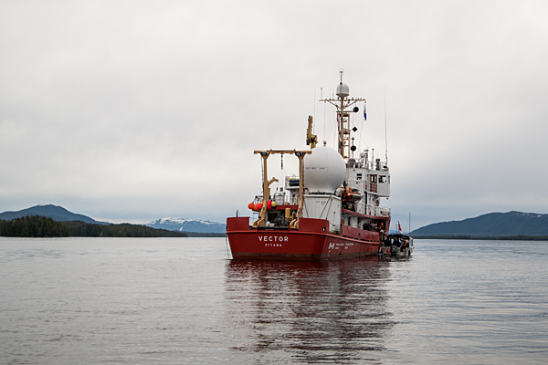
The Canadian Coast Guard research vessel Vector exploring the Central Coast. Photo credit: Oceana Canada/Evermaven

The fjords of B.C.’s Central Coast are home to an astounding abundance of marine life including fragile deep-sea corals and sponges and the rockfish they provide habitat for. While First Nations Elders have long spoken of this profusion of life, traditional Indigenous knowledge is now backed up by scientific data gathered during an expedition aboard the Canadian Coast Guard research vessel Vector. Scientists visited Kynoch Inlet, Seaforth Channel and Fitz Hugh Sound in March 2018 as part of a collaborative survey between Fisheries and Oceans Canada (DFO), Oceana Canada, Ocean Networks Canada, the Central Coast Indigenous Resource Alliance (CCIRA), and the Heiltsuk and Kitasoo/Xais’Xais First Nations. The Marine Plan Partnership’s (MaPP) Central Coast Marine Plan includes objectives and strategies for identifying and closing information gaps – and there is much to learn about marine life far below the water’s surface.

“The plan was essential to our expedition,” said Oceana Canada’s Science Director Dr. Robert Rangeley. “We were building on existing knowledge and we referred to the Central Coast Marine Plan frequently. There was a lot of back and forth between the partners about where to explore and the Central Coast marine plan was used in those discussions.”

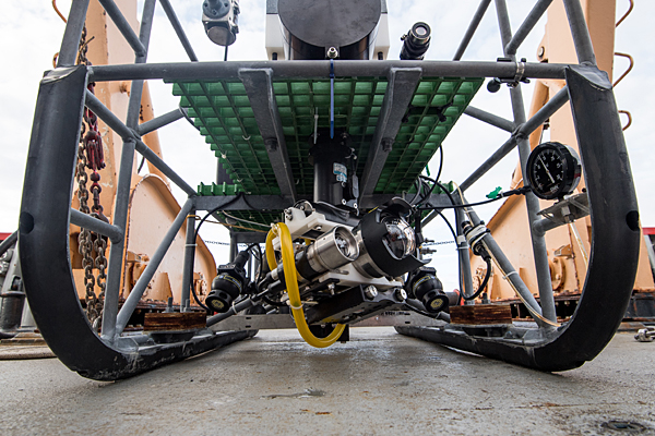
The expedition used a camera capable of filming at depths of more than 2,000 metres—much deeper than previous studies had access to.

drop-camera

Footage taken from the seafloor was captured using Fisheries and Oceans Canada’s submersible drop-camera called BOOTS. This drop-camera has an array of sub-sea scientific and navigational instruments, including high-resolution cameras, flood lights and sensors. Photo credit: Oceana Canada/Evermaven

“We were able to find high densities of vulnerable species such as corals and sponges in habitats never explored,” said DFO’s Program Head for Deep Sea Ecology, Tammy Norgard. “We’ll be using these findings to refine our modelling to determine locations for these species.”

livestsream

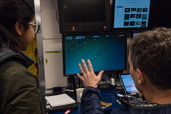
Robert Rangeley, Oceana Canada’s science director, and a youth from Klemtu talk about what they are seeing on the seafloor, streamed to the boat live from the submersible drop-camera. Photo credit: Oceana Canada/Evermaven

Marine Planning Co-ordinator for the Kitasoo/Xai’Xais Nation Barry Edgar acted as the community liaison in Klemtu. “People were fascinated to watch the live video feed and surprised to see all the life at those depths,” he said. “It confirmed a lot of knowledge that has been passed down and we also learned a lot. It was great to have this happen in our community.”

“Before this expedition, the deepest we’d been able to do video work was 200 metres,” added CCIRA Field Technician Tristan Blaine. “Our Elders have talked about these areas, but there was no scientific knowledge. The data we’ve collected has changed the way we see these fjords and provides vital information needed for protecting them.”

identify-marine-life

From left: Lily Burke, Fisheries and Oceans Canada, Tristan Blaine, CCIRA, and Desiree Lawson, Heiltsuk First Nation guardian watchman, identify and log marine life they are seeing during the expedition. Photo credit: Oceana Canada/Evermaven

“The information collected will feed directly into the process of planning a network of marine protected areas in the Northern Shelf Bioregion, with a goal of protecting high value areas including unique habitats and species,” said Sally Cargill, a marine planning specialist with the provincial government and Central Coast co-lead for MaPP. “Deep sea corals and sponges were found within protection management zones. The new information also provides further rationale for MaPP’s protection management zones and may inform future management direction in those areas.”

All the partners were enthusiastic about the expedition’s community engagement component that was led by Maia Hoeberechts with Ocean Networks Canada.

“Ocean Networks Canada supplied the satellite dome and transmitted the underwater video feed to communities along the Central Coast and elsewhere,” said Maia. “This was broadcast to the schools in Bella Bella and Klemtu. We also made sure community members from youth to Elders had an opportunity to visit the research vessel and take part in the expedition. Our goal was to help provide data that helps communities, governments and industry to make informed decisions about our future.”

Brock-Vernon-rockfish

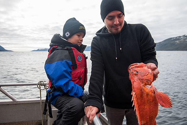
As part of the expedition’s community engagement initiatives, First Nations youth were welcomed aboard the Vector. Here Brock and Vernon examine a rockfish that lives in the region’s depths. Photo credit: Oceana Canada/Evermaven


oceana-team-photo

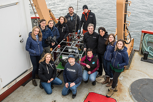
The expedition was a collaboration of several partners. Clockwise from top (12 o’clock): Kim Wallace, DFO; James Pegg, DFO; Caroline McNicoll, DFO; Jennifer Whyte, Oceana Canada; Alexandra Vance, Oceana Canada; Maia Hoeberechts, Ocean Networks Canada; Robert Rangeley, Oceana Canada; Tammy Norgard, DFO; Alexandra Cousteau, Oceana; Joshua See, Evermaven; Caitlin McManus, Evermaven; Lily Burke, DFO; and Tristan Blaine, CCIRA. Photo credit: Oceana Canada/Evermaven

Pushing back against new aquatic invaders: Central Coast Nations take critical first steps

European green crab

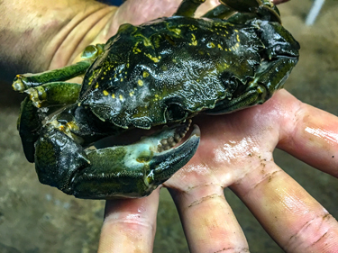
With a 158 mm-wide carapace, this European green crab (Carcinus maenas) trapped by the CCIRA monitoring team is unusually large: on the Central Coast, the observed average is closer to 50 mm. Females can release up to 185,000 eggs once or twice per year, and larvae can drift around 50 to 80 days in ocean currents before settling to the sea floor. Image courtesy of CCIRA.

Four First Nations are partnering with the Province of B.C. to implement MaPP on the Central Coast through a coordinated response to three aquatic invaders: European green crab, tunicates, and bryozoa.

Originating in northern Europe, green crab is billed by Fisheries and Oceans Canada as “one of the world’s 10 least wanted species.” They’re small (about 10 cm wide) but multiply rapidly, tolerate a wide range of salinities, and survive out of the water for up to two weeks. They disrupt ecosystems by voraciously consuming mussels and clams and decimating habitat for important species like Dungeness crab, wild salmon, and manila clams.

Tunicates (commonly known as sea squirts) and bryozoa (tiny aquatic invertebrate animals) are at least as pernicious. These filter-feeders live on almost any underwater surface, including plants, other animals, and marine structures. Growing in colonies, they can quickly overtake kelp and seagrass beds, plug water pipes, and sink marine structures. Once established in a new area, they’re very tough to get rid of.

Tristan Blaine is a professional diver and field technician who works for the Central Coast Indigenous Resource Alliance (CCIRA, which is comprised of the Heiltsuk, Kitasoo/Xai’Xais, Nuxalk, and Wuikinuxv First Nations). He describes the challenge of “biofouling” from tunicates and bryozoa: “You clean them off [marine structures], and a month later they’ve totally regrown. The amount of work involved is pretty concerning.”

Keith Windsor

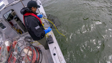
Keith, a Guardian Watchman from the Nuxalk Nation who is engaged with the CCIRA monitoring effort, retrieves a green crab trap. These traps are relatively costly, imported from Japan, and specially designed to minimize bycatch—provided they’re checked almost daily. Image courtesy of CCIRA.

These problematic species have hitchhiked to oceans around the world, as larvae in ballast water on intercontinental shipping routes and on poorly cleaned boat hulls, fishing gear, aquaculture equipment, floating debris, and ocean currents.

In May 2017 as part of MaPP implementation, CCIRA began building on the Heiltsuk Nation’s work over the past decade to eradicate green crabs around Gale Creek—by expanding it to include the other Central Coast Nations. More than 10 people (Guardian Watchmen and other fieldworkers) from the four Nations are now monitoring these aquatic invaders, collecting critical baseline data on their presence, abundance, and damage to the ecosystem.

For green crabs, the monitors use traps specially designed to reduce bycatch, boating several times weekly to trap locations to record trap data and dispatch them (usually by freezing). Green crab have been found at 4 of 25 continuously sampled sites—but data suggest green crab are spreading more slowly than expected on the Central Coast. Is this because of Heiltsuk extirpation efforts—destroying hundreds annually—or because of deep, chilly conditions of the region’s many fjords?

“We don’t know yet,” says Blaine. “But I can guarantee that if more trapping effort were all that’s required to get rid of green crab, these Nations would have everyone in their communities helping.”

Invasive tunicate

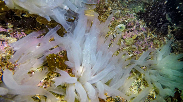
This translucent tube-shaped species of tunicate, Ciona savignyi, is one of many now appearing on the Central Coast. This filter-feeder consumes small organisms like phytoplankton, zooplankton, and the larvae of important species of fish and shellfish. Growing in colonies, it can reach a height of six inches and rapidly outcompete local species. Image courtesy of CCIRA.

To look at tunicates and bryozoa, monitors suspend weighted plates 1.5 m below docks at Shearwater Marina—about 4 km east of Bella Bella and the hub of Central Coast marine traffic. “The goal is to sample areas with highest boat traffic, because that’s one of the ways they spread,” explains Blaine.

After five months, monitors retrieve plates, record data on the observed tunicates and bryozoa in CCIRA’s database, and send five randomly selected plates to researchers at Fisheries and Oceans Canada for detailed analysis.

The intent was to quickly train local stewardship technicians to do all baseline analysis, but it’s a very specialized process. There are only a few biologists in BC equipped to definitively identify these invasive species, using a microscope and working through complicated classification steps. Each of the 22 1-cm2 points on a plate can host several tunicate and bryozoa species, and analysis of five plates can take a couple of days to complete.

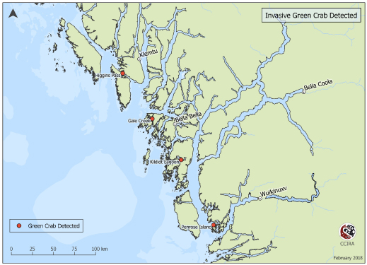
Locations of green crab

This map shows the locations where invasive green crab was detected in the Central Coast sub-region. Image courtesy of CCIRA.

Data shared among Nations begs questions: If eradication of invasives isn’t realistic, can they be contained? Should regulations be strengthened and better enforced, and if so, how? How will climate change affect these introduced species?

Some answers may come from a related MaPP-funded study on climate change that began in January at the University of Victoria, says Sally Cargill. She’s a marine planning specialist with the Ministry of Forests, Lands, Natural Resource Operations and Rural Development, and is the provincial co-lead on implementation of the Central Coast marine plan.

“They’re looking at existing frameworks and tools for carrying out vulnerability and risk assessments that have been used around the world,” says Cargill, noting that risks include invasive species. “They’ll recommend assessments that could be applied to the MaPP areas.” The sub-regions could then decide to carry out detailed vulnerability and risk assessments in coming years—which could lead to actions such as additional monitoring, site restorations, education campaigns, and measures to protect aquaculture operations.

The Nations’ millennia-long connection to these ecosystems is integral to this work, says Blaine: “They rely on the surrounding resources to survive, and a big priority for these communities is to make informed choices about resource management.”

Supporting Emerging Aboriginal Stewards (SEAS) projects in the Central Coast

High school students learn traditional skills on a SEAS Outdoors Club camping trip to Goose Island in Heiltsuk territory. Photo credit: Johanna Gordon-Walker.

High school students learn traditional skills on a SEAS Outdoors Club camping trip to Goose Island in Heiltsuk territory. Photo credit: Johanna Gordon-Walker.

Raised on a gillnetter in a fisher family, Howard Humchitt spent most of his childhood on the water learning how to harvest Heiltsuk Nation marine resources. “It’s a way of life for us,” he explains. “For many parents who own boats, their kids get their sea legs early. They get a feel for the ocean under their feet before they’re even walking.”

For families who don’t own boats or lack the resources to get out on the water, Howard says the Supporting Emerging Aboriginal Stewards (SEAS) initiative fills a gap. As a SEAS Outdoors Club mentor in Heiltsuk territory, he says the program helps prepare First Nations youth to become the next generation of stewards in their communities.

“The SEAS outdoor program has given me a huge opportunity to pass on the knowledge that I’ve been taught by my father, uncles and brothers to others,” he says. “We help kids to get out and be a part of the land and a part of the ocean.”

First started in 2009, SEAS is active in the Heiltsuk, Kitasoo, Nuxalk and Wuikinuxv First Nations communities of the Central Coast of British Columbia. Classroom and outdoor activities are designed to cultivate a deeper understanding of traditional cultural beliefs and marine values.

“It keeps our kids in touch with who we are as a people,” Howard affirms. “We’ve always been a part of the ocean. It’s a mainstay of our diet.”

In line with the goals of the Marine Plan Partnership (MaPP), the SEAS Outdoors Club helps foster ocean stewardship. High school students learn practical skills in fishing, wilderness first aid and boat safety. They visit ancient clam middens and learn how important ocean resources have been to their community for thousands of years.

“Stewardship is something that is learned by being out on the land and the water,” says SEAS instructor Johanna Gordon-Walker. “Students are picking up the skills needed to become young leaders and the confidence to share their skills. They know how to make a fire and cook over it and they learn the territory well enough to know which way to go in a boat.”

The Central Coast Marine Plan includes objectives and strategies aimed at protecting and sustaining the region’s rich traditional and cultural resources by engaging young people in traditional use activities. SEAS brings elders into the classroom to demonstrate how to use plants as medicine and to teach the cultural protocols for sharing harvests with the community. Grade 4 students study herring science on the water. They learn how to set tree branches for herring roe and to preserve the eggs.

“The thing that really sticks with you most is the wonder and awe factor,” says Johanna. “It’s a huge adventure for the younger children to go out on a boat for the day. The more they learn, the more questions they have.”

Funding for MaPP supports SEAS program coordination, cultivating the next generation of stewards to carry out marine plan implementation. On this year’s first winter camping trip, students job-shadowed commercial crab and prawn fishers.

At the end of the SEAS program, some graduates aspire to work with the coastal guardian watchmen or the Coast Guard. For others, learning to harvest ocean resources for their families makes them feel appreciated and gives them a productive role in their communities.

The experience is rewarding for Howard, too.

“When the students see something for the first time, I take joy in seeing their eyes light up,” Howard recounts. “When somebody sees a wolf for the first time, I realise it’s not just another wolf. It’s the first wolf this person is seeing. Every one of these opportunities make me appreciate what we have and allows me to see something for the first time– again.”

Coastal Guardian Watchman training and ecosystem-based management indicator development

CGW1

(Clockwise from top) Vernon Brown, Curtis Rollie, Anna Gerrard, and Chantal Pronteau review MaPP deliverables, discussing objectives and required actions and outcomes. Photo credit: Gord McGee.

First Nations people have long understood that the use of natural resources needs to be carefully managed in order to remain sustainable. They recognize that species, ecosystems and humans cannot be considered in isolation – healthy environments and healthy communities go hand-in-hand. This has been a guiding principle in their relationship with nature for thousands of years. Today, the Coastal First Nations – Great Bear Initiative Coastal Stewardship Network is supporting First Nations in using monitoring and standardized data collection to demonstrate scientifically why this approach, known as ecosystem-based management (EBM), is so important to preserving the lands and waters for future generations.

Chantal Pronteau and Curtis Rollie are guardian watchmen in the Central Coast’s Kitasoo/Xai’Xais Nation. This is the second year they have been monitoring and protecting their territory’s natural resources. Both live in Klemtu but are stationed in remote Mussel Inlet for three months of the year and spend an additional three months monitoring the rest of their Nation’s vast area.

With support from the Marine Plan Partnership (MaPP), Rollie and Pronteau took the first level of the Coastal First Nations Stewardship Technicians Training Program and are now participating in Level 2. The training includes 14 courses that develop a variety of skills including environmental compliance and monitoring.

Rollie Gerrard work

Kitasoo/Xai’Xais Nation Guardian Watchman Curtis Rollie (left) and Marine Plan implementation coordinator Anna Gerrard go over the upcoming guardian watchman schedule and responsibilities. Photo credit: Gord McGee.

“The training made a huge difference to how we do our work,” says Pronteau. “It made me more comfortable in my role as a watchman. This is work that can’t be done from a desk; we are the stewards of this land.”

“I’ve learned what to look for when patrolling, how to approach people so they feel welcome, and how to enforce First Nations laws,” says Rollie. “The small motors course has been valuable as we rely on our boats every day to accomplish our tasks.”

EBM monitoring is a priority for near-term implementation of the MaPP Central Coast Marine Plan, and Rollie and Pronteau collect data to support a variety of indicators including key species as well as noting human pressures on the ecosystem. They enter their findings on tablets and upload the information to the Coastal First Nations Regional Monitoring System (RMS).

“We’ll enter how many crab traps we see and where they are, how many boats we see and what they’re doing,” says Rollie. “We’ll record locations of logging and fishing tenures to monitor whether they’re operating in the right zone. We’ve done a rockfish survey where we count all the fish we catch in a 15-minute span and document all of them. We record water temperature, salinity and pH levels. We have a long list of things to check and all these indicators show us how everything is interconnected.”

Lara Hoshizaki administers the database that guardian watchmen such as Pronteau and Rollie upload information to. As the regional monitoring system coordinator, she works closely with the six Coastal First Nations that use the RMS and provides monthly reports.

CC CGW boat

Kitasoo/Xai’Xais Nation Guardian Watchmen Curtis Rollie (left) and Chantal Pronteau (right) work with the Coastal Stewardship Network’s training coordinator Elodie Button (centre) to measure ocean pH in their Nation’s territory. Photo credit: Curtis Rollie.

“A standardized system is able to provide a more accurate regional picture,” says Hoshizaki. “The data collected support Nations in studying and communicating what’s happening in their territories in a quantifiable way and also support ongoing scientific research, for example, the trap sighting data collected by the RMS is shared with the Central Coast Indigenous Resource Alliance for use alongside their ongoing Dungeness Crab research. EBM monitoring offers a holistic picture by looking at a broad suite of indicators related to ecological, economic, social and cultural well-being, and can provide solutions from several perspectives.”

An EBM framework guides the implementation of many of the MaPP strategies and the work the guardian watchmen perform is important to its success. Through training, MaPP is building capacity to collect data related to EBM indicators. This improves monitoring and enforcement and measures long-term changes in ecological and human well-being.

The Hakai Program brings together big minds to answer big questions

outershore_w375

West shore of Calvert Island

We know a lot about forests and the important role they play in our environment and our economy. But what do we know about underwater forests – the nutrient-rich kelp forests found along the North Pacific Coast?

Applied marine ecologist Anne Salomon, who studies kelp forests, calls them one of the most productive ecosystems on our planet. They provide habitat for rockfish, abalone, sea urchins and many more marine species. Kelp forests are also a source of food that fuels marine food webs and they help to calm the waters on wave-exposed outer shores, providing a safe haven or nursery for tiny larvae, fish and shellfish.

“They also sequester carbon dioxide, so they’re carbon sinks,” Salomon says. “That’s a pretty important service these days given that we have too much carbon in our atmosphere.”

Salomon is an assistant professor at Simon Fraser University in the School of Resource and Environmental Management and a member of the MaPP Central Coast Marine Plan Advisory Committee. She is also one of the principal investigators of the Hakai Network for Coastal People, Ecosystems and Management. Housed at SFU, it is a network of Canadian and international scientists that works with the Hakai Beach Institute on Calvert Island off the central coast of British Columbia.

Hakai and its funding body, the Tula Foundation, are the brainchildren of Eric Peterson and his wife, Christina Munck. A fourth generation British Columbian, Peterson is an early-stage entrepreneur who thinks long-term. He is a geneticist and molecular biologist who is used to examining things in detail. He is a former McGill University professor who worked in B.C.’s coastal resource industries in his student years. He is also a successful tech entrepreneur who sold his commercial interests to establish the Tula Foundation.

The Tula Foundation finances and runs the Hakai Program, a set of interlocking initiatives in ecological research and education that concentrate on coastal margins and the watersheds and estuaries that feed them. The Hakai Program focuses on long-term ecological research, which Peterson describes as, “Choose a region, study it long-term, study it year round, and study lots of factors and their interaction.”

Peterson’s commitment to long-term research is valued by scientists who often are funded for shorter time spans. “It’s a huge amount of foresight to provide long-term funding because you can only detect change with long-term monitoring … we need data that go through time,” Salomon says.

She adds that the type of data collection that Peterson helps to fund through the Hakai Beach Institute over time will assist scientists in assessing the effects of initiatives such as MaPP.

Recently, Salomon and a number of other scientists launched the Outer Shores Research Program. Funded by the Tula Foundation, the program works in collaboration with the Hakai Beach Institute and Central Coast First Nations, including the Heiltsuk and the Wuikinuxv. “The whole idea of the Outer Shores Research Program is to understand the major drivers of changes and their effects on near shore coastal ecosystems (including kelp forests and eel grass meadows) that people rely on – for sustenance, for cultural values, for economies,” Salomon explains.

Equally important to Salomon’s scientific research is the knowledge she and her colleagues gain from what she calls “deep time” or prehistory. “There is very clear evidence of prehistoric use and management for these resources. So I think we have a lot to learn from coastal First Nations.” For instance, Salomon’s lab work has recently shown that ancient First Nations clam gardens can almost double clam production compared to uncultivated non-walled clam beaches.  “Indigenous people in the past didn’t increase their footprint,” she says, “They made their footprint more productive.”

Michael Reid is the aquatics manager for the Heiltsuk Integrated Resource Management Department. For more than a decade he has looked for solutions to challenging marine issues on the Central Coast. “Eric Peterson and Christina Munck not only provide funding, they provide the opportunity to bring all of us together,” he says. “They have brought a lot of brilliant minds together in trying to answer some of the bigger questions. And you know, it’s worked really well.”

See video of underwater kelp forests.


See the rugged coast of Calvert Island from helicopter.

Hakai – The Rugged Coast from Grant Callegari on Vimeo.


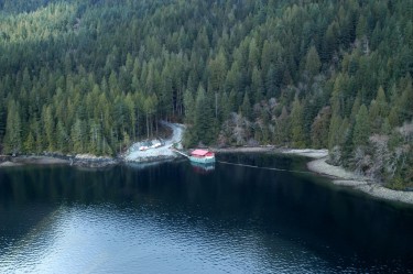
Where the forest meets the sea – harvesting logs, protecting habitat

A typical small log dump found today. A protective debris curtain to the right of the float camp is designed to protect the beach habitat.

A typical small log dump found today. A protective debris curtain to the right of the float camp is designed to protect the beach habitat.

A two-year old artificial rock reef used to compensate for log dump impacts. Shellfish in foreground is endangered abalone.

A two-year old artificial rock reef used to compensate for log dump impacts. Shellfish in foreground is endangered abalone.

How do First Nations, the forest industry and the provincial government work together to manage logging in the Central Coast? And, just as importantly, how do they protect the environment while they’re doing it?

In response, Warren Warttig quotes a university professor: “Forestry isn’t rocket science – it’s much harder than that,” he notes. Warttig is the senior planning biologist with the forest company Interfor, and a member of the Central Coast Marine Plan Advisory Committee. The challenges surrounding forestry are particularly critical in the Central Coast Region, he says, where about 50 per cent of the land is either park or protected and an additional 35 per cent of the productive forest land-base is constrained by some form of protective legislation.

In the old days, when understanding of how to protect the environment was less acute, forest companies typically dumped their logs into well-developed estuaries. “We now recognize those areas as some of the worst places to put log dumps,” Warttig says.

Now there is a ‘no-net-loss-of-habitat’ policy in place, established by the federal department of Fisheries and Oceans (DFO). When forest companies have an impact on habitat they are required to replace it with a compensation habitat. “We’d find an area and build a rock reef which, if done right, can produce some pretty nice habitat – particularly for abalone and rock fish,” Warttig says. Visual impact is a whole additional matter, addressed through forest legislation. Forest companies now have software allowing them to accurately model what an area will look like after logging.

Interfor already has a protocol agreement with the Wuikinuxv First Nation and is currently working on one with the Heiltsuk. Protocol agreements formalize the relationship between industry and First Nations and clarify information sharing, management best practices, and consultation requirements. They may also include employment and economic components. “It’s important to us that we have these agreements,” Warttig says. “We’re aware that we’re operating in the traditional territories of the First Nations and we want to be thought of as a good neighbour.”

From the Heiltsuk point of view, the forest industry has been pretty good in recent years, according to Heiltsuk stewardship director Kelly Brown. “They’ve responded well to having First Nations staff members on their team and we’re working our way to becoming more involved in activities in our territories.”

Six different forestry companies operate in the Heiltsuk territory and the First Nation hopes to make formal agreements with all of them. “We have a fairly vigorous checklist of requirements from industry and the province that we set out in the agreement itself,” Brown says.

“Industry has responded quite positively in moving their projected cut-block areas so they wouldn’t affect Heiltsuk or salmon,” Brown says.  “Everything is moving in the right direction and we expect to have agreements in principle very soon.”

The Heiltsuk are also applying for some buffers around old village sites and, in general, they hope to minimize the amount of lumber that’s being taken. “The review’s going on right now,” Brown says. “There are always pros and cons to taking timber,” he says. “We don’t want cutting for the sake of cutting.”

Heilsuk marine planner Julie Carpenter agrees. “We’ve been working with the province and the forest industry through the MaPP process to identify areas of interest for protection,” she says. “We’ve talked quite a bit about cumulative impact of different logging sites and we’re trying to work with the logging companies to limit those impacts.”

Spirit bears bring international tourists to remote B.C.

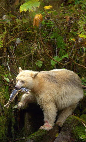
DNeasloss_IMG_7009_spiritbear_salmon_350x576pxDoug Neasloss was a kayak touring guide in the remote village of Klemtu, found on Swindle Island in B.C.’s Inside Passage (between Vancouver Island and southeast Alaska). Neasloss had just closed up shop for the 2003 season, when he got an unexpected visitor.

“Then, this one lady showed up at my doorstep,” he recalls. “I explained that our season had ended but she got quite upset because she was a freelance photographer who’d flown here from Toronto.”

Neasloss checked the weather and agreed to take her out the next morning. He used his expert guiding knowledge to help her find a spirit bear, “and she got some amazing photos which allowed her to make a ton of money.”

This experience helped turn Neasloss into a photographer himself (he’s completely self-taught) and also sowed the seeds for what is now The Spirit Bear Lodge, a thriving eco-tourism business run by the Kitasoo/Xai’Xais First Nation.

The operation brings in about 300 visitors each year, many from Europe and Australia and employs 40 local people – mainly youth.

The heart of the enterprise? Interest in the region’s estimated 200 highly prized spirit bears. This majestically coloured white animal – that used to be, wrongly, thought of as a rare albino – is a sacred animal to the First Nations people.

Today scientists know that the spirit bear’s unique colouring is the result of a double recessive gene found in black bears. A white spirit bear can have a black cub and vice versa.

The spirit bear survives because of its isolation from other bears, namely grizzly bears, and an abundance of salmon in intact estuaries. These key characteristics are essential to Neasloss – and to the success of the lodge.

In fact, it’s one of the reasons he’s been so active in government-related work. A marine use planning coordinator for the Kitasoo Band from 2005 to 2011, he helped the community develop its own marine use plan. “We’ve been doing a lot of work on behalf of the bears,” he says, arguing that marine protection is just as important as land preservation. Why? Because bears depend on salmon.

Lodge manager Tim McGrady agrees. “If we’re not looking after the salmon, we’re not looking after the bears,” he says. “Without the salmon, we don’t have a business. The resources are at the core of what we do.”

The community is happy with the spectacular lodge it built in 2007 and looking forward to continuing to grow its business.

We want to provide an alternative to the consumption economy,” says McGrady. “We couldn’t just be a small mom and pop business. We’ve had to show real revenue and real return. Logging and mining have been economic drivers in the region. We want to be a really viable alternative.”