
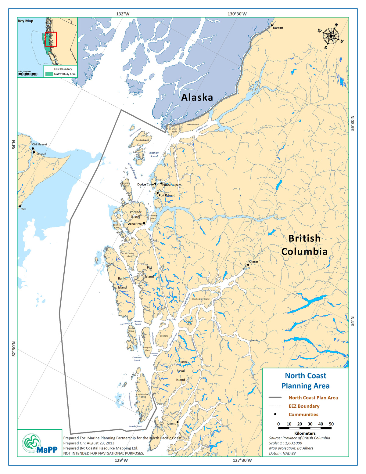
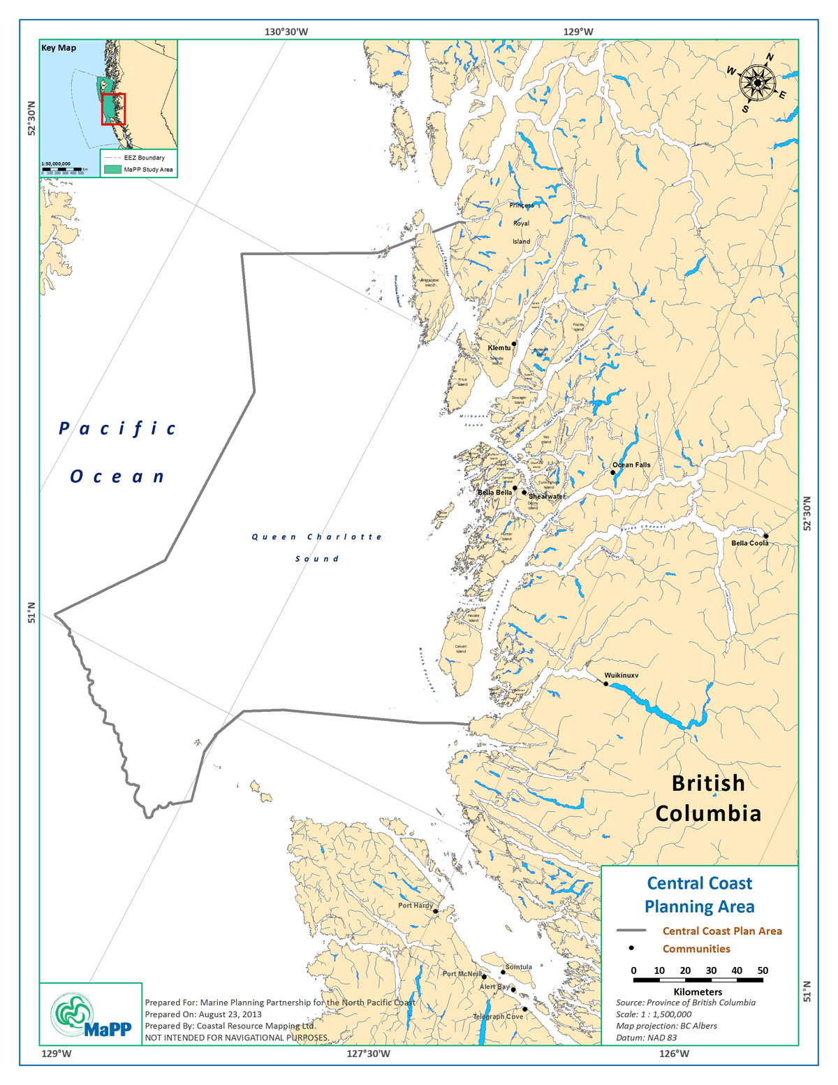
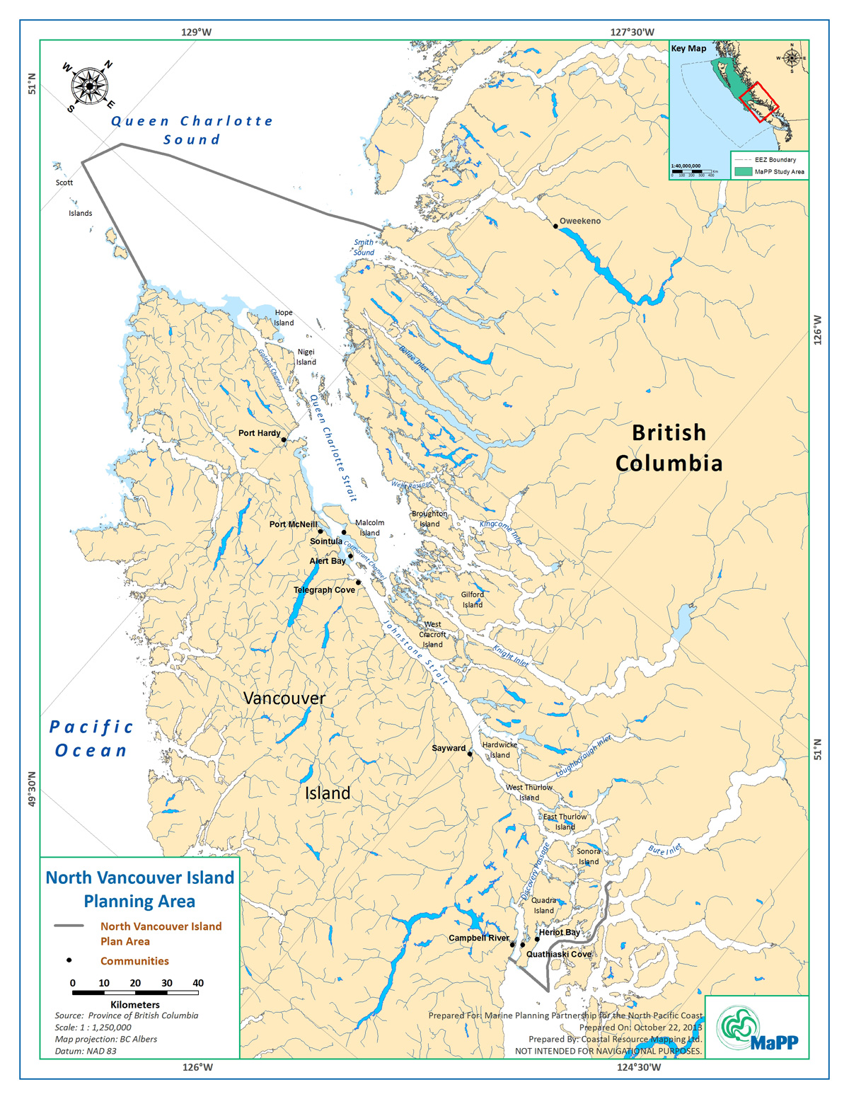
The MaPP study area encompasses about 102,000 square kilometers – a vast expanse of ocean that stretches along two thirds of British Columbia’s north coast. The boundaries for the MaPP study area are based on a mix of ecological considerations and administrative boundaries. The area begins in the south at Quadra Island/Bute Inlet and reaches north to the Canada-Alaska border. West to east, the study area’s boundary extends from the base of the continental slope off Haida Gwaii and Vancouver Island to the coastal watershed in the east (adjacent terrestrial watersheds are not included). Ecologically, the MaPP boundary represents the Northern Shelf Bioregion of the Pacific Ocean. The MaPP study area is divided into four sub-regions: Haida Gwaii, North Coast, Central Coast and North Vancouver Island.
Hover your mouse over the region names to see the sub-regional boundaries. Click on a highlighted area to expand a sub-regional map. To learn more about each sub-region, click on the links above.
Note: The North Vancouver Island Plan Area is primarily based on the marine territories and areas of interest of the seven participating Nanwakolas member First Nations, and consequently excludes an area on the northwest side of Vancouver Island that is part of the broader MaPP Study Area.