New article published about Marine Zoning for the Marine Plan Partnership

Marine zoning for the Marine Plan Partnership (MaPP) in British Columbia, Canada is a new article published in the journal, Marine Policy, in February 2023. 

 The authors of the paper are Charlie Short, Joanna L Smith, John Bones, Steve Diggon, Aaron Heidt, Chris Mcdougall, and Kylee A  Pawluk.

 Abstract

A zoning framework was developed for the Marine Plan Partnership for the North Pacific Coast (MaPP) in order to provide guidance for decisions regarding coastal and marine economic development, marine resource management, and marine protection or conservation across the MaPP region, the Northern Shelf Bioregion, British Columbia, Canada. The MaPP Zoning Framework was developed over an 18-month period at the beginning of the marine spatial planning (MSP) process with stakeholder consultation and incorporated lessons learned from other planning efforts in British Columbia and globally. The three main requirements for the Framework included that it was applicable and flexible for use across the MaPP regional boundary, which included four sub-regions that had diverse priorities and marine activities, that guiding principles for zoning would provide consistency for policy and other decisions within the MaPP regions, and that zone categories synergized with existing policy and legislation. A stakeholder advisory process was used to develop the Framework which resulted in three zone categories to achieve the goals of MaPP: Protection Management Zone (PMZ), Special Management Zone (SMZ), and General Management Zone (GMZ). Zone identification included numerous factors such as species and habitat diversity, cultural values, existing uses and activities, and priorities for sustainable economic development and conservation. The Framework was effectively used to zone 102,000 km2 of the MaPP region during the MSP process for more than 15 different sectors that were within the scope of the MaPP partners’ jurisdiction. Importantly, the Framework was successfully adapted across the four distinct MaPP sub-regions and consistently applied for an effective regional approach to decision making and management for both First Nations and provincial governments.

Map of the MaPP study area showing the four sub-regions (Haida Gwaii, North Coast, Central Coast, and North Vancouver Island) and the zones developed using the Framework during the planning process.

Kelp Monitoring Training Videos: Strength in Data Diversity

A series of kelp monitoring training videos has been produced.

Learn the approach MaPP First Nation Partners are using to study canopy kelp (the uppermost layer of a kelp forest) in the MaPP Region. First Nations are applying a standardized methodology to collect and analyze data in the four sub-regions to find out:

  1. Where the kelp is;
  2. How kelp is changing;
  3. What is causing the kelp to change; and
  4. What else is affected by these changes to kelp.

With canopy kelp functioning as a canary in the coalmine, research is necessary to address the First Nations’ observations that significant declines have occurred in recent years in the distribution, abundance and quality of kelp in their territories. The training videos were produced in collaboration with the Tula Foundation and feature tools, techniques and protocols being used to support standardized kelp monitoring in the MaPP region. The methods shown in the videos are accompanied by a detailed Kelp Monitoring Methods protocol document.

Together with community-based local and Indigenous knowledge, MaPP is generating a bigger picture of kelp historically, today and for future scenarios, as illustrated in our Regional Kelp Monitoring Storymap. As culturally and ecologically significant species, kelp conservation and restoration are essential for food, habitat, improved shoreline protection and increased marine nutrients. Kelp monitoring information, therefore, will be used to inform future management recommendations about protected areas, ecosystem health and marine use.

View the video playlist here.

A Decade of Collaborative Marine Planning

On June 1, Nature United hosted a celebration for the 10-year anniversary of the world’s first co-led marine planning effort with Indigenous Peoples.

mapp-group-shot

MaPP 10 year celebration, group shot. June 1, 2022. © Allison Penko

When people come together under a common vision, they can accomplish wonderful things. And the Marine Plan Partnership—or MaPP—is truly a wonderful thing.

The truth is, I’m not sure many people fully appreciate just how significant it is to have 17 different First Nations working collaboratively with a crown government to advance ecosystem-based management. MaPP has been successfully doing this for 10 years.

It’s unprecedented. It’s something we should celebrate. It’s something that should be supported into the future.

Building on the world-renowned agreements for conservation and land use in the Great Bear Rainforest and Haida Gwaii, the Province of British Columbia and 17 First Nations collaboratively developed the world’s first collaborative large-scale marine planning initiative.

A Shining Example

Ten years later, MaPP is still a leading partnership model for governments working together on complex collaborative marine spatial planning. Integrating healthy ecosystems, economies and people, this partnership represents the kind of conservation that’s possible through bold collaboration.

It was wonderful to have the chance to celebrate this milestone in person. On June 1, 2022 Nature United hosted an event where First Nations MaPP partners from up and down the coast came together with B.C. government MaPP partners to celebrate 10 years of working together. The celebratory energy in the room was palpable.

“This partnership is a shining example of how First Nations and the provincial government collaborate to find solutions to difficult problems, all in the interest of maintaining the health of coastal marine ecosystems and fostering sustainable development opportunities,” said Minister of Land, Water and Resource Stewardship Josie Osborne in remarks at the event. “The partnership is strengthened by everyone who contributes to its ongoing development.”

CELEBRATORY ENERGY During a celebration of the 10 year anniversary of the Marine Plan Partnership, a performance by the Numwayut Culture Group welcomed the attendees. © Allison Penko


BOLD COLLABORATION Placards highlighting the key outcomes of the Marine Plan Partnership. © Allison Penko

Modeling Reconciliation

MaPP has been, and continues to be an important model and success story—one that  First Nations and the government of B.C. can look to as they move forward on reconciliation and implementing B.C.’s Declaration on the Rights of Indigenous People’s Act.

In 2021, MaPP received an inaugural British Columbia Reconciliation Award, which celebrates exceptional leadership, integrity, respect, and commitment to furthering reconciliation with Indigenous peoples in B.C.

MaPP is in fact the world’s first co-led Marine Spatial Plan between Indigenous Governments and Crown Governments. Since it was signed, it has provided inspiration to other countries developing marine plans with Indigenous peoples in places like New Zealand, Indonesia and Costa Rica.

Jenn Burt of Nature United hosted the MaPP 10-year celebration. © Allison Penko

MaPP is in fact the world’s first co-led Marine Spatial Plan between Indigenous Governments and Crown Governments.
JENN BURT
Marine Program Lead

The collaborative governance structure and planning frameworks of MaPP are considered a “global gold standard” for marine planning.
JENN BURT

Global Impact

Working for an organization that is a global leader in Marine Spatial Planning, I can convey that the benefits of MaPP extend well beyond the boundaries of B.C.

The collaborative governance structure and planning frameworks of MaPP are considered a “global gold standard” for marine planning.

Recently my global colleague was speaking with the president of Palau and a high minister of the Marshall Islands in the western central Pacific. They are interested in regional marine planning, but feel challenged by the multiple countries, governments, and priorities within the prospective planning region. My colleague suggested that a model existed to overcome these challenges—and she pointed to MaPP.

In MaPP, individual marine use plans were developed within four separate subregions, each with different and multiple governments, cultures, and priorities for their marine space. But they are unified under a Regional Action Framework, which outlines the collective vision, overarching priorities, a pathway for working together.

Looking Forward

We all know that we need to protect the land, air and water that we rely on to survive and thrive and that this needs to be done by working in partnership with the Indigenous Peoples who have been stewards of this land since time immemorial.

Year after year, the results of MaPP are influencing  decisions about B.C.’s coast and coastal waters and in doing so are improving the alignment of marine uses with First Nations’ values and vision for their territories.

I’m very proud to be supporting this awesome achievement, and look forward to what the future of MaPP will bring.

Thanks to Jenn Burt, British Columbia Marine Program Lead, Nature United | June 08, 2022 | Source


MaPP Launches the Kelp StoryMap

First Nation and provincial partners of the Marine Plan Partnership (MaPP) are excited to announce the launch of an innovative communication tool, Regional Kelp Monitoring on the North Pacific Coast: A Community-Based Monitoring Initiative to Inform Ecosystem-Based Management, a StoryMap, to share information about their ongoing work to learn about kelp in Haida Gwaii, the North Coast, Central Coast, and North Vancouver Island.

Because kelp is such an important component of the marine ecosystem – culturally, economically, and ecologically – MaPP developed a Regional Kelp Monitoring Project. Each summer since 2017, Guardians have mapped the extent of kelp beds, collected data on kelp density, and assessed the condition of the kelp. The data can be used to inform kelp management as well as other research both locally and globally such as studies on the impacts of climate change.

Visit Regional Kelp Monitoring on the North Pacific Coast: A Community-Based Monitoring Initiative to Inform Ecosystem-Based Management, a StoryMap to learn about the importance of kelp, the MaPP kelp monitoring framework including how kelp is monitored, sub-regional highlights, collaborators supporting data collection, lessons learned, and the vision for the future. Some unique elements of the StoryMap include the First Nations names for different species of kelp, stories from each of the sub-regions about the focus and achievements of the Guardian crews, along with maps and research results.

The StoryMap is expected to be updated annually to share the most recent findings and accomplishments.

The Nature of Things features the work of NVI Guardians

A recent episode of The Nature of Things on CBC features First Nation Guardians of the MaPP North Vancouver Island Sub-region.

Titled Ice and Fire: Tracking Canada’s Climate Crisis, the documentary describes how citizen science and community-based research is being used to assess how climate change is impacting different parts of Canada. Off the coast of Vancouver Island, First Nations have partnered with the Hakai Institute to monitor and understand the impacts of climate change on kelp. The Tlowitsis and Wei Wai Kum Guardians discuss the MaPP kelp monitoring program, which is also being implemented by Guardian crews in Haida Gwaii, the North Coast and Central Coast sub-regions.

In Knight Inlet, on the BC mainland coast, Dallas Smith, president of Nanwakolas Council, describes salmon habitat restoration efforts to counter the impacts of forestry and climate change, in order to increase salmon populations, and to help grizzly bears survive in the inlet. Guardians of the Da’naxda’xw and Awaetlala First Nations are featured in this work.

Watch the 45-minute documentary by clicking here.

MaPP featured in latest Coastal Zone Canada Newsletter

We are pleased to announce that the Winter 2022 issue of THE ZONE, the newsletter of the Coastal Zone Canada Association, features a comprehensive overview of the Marine Plan Partnership, titled On the MaPP. The article, authored by Berry Wijdeven (provincial co-lead for the Haida Gwaii and North Coast Marine Plans), was written for an international audience of marine planning practitioners and students.

Coastal Zone Canada is an organization that facilitates the sharing of research, policy, news and management of coastal habitats all over the world. Its biennial conferences attract hundreds of attendees who exchange information about their programs and forge new collaborations to improve Integrated Coastal Zone Management practices across the globe.

Read On the MaPP here: https://www.coastalzonecanada.org/wp-content/uploads/2022/02/CZCNewsletter-Winter-2022.pdf

MaPP Selected as a UNESCO Ocean Decade Project


The Marine Plan Partnership (MaPP) is pleased to confirm it has been endorsed as a UNESCO Ocean Decade project. This is a unique opportunity to partner with scientists and policy makers around the world to address the decline in ocean health and to support the sustainable development of the ocean.

MaPP was recognized as a project that can support the Ocean Decade mission to “catalyse transformative ocean science solutions for sustainable development, connecting people and the ocean, in order to achieve the Ocean Decade vision of the science we need for the ocean we want” (UNESCO).

The Ocean Decade runs from 2021-2030. During the next decade, MaPP Partners intend to participate with international scientists and stakeholders from diverse sectors to develop scientific knowledge and forge partnerships to advance ocean science.

Features of the MaPP initiative that qualified it for the status of Ocean Decade project include our initiative’s commitment to ecosystem-based management, that it is a co-led approach by First Nations and B.C., the inclusion of stakeholders and local governments in the planning process and implementation of marine plans, the focus on sustainability, the vast geographic area covered, and the already-established collaborations with other researchers.

Leaders of the MaPP initiative look forward to exploring opportunities in support of the vision of the Ocean Decade.

For more information, visit https://ioc.unesco.org/ocean-decade

and

https://www.oceandecade.org/actions/marine-plan-partnership-for-the-north-pacific-coast-mapp/

New article published about stakeholder and public engagement to develop the MaPP marine plans

Marine Plan Partnership for the North Pacific Coast: Engagement and communication with stakeholders and the public, is a new article published in the journal, Marine Policy, in July 2021.

The authors of the paper are Gord McGee, Josie Byington, John Bones, Sally Cargill, Megan Dickinson, Kelly Wozniak and Kylee Pawluk.

Abstract:
A key requirement for success in marine spatial planning is a meaningful stakeholder engagement process. During the planning phase of the Marine Plan Partnership (MaPP) initiative, the Partners (the B.C. provincial and 18 First Nations governments) employed, what was termed, an advisory approach to engagement. This advisory approach committed the Partners to engage meaningfully with stakeholders and the public, consider their feedback, work towards balanced solutions, and incorporate what was found to be agreeable. However, it did not require a consensus among participants in order for advice to be accepted or acted upon. Planning occurred over a three-year period in four sub-regions encompassing 102,000 square kilometers of coastal and marine waters on the North Pacific Coast of Canada. Engagement spanned more than 10 sectors of special interest and 22 coastal communities throughout the planning area and included interested members of the general public. Upon plan completion, there was broad stakeholder support for the final sub-regional plans and the Regional Action Framework. The purpose of this paper is to describe from the MaPP governance partners’ perspective, the components of the MaPP advisory-based stakeholder engagement policy and key lessons learned about the factors contributing to the success of its approach. The paper draws upon analysis of MaPP Partner discussions and reflections during and after the planning process, and includes the results of an internal evaluation of stakeholder engagement by independent consultants who surveyed the MaPP team, stakeholders, and the public.

NC-MPAC

North Coast Sub-region Marine Planning Advisory Committee and MaPP Team members (photo credit: Gilian Dusting)

A Family of Graduates

Nanwakolas Guardians Graduation 2021. Photo credit: Angela Davidson.

Nanwakolas Council Guardians Graduation 2021. (Photo credit: Angela Davidson)

Nanwakolas Council recently published an article describing the graduation of students from the Vancouver Island University Stewardship Technician Training Program. Since 2016, the Marine Plan Partnership (MaPP) has supported the Nanwakolas Guardian program to implement objectives and strategies in the NVI Marine Plan.

MaPP Receives British Columbia Reconciliation Award

On April 26, 2021, the Marine Plan Partnership received the British Columbia Reconciliation Award.


The Office of the Lieutenant Governor and the BC Achievement Foundation Announce Inaugural Reconciliation Award Recipients

 The Office of the Lieutenant Governor of British Columbia, in partnership with the BC Achievement Foundation, is honoured to announce the recipients of the inaugural British Columbia Reconciliation Award. The award recognizes nine extraordinary individuals and organizations who have demonstrated exceptional leadership, integrity, respect, and commitment to furthering Reconciliation with Indigenous peoples in the province of British Columbia, or inspired others to continue Reconciliation efforts.

Individual Recipients:

  • Dawn Drummond
  • Doris Paul
  • Corey Payette
  • Grand Chief Stewart Phillip
  • David Suzuki
  • Corporal Christopher Voller

Organization Recipients:

  • Carrier Sekani Family Services
  • Marine Plan Partnership for the North Pacific Coast
  • xaȼqanaǂ ʔitkiniǂ (Many Ways of Doing the Same Thing) Research Team

“Being part of establishing the Reconciliation award program and serving on the inaugural selection committee has been heart-warming and empowering. Reviewing all the nominations has shown me the power of Reconciliation and how it can change people and community’s lives for the better.” said BC Achievement Foundation board member Kekinusuqs, Judith Sayers. “It shows we can live together and achieve great things if there are willing people working towards a vision of Reconciliation.” The BC Achievement Foundation has several established programs honouring excellence and inspiring achievement throughout British Columbia, including the Indigenous Business Award and the Fulmer Award in First Nations Art.

“The inaugural recipients of this award are shining examples of those in British Columbia who have demonstrated the many approaches to furthering Reconciliation through meaningful action. It is humbling and inspiring to read of their stories, their incredible impacts in their communities, and to learn from their perspectives on Reconciliation. I am deeply honoured to have the opportunity to partner with the BC Achievement Foundation and the selection committee to develop this award and to recognize these exemplary individuals,” says Austin, “Reconciliation must take root in our hearts, within families, between generations, and throughout our communities. I invite all British Columbia to join us in celebrating these champions, to learn from their stories, and to strive to build relationships with each other across cultures.”

The Honourable Janet Austin, Lieutenant Governor of British Columbia, has chosen Reconciliation as one of the key priorities of her mandate. This commitment includes participation in promotion of public awareness of the ongoing journey of Reconciliation.

The British Columbia Reconciliation Award draws inspiration from the work of the Honourable Steven Point [Xwĕ lī qwĕl tĕl], 28th Lieutenant Governor of British Columbia, and a founder of the Award. His hand-carved red cedar canoe, Shxwtitostel, currently on display at the BC Legislature buildings, was created as a symbol of reconciliation, with the understanding that “we are all in the same canoe” and must “paddle together” to move forward. In honour of this legacy, this year’s recipients will receive a print of a canoe paddle painted to commemorate the award by Kwakwaka’wakw artist Cole Speck.

The selection committee for the 2021 British Columbia Reconciliation Award, including representation from Indigenous Elders and leadership, is:

  • T’esóts’en, Patrick Kelly – Leq’á:mel First Nation
  • Nicole McLaren – Métis Nation
  • Chief Sophie Pierre – Ktunaxa Nation
  • Kekinusuqs, Judith Sayers – Hupacasath First Nation
  • T,lalisam, Kim van der Woerd – ’Namgis First Nation

Members of the selection committee, along with the Honourable Steven Point, led in the creation and design of the BC Reconciliation Award, ensuring the award was founded on the principles of Indigenous culture and knowledge.

Links:

New article about the Marine Plan Partnership

“The Marine Plan Partnership for the North Pacific Coast – MaPP: A collaborative and co-led marine planning process in British Columbia” is an article published in the journal Marine Policy in June 2020.

The authors of the paper are Steve Diggon, John Bones, Charlie Short, Joanna Smith, Megan Dickinson, Kelly Wozniak, Karen Topelko and Kylee Pawluk.

Abstract: For more than a decade, marine spatial planning has been used around the world to advance objectives for conservation, economic development, and ecosystem-based management. Ecosystem-based management (EBM) in British Columbia began with the development of land use plans in the 1990s to address coastal and land use issues related to terrestrial land management. Managing marine resources is challenging on Canada’s Pacific coast because of multiple, overlapping jurisdictions, unceded indigenous territories, and lack of coordination amongst governments in the region and their agencies. The Marine Plan Partnership for the North Pacific Coast (MaPP) was formed in 2011 and was a co-led partnership between 18 First Nations’ and the Province of British Columbia governments. The purpose of the MaPP Initiative was to develop and implement marine plans for 102,000 square kilometers of coastal and offshore water in northern British Columbia. A co-led governance framework included the member First Nations and the Provincial government structured into multiple levels of decisions making, conflict resolution, and technical support. Integral to the planning process was broad and continual stakeholder engagement through multiple advisory committees as well as public engagement. The planning process made use of multiple information sources including traditional, scientific, and local knowledge and was completed in 3.5 years. The result was the development and signing into policy of four sub-regional marine plans (one for each of the four MaPP sub-regions: Haida Gwaii, North Coast, Central Coast, and North Vancouver Island) and a Regional Action Framework. The sub-regional plans delineate protection, special, and general management zones for multiple objectives and will inform future policy decisions for marine protected areas, tenures, resource management and coastal development through an EBM approach. The plans will inform permits for marine tenures including aquaculture, offshore renewable energy siting, contribute to Canada’s marine protected areas network, and improve coastal infrastructure. The Regional Action Framework highlights activities to occur across the entire region through five main activity areas (Regional Governance, Ecological Integrity and Human Well-being, Compliance and Enforcement, Cumulative Effects Assessment, and Zoning Recommendations). Funding for planning was through a public-private model that also supported the development of the plans and decision support tools (e.g. planning and mapping portal). Discussions regarding implementation began during the planning phase to ensure long-term commitment from the Partners and continuity to improve decision making and management within the MaPP area. The process design and methodology created by MaPP can be a model for planning in areas that involve multiple authorities, complex geographies and jurisdictional arrangements that can be scaled up for regional, cross border, and transboundary marine spatial planning.

Article

Marine planning brought to life in new MaPP video

On, over, and under the waters of the North Pacific Coast, a new video from the Marine Plan Partnership (MaPP) takes you on a magnificent journey into the heart of its work. Travel along as coastal guardians gather data and monitor environmental conditions. Visit the towering kelp forests that support a wide array of biodiversity, including ecologically and culturally important species. Witness young people connecting with their marine heritage. Hear from First Nations and provincial leaders who are working together to protect, conserve, and manage this precious shared resource.

MaPP – The Benefits showcases the spectacular nature of the North Pacific Coast. It also demonstrates that the work conducted during MaPP’s first phase has created a strong foundation. Data collection, fact finding, habitat monitoring, stakeholder engagement, pilot projects, and contributions to other planning processes that are critical to successful future implementation have been established.

MaPP is now poised to move into its second phase of implementation with the goal of creating positive change in coastal communities and ocean health.

New video: Creating a Protected Area Network for the Northern Shelf Bioregion

A new video developed by the Coastal First Nations-Great Bear Initiative tells the story of collaborative work between First Nations along the North Pacific Coast, and governments of Canada and BC, to establish a network of Marine Protected Areas in the Northern Shelf Bioregion (28 minutes).

To view, click: Creating a Protected Area Network for the Northern Shelf Bioregion

Helping the Kelp

kelp-bed

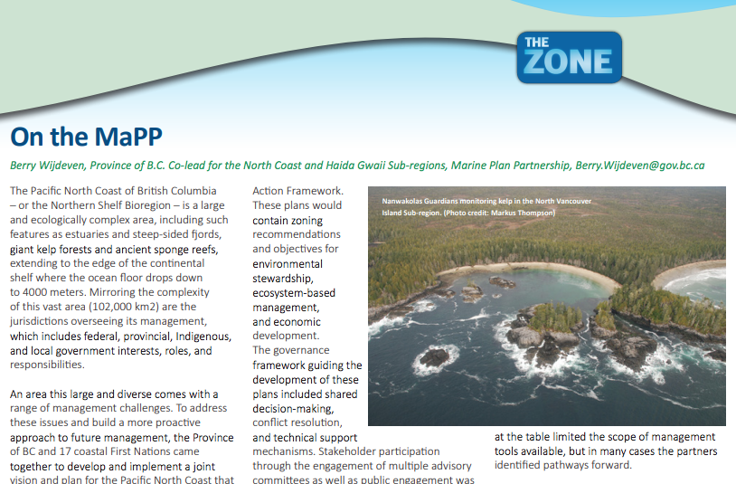
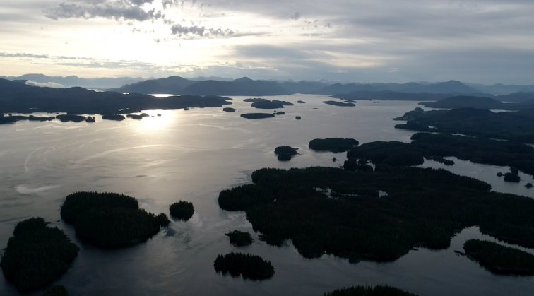
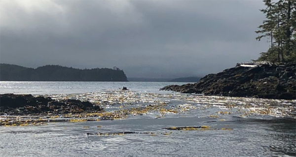
Kelp bed in the North Vancouver Island sub-region. Credit: Nanwakolas Council.

The giant and bull kelp plants that grace British Columbia’s waters are not only beautiful to look at; they are important indicators of the province’s coastal ecosystem health. First Nations Guardians are part of the vital and exciting work taking place to learn more about them.

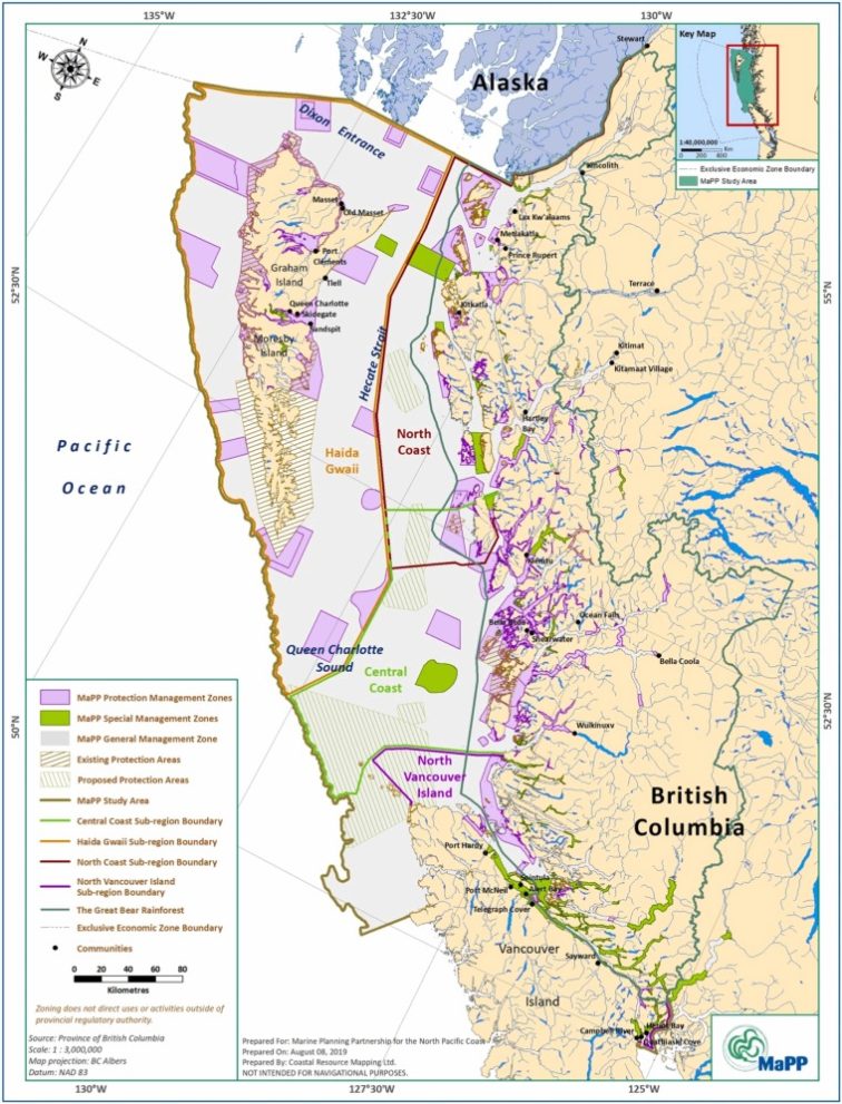
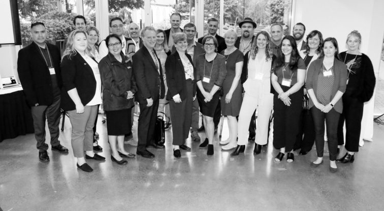
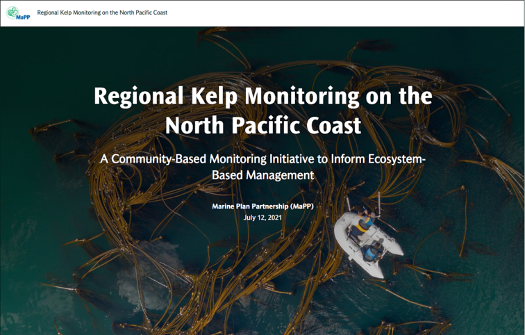
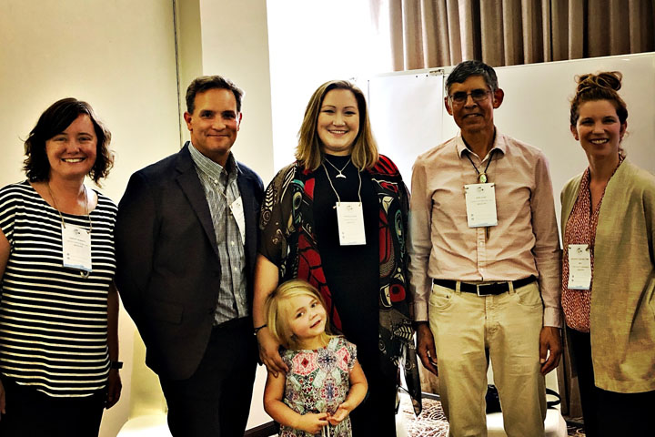
“Some of the areas we are studying are incredibly biodiverse,” enthuses Markus Thompson. Thompson, a marine environmental practitioner based on Quadra Island, has been working over the 2018 season with First Nations Guardians, staff from Nanwakolas Council, the provincial government, and the Hakai Institute on the first phase of a study of kelp in the waters around Northern Vancouver Island. The project was initiated and supported by the Marine Plan Partnership for the North Pacific Coast, or MaPP for short.

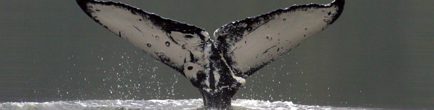
“Nutrient rich waters and strong currents along the northeastern coastline of Vancouver Island support a huge abundance of wildlife—whales, sea lions, and of course, kelp. But each First Nation territory also comes with unique challenges. Some territories have such an abundance of kelp that we have been unable to survey all of it,” says Thompson. “There’s a lot more to be done to ensure we have the right information to make sure we’re taking good care of these precious ecosystems.”

What’s the deal with kelp?

Thompson worked closely on this project with provincial government marine biologist Dr. Rebecca Martone. Martone, who works for the Ministry of Forests, Lands, Natural Resource Operations and Rural Development (FLNRORD) describes her role this way: “My primary responsibility is supporting the implementation of the MaPP marine plans and the marine protected area network process.” The bigger picture, she explains, is supporting ways to “get good science into decision-making,” from an ecosystem-based management, or EBM, perspective.

Monitoring indicator species like kelp is an important part of planning and implementing an EBM framework, say both experts. “If you think about the objectives of EBM being effective ecosystem function and human well-being, healthy marine habitats support that,” explains Martone. “An EBM indicator program is about measuring the status of systems like marine habitats and the things that affect them, so we can manage them most effectively to meet those objectives.”

Martone-Thompson-kelp

Rebecca Martone and Markus Thompson provided kelp monitoring training to Guardians. Credit: Nanawakolas Council.

Kelp, as it happens—both the giant and the bull species that grace most of British Columbia’s coastline—are excellent indicator species of marine habitat health. “If the kelp isn’t thriving, it’s likely that whatever is causing that is also affecting other parts of the ecosystem negatively. Moreover, kelp are the foundational species that support many other ecologically, culturally, and economically important species, so the loss of these habitats can have cascading effects. Understanding the status of the kelp is going to be very helpful in assessing the overall health of the region,” says Martone.

Trouble is, we don’t know what we don’t know

Aquatic plant harvesting is regulated by FLNRORD, which licenses the wild harvest and culture of aquatic species and commercial harvesting. Kelp is used commercially for everything from herbal remedies to cosmetics and fertilizer, and for medical purposes. First Nations harvest kelp on which herring have spawned, as well as for general consumption.

But the last time any studies were undertaken of these important species was in 2007, in one small part of the central coast. Scattered studies of small areas have been undertaken since the mid-1970s, but no comprehensive contemporary inventory of the coast as a whole exists.

Filling that information gap is important, says Thompson, for three reasons. Firstly, understanding the state of the species can, as we know, tell us a lot about the overall health of the marine environment on British Columbia’s coast. “Secondly, we have an opportunity to work closely with First Nations this time to undertake the monitoring and include their knowledge in the assessment of species health. Last but not least,” says Thompson, “there’s been a flurry of recent applications to harvest more kelp, but we don’t have up-to-date information on the health of the kelp stocks to inform decisions on those applications.”

The goals of the study are to bring up-to-date measurements of data like water temperature and salinity together with observations and analysis of both human activity and other

influences such as climate change, to assess impacts on and changes in the ecosystem over time. “For example,” says Thompson, “kelp productivity is generally most productive in cooler water, so as water temperature increases with climate change we may see a drop in kelp abundance. Another example is that we are seeing sea otters returning to the east coast of Vancouver Island. Sea otters eat sea urchins, which eat kelp, so that will have an impact as well.”

Guardian-boat-kelp

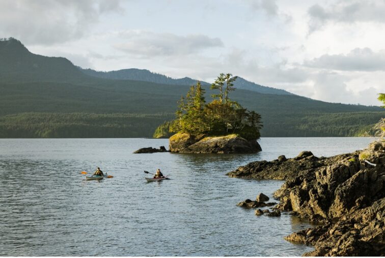
Guardians travel to kelp monitoring sites. Credit: Nanwakolas Council

Not least of all the study project, which began in 2018, will incorporate invaluable First Nations’ knowledge. “It’s a great fit,” says Martone. “It’s pretty challenging to monitor species that are mostly underwater, in remote locations with difficult access. Having people who know the territories inside out, who are competent in boats in these places and who understand how the tides work and the tough conditions is priceless.”

Western scientists, adds Martone, are only “beginning to understand” the value of traditional knowledge and experience. “These perspectives are not less valuable, simply different, to the way other science has looked at the issues.” Science, she says, is observational by nature, and about wanting to understand what’s happening. “So there’s a major connection to local knowledge and experienced local interpretation of what we are seeing.”

Working in partnership with First Nations

“Eelgrass was originally identified as the regional indicator species to study but in discussions with the First Nations, kelp came up as a priority as well,” notes Martone. “They told us that’s because they have been observing major declines in abundance, particularly on the north coast and around Vancouver Island. They are very concerned about the increased interest in harvesting kelp under the circumstances.”

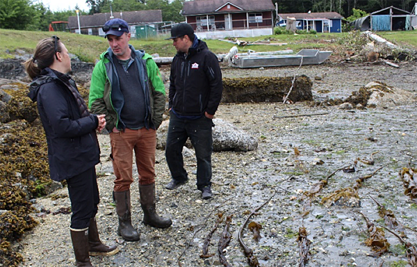
Working with First Nations Guardians who have significant experience and knowledge of the environment and who are comfortable working in remote, challenging waterscapes, but who also don’t necessarily have a scientific qualification, demanded a partnership approach to the design of the study that was scientifically rigorous but practical and straightforward. “An important part of this work is building the capacity within the First Nations to undertake the monitoring work directly,” says Thompson. “So we designed the approach together in the best way to achieve that.”

Kayak-kelp

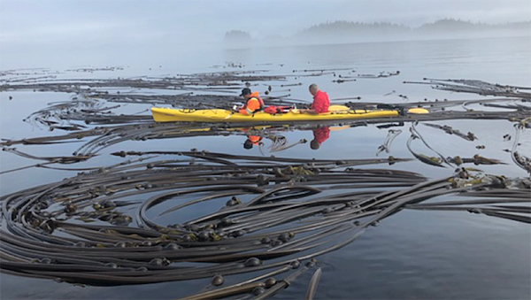
Tier Two kelp surveys are conducted from kayaka. Credit: Markus Thompson

Getting out on—and into—the water

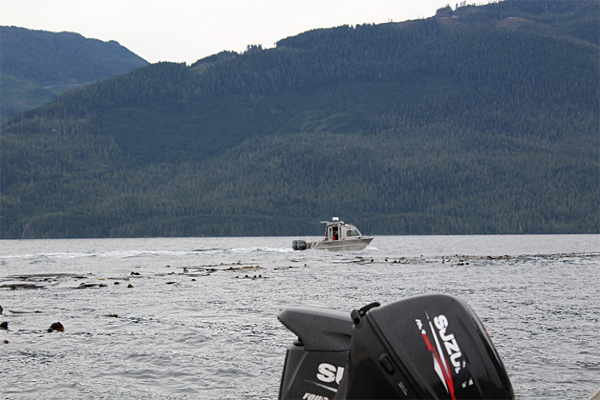
The team took a three-tier monitoring approach to the study project. “In tier one, we just wanted to know how much kelp there is, and where it is,” says Thompson. “The best way to do that was to go out in small boats with the Guardians, who know where to find the kelp, and a GPS system to map locations and extent of the kelp beds, and then spend a few minutes in each bed making notes about what you could see from the surface, the density, visible impacts, any other species in the beds like urchins or sea otters nearby.”

Based on the data gleaned from tier one, tier two surveys were done in a two-pronged approach: from kayaks and through drone aerial imagery. More detailed information about the extent, density and biomass of the kelp beds was gathered from this method of surface observation. Over hundreds of kilometres of coastline, the Guardians patiently counted kelp bulbs and strands in quadrants of one square metre at a time. At the same time, a start was made on gathering overhead images of the beds using drones. Tier three continued the work underwater, using scuba divers to observe what is happening below the surface.

All three tiers were deployed in 2018, says Thompson, with divers for the tier three work supplied by the Hakai Institute and the A-Tlegay Fisheries Society.

Preliminary findings confirmed that the distribution and density of kelp across all of the regions substantially different, and a relationship exists between bull kelp stipe diameter and biomass, among other things. In 2019, the work will continue, again taking on all three tiers. The partners will continue working together to refine the approach and find ways to improve the field testing methods, as well as how the data obtained will feed into longer-term planning and ecosystem management, including harvesting controls.

Underwater-kelp

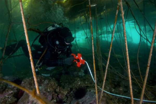
Tier Three surveys are conducted underwater by divers. Credit: Ryan Millar

Putting power in the hands of the First Nations

An important element will be continuing to work with the Guardians to increase their capacity to undertake the monitoring work themselves, including training and qualifications in underwater work. “I think this is one of the biggest benefits of this work so far,” says Thompson. “It’s so important that the First Nations have access to this information to inform their decisions about taking care of their territories based on our collective knowledge and work.”

Thompson also notes, that requires commitment on the part of the non-First Nations partners to stay the course: “You can’t just parachute in and then stop,” he says firmly. “We have to commit to the relationship and seeing through the work, and that isn’t completed when these short-term studies are finished. That’s a long-term commitment.”

Fortunately, that seems to be the collective view. “Working with the Guardians has been such a gift for me,” says Martone. “Their knowledge is so critical to the work we do together. The fact they have invited me out on the water and shared their perspectives with me is incredibly rewarding. I hope they feel the same way!”

The long view

Gina Thomas, senior Tlowitsis Guardian, certainly does.” I think this work is going to be very helpful,” says Thomas. “It’s also been very helpful to connect directly with the decision-makers in the province. That’s been a really exciting part of this year’s experience.” Thomas says you also have to take a long-term view: that in the bigger picture, it is all about managing the kelp and the ecosystems for better health and the well-being of all concerned.

When you get out on the water with people from the government and other partners First Nations work with, says Thomas, and everyone sees what it is like in these beautiful, remote places, “we find we share the same passions and desires for good outcomes for them. We have the same information, we’re on the same page, and it makes it easy to make good decisions.”

Gina-Thomas

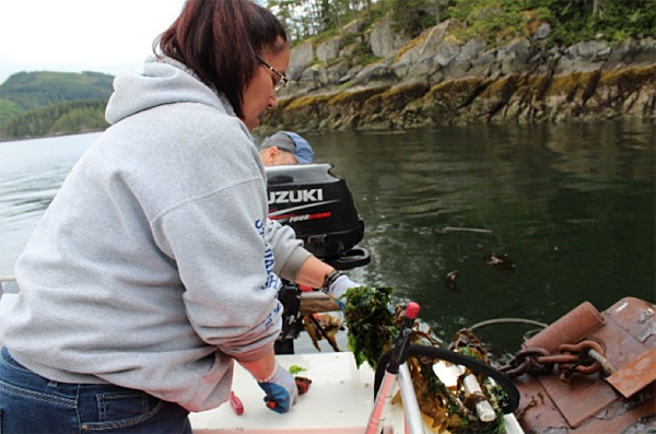
Gina Thomas monitors kelp. Credit: Nanwakolas Council

MaPP workshop presented during the 2018 B.C. Seafood Expo in Comox

Sally Cargill visits a booth promoting locally harvested sea urchin. (Photo credit: Andy Witt)

Sally Cargill visits a booth promoting locally harvested sea urchin. (Photo credit: Andy Witt)

On behalf of the Marine Plan Partnership (MaPP), Dr. Myron Roth, Industry Specialist – Aquaculture & Seafood with the B.C. Ministry of Agriculture, moderated a workshop for 40 people, Aquaculture Resources for Commercialization. Held on June 11, the workshop was part of the B.C. Seafood Expo, a large seafood industry trade event, held in conjunction with the annual B.C. Seafood Festival in Comox on Vancouver Island.

Through the MaPP initiative, First Nations communities in the Haida Gwaii, North Coast, Central Coast and North Vancouver Island sub-regions are implementing marine plans, which include objectives and strategies for shellfish aquaculture and sustainable marine resource development. First Nations in other coastal areas of B.C. have been actively engaged in seafood economic opportunities through research, pilot and commercial projects. The goal of the workshop was to present an update on these various projects and to facilitate a broader discussion on financial and business resources currently available to First Nations communities for the development of business opportunities.

The workshop began with opening remarks and welcome by Chief Richard Hardy, K’ómoks First Nation/Pentlatch Seafoods.

Presentations kicked off with updates by representatives involved in shellfish aquaculture projects in the MaPP sub-regions. They were:

  1. Central Coast: Sally Cargill, Ministry of Forests, Lands, Natural Resource Operations and Rural Development
  2. North Vancouver Island: Andy Witt, Ministry of Forests, Lands, Natural Resource Operations and Rural Development
  3. Haida Gwaii: Barry Wijdeven, Ministry of Forests, Lands, Natural Resource Operations and Rural Development
  4. North Coast: Brian Kingzett, Coastal Shellfish Corporation

“Through the implementation of the Central Coast Marine Plan, First Nation and provincial partners are establishing shellfish aquaculture pilot sites to better understand if and where there might be opportunities for sustainable economic development that supports community interests,” said Cargill. “The MaPP ARC workshop at the B.C. Seafood Expo was a great networking and learning opportunity for both of the MaPP partners.”

A series of presentations followed. The first, on business planning, lessons learned in the agri-business sector, the value of best practices, and case studies from top producer success stories, was presented by Trish Laugharne and Anne Skinner of the Sector Development Branch, Partnerships and Outreach, B.C. Ministry of Agriculture.

Next, Kelly Masson of the Pacific Integrated Commercial Initiatives Business Development Team, Castlemain Group, discussed aquaculture funding opportunities and how to harness them, using a funder’s perspective. Valuable insight on how to use business planning and feasibility assessments for developing eligible projects for funding and what funders look for in a successful application.

The session finished with a presentation by Lynn Lashuk and Rob Cunningham of BMO Bank of Montreal, who gave an overview of BMO’s Aboriginal Banking Services, basic requirements of their lending programs and an overview of branches and staff delivering their services.

The workshop concluded with a question and answer period.

“We discussed ways to open up capital funding for aquaculture projects that will unlock potential for coastal First Nations communities,” said Dr. Roth. “We also got updates on various projects and had a good discussion on financial and business resources for First Nations communities to develop opportunities in the seafood value chain.”

Part of this discussion highlighted the value of economic partnerships that have led to development of several successful aquaculture projects in B.C.

Expo delegates sampled local seafood. (Photo credit: Andy Witt)

Expo delegates sampled local seafood. (Photo credit: Andy Witt)

Another event held the same day was a workshop co-ordinated by Ministry of Jobs Trade & Tourism (JTT), Exploring International Markets for Indigenous Seafood, which focused on business opportunities for B.C. First Nations and making connections with international clients. As well, an evening reception allowed attendees to sample a wide variety of B.C. seafood dishes from shellfish and finfish producers prepared by B.C. chefs, along with the chance to mingle with the JTT International Buyers Delegation.

For more information, visit B.C. Seafood Expo (https://bcseafoodexpo.com/) and B.C. Seafood Festival (https://bcseafoodfestival.com/)

The tradeshow featured representatives of international companies. (Photo credit: Andy Witt)

The tradeshow featured representatives of international companies. (Photo credit: Andy Witt)

MaPP representatives attend the fifth International Marine Conservation Congress

MaPP Team IMCC5

Members of the panel discussing the transition from MaPP marine planning to implementation of the plans were, left to right, Kristin Worsley, Steve Diggon, Danielle Shaw, Russ Jones, and Meaghan Calcari-Campbell. (Photo credit: Caroline Butler)

In a panel presentation at the fifth International Marine Conservation Congress (IMCC5) in Kuching, Sarawak, held June 24-29, 2018, delegates from the Marine Plan Partnership (MaPP) discussed the transition from marine planning to implementation of the MaPP marine plans. Moderated by Meaghan Calcari-Campbell of the Gordon and Betty Moore Foundation, the discussion covered key steps in the planning process, implementation achievements and learning to date, and insights on how the team is overcoming challenges. The presentation was part of a symposium that focused on achievements in governance, marine zoning and protection, stewardship and monitoring, and sustainable economic development.

Kristin Worsley, manager, Marine and Coastal Resources, B.C. Ministry of Forests, Lands, Natural Resource Operations and Rural Development, reflected that, “This conference was a great opportunity to share the early learning we’ve had in implementing the MaPP plans and to learn about what others are doing around the world. Marine spatial planning is often touted as a useful tool for addressing a range of issues and interests. But there aren’t that many opportunities to talk with other practitioners about how to do it.”

Russ Jones, consultant to the Haida Oceans Technical Team, Council of the Haida Nation, said, “Our panel discussion emphasized enabling conditions for MaPP and the importance of governance arrangements between First Nations in northern British Columbia to co-operative planning and ongoing implementation. Governance structures such as sub-regional implementation teams are established through government-to-government agreements with the Province of British Columbia and continue to balance the bottom up approach to planning required by First Nations with the need for ongoing leadership and co-ordination. Discussions delved into the concrete outcomes of MaPP as well as recent work with the federal government that are contributing incrementally to enhanced marine protection and sustainable economic development in the Northern Shelf Bioregion. Our story resonated with communities and planners elsewhere who are striving for a stronger community voice in marine planning and management.”

Other panel presenters were Steve Diggon, regional marine planning co-ordinator for Coastal First Nations-Great Bear Initiative and Danielle Shaw, Stewardship Director with the Wuikinuxv Nation.

During the question and answer section of the session, the panel members fielded questions on strategies to ensure consistency between and among the plans at different scales, how MaPP is monitoring human well-being indicators, whether zoning is a traditional tool used by First Nations, and how decision-making between governments works. They also responded to queries about ways to resolve conflicting uses in overlapping First Nation traditional territories, and on the impacts of ocean noise and which level of government is responsible for regulating noise.

At a separate session, Caroline Butler, Gitxaala Fisheries Program, presented Cultural Conservation Priorities: A methodology for integrating Indigenous values into marine protected area network design.

Butler commented, “The community-based planning process and this methodology for integrating data were of significant interest to marine planners in a number of other countries. Planners throughout the world are seeking effective and efficient ways to attend to local values and practices – often under very tight timelines. This conference was a great opportunity to share our experiences and learn about other processes. The marine planning governance structures and methodologies that were developed through MaPP and continued in the Marine Protected Area Network for British Columbia’s Northern Shelf region are quite progressive when presented in a global context.”

The IMCC5 was co-ordinated by the Society for Conservation Biology. More information can be found at https://conbio.org/mini-sites/imcc5/


IMCC5 logo

MaPP receives H.B. Nicholls Award

In this video John Bones (Secretariat and Nanwakolas Council) accepted the H.B. Nicholls Award given to the Marine Plan Partnership (MaPP) by the Coastal Zone Canada Association (CZCA) at its conference in St. John’s in July 2018. The award recognized MaPP for the unique partnership between the Government of British Columbia and 17 First Nations for marine spatial planning and implementation of the marine plans. Bones accepted the award from Peter Zuzek, President of CZCA, on behalf of the MaPP partners.

Field orientation in the MaPP North Vancouver Island (NVI) Sub-region: Discussing protection for archaeological sites, opportunities for Aboriginal tourism and economic development

NVI Field Orientation Oct 2017 from Josie Byington on Vimeo.

A very productive field orientation for MaPP North Vancouver Island implementation team members and guests occurred over three days in early October 2017 through parts of the traditional territories of the Mamalilikulla, K’omoks, Tlowitsis and Da’naxda’xw Awaetlala First Nations. Hosted by Chief Richard Sumner of the Mamalilikulla Nation and guided by guardians from the four First Nations, the group included staff from the Ministry of Indigenous Relations and Reconciliation (MIRR), the Archaeology Branch of the Ministry of Forests, Lands, Natural Resource Operations and Rural Development (FLNRO), two archaeological consultants and an economic development consultant. The focus of the tour was to increase awareness of the role of guardians as well as some of the Aboriginal tourism and archaeological site protection challenges and opportunities in the territories.

During the orientation, participants saw, first-hand, the implementation of strategies developed in the NVI marine plan, like the shellfish aquaculture pilot project. The trip also allowed the team to discuss ideas on how to ensure First Nations inclusion in the management and protection of cultural sites/areas.

Coastal guardians describe themselves as the “eyes and ears of the land and sea” as they conduct patrols almost daily to assist in protection of ecosystems and cultural heritage resources within their traditional territories. They conduct ecological monitoring, promote compliance through their presence on the water and provide data to support enforcement activities. Guardians work with agencies and organizations such as BC Parks, Parks Canada, Department of Fisheries and Oceans, and local stewardship groups. Coastal guardians have an important and evolving role in implementing the NVI marine plan that currently includes collection of ecosystem and cultural heritage data.

Following a brief safety and logistics meeting at the Nanwakolas Council office in Campbell River, the group split up and travelled to two different departure points, Sayward and Telegraph Cove.

The first day of the trip focused on orientation to vulnerable and sensitive archaeological sites in the First Nation territories and an inspection of the Tlowitsis shellfish aquaculture pilot project.

oyster tray

Greg Johnson of Nanwakolas Council inspects trays of oysters at the shellfish aquaculture pilot project site. Photo credit: Barb Dinning.

The Tlowitsis guardian boat left Sayward with four group members and stopped in Port Neville to view the shellfish aquaculture pilot project located there. The project is an experimental grow-out of blue mussels, scallops and oysters for two years to determine viability of the species for commercial development. The group inspected the trays and nets containing the young shellfish suspended along an array of nine buoys. The pilot project also includes data loggers that measure ocean salinity and temperature at the site and two other locations.

Next, the group visited a site to view petroglyphs and a midden in Port Neville and then travelled north, stopping to view priority archaeological sites including pictographs and village sites at different locations and learning about the Tlowitsis traditional way of life from its Nation’s Guardians.

Village Island

Chief Richard Sumner describes the midden and the buildings that once stood at this site on Village Island. Photo credit: Scott Harris.

Other field trip members departed from Telegraph Cove aboard the K’omoks and Mamalilikulla guardian boats and visited the Broughton Archipelago where Chief Sumner provided examples of archaeological sites of high sensitivity and vulnerability. Chief Sumner was very concerned about one site in particular and showed the group how a sign discouraging people from visiting the area is actually having the opposite effect. The Mamalilikulla Guardians have noted a number of tourists this past summer using the trail to a Mamalilikulla sacred site.

The two groups and the Da’naxda’xw Awaetlala Guardian boat carrying a consultant archaeologist met at Village Island and hiked to the site of Meem Quam Leese village. Chief Sumner described life at the village, abandoned in the 1960s, which is currently visited annually by about 800 kayakers. He discussed plans to replace the dock and clear brush from the village site to enhance the experience for tourists. The group members discussed options for protection of the site, such as educational signage and establishing a permanent guardian field station for the Mamalilikulla. The Chief pointed out several cinder block burial boxes on nearby islands that were installed to protect human remains. Over the past 50 years, the islands had been robbed of hundreds of burial boxes and human skulls.

Arch-discussion

Tlowitsis Guardian Gina Thomas (right) discusses options for the protection of archaeological sites with provincial staff members. Photo credit: Josie Byington.

The boats then travelled to Kalogwis and other sites in Tlowitsis traditional territory to view sensitive and vulnerable archaeological sites, including pictographs, village sites and middens.

The first day of the field trip concluded at Tsatsisnukwomi Village, or “New Vancouver,” where all members of the group were hosted to dinner and exchanged information about the work they do relative to the NVI MaPP area.

Day two of the field trip focused on Aboriginal tourism and economic development. It began with a tour of Tsatsisnukwomi Village, including visiting the big house, which contained regalia and artifacts on display. The guide described the dances and sequence of a potlatch. Guardians at the village provide similar tours and accommodation for visitors each summer.

Compton Island

Chief Richard Sumner shares ideas for tourism development on Compton Island. Photo credit: Scott Harris.

The group travelled to Compton Island, in the Broughton Archipelago, where Chief Sumner provided his vision for tourism development there. Economic development consultant, Tony Wong, discussed his findings about economic development opportunities and constraints for the NVI sub-region. During the discussions, the new National Geographic ship, Venture, paused in front of the island to watch humpback whales and orcas, prime attractions of the area. An estimated 10,000 tourists visit the archipelago each year.

Next, the group visited Farewell Harbour Lodge, a luxury resort on Berry Island. The resort operates from spring through fall each year and caters mostly to international visitors who come to view grizzly bears on the mainland and whales on day trips from the lodge.

Tourism talk

Economic development consultant, Tony Wong, describes his findings about the opportunities and constraints for tourism initiatives in the NVI plan area. Photo credit: Josie Byington.

The group returned to Tsatsisnukwomi Village for a demonstration of the drone and mapping technology used by the guardians and the Nanwakolas GIS (geographic information system) technicians to monitor and map their territories.

A roundtable discussion was held with the guests, guardians and hosts to discuss highlights of the day, strategies for protection of archaeological sites, tourism development ideas and data gathering techniques.

The final day of the trip included a visit to Port Harvey, the site of a spill from a diesel tank on land in 2017, which was discovered by the Tlowitsis guardians on a routine patrol. The owner of the site met the group and described the clean-up process and discussed ideas for improved spill response. One of the NVI marine plan actions is the development of marine response plans.

The last archaeological site visited was near Sayward in K’omoks territory. Archaeologists attempted to locate a site that was marked on old maps that appears to have been impacted by subsequent development, and the K’omoks Guardians met with the owners of the property to inform them about the purpose of the visit.

Andy Witt, B.C. government MaPP co-lead for NVI, said, “It was a great opportunity to get out into the NVI MaPP area, to explore this amazing landscape and meet the people who live, work and play there. Having them share their passion and vision with us really helped to gain perspective on the responsibilities and opportunities that come with implementation of the plan.”

John Bones, Nanwakolas Council MaPP co-lead for NVI, added, “It was a trip to remember, not only for the incredible marine wildlife on display and the amazing weather conditions, but also for an appreciation of the passion that our guardians are putting into their work and their amazing knowledge and skill sets. We benefitted greatly from the presence of Chief Richard Sumner (Mamalilikualla), our hosts (Da’naxda’xw Awaetlala) and all the guardians from each of the Nations.”

Participants

Some of the participants of the NVI field orientation are seen at Tsatsisnukwomi Village. Members of the group, who were hosted by Chief Richard Sumner of the Mamalilikulla Nation, included guardians from Mamalilikulla, K’omoks, Tlowitsis and Da’naxda’xw Awaetlala First Nations, provincial government staff, Nanwakolas Council staff, consultants, and the MaPP NVI co-leads and technical support. Photo credit: Tony Wong.