The Central Coast is home to the Kermode or spirit bear, which is famous for its distinctive white coat, and a sacred animal to First Nations people.

The Central Coast is home to the Kermode or spirit bear, which is famous for its distinctive white coat, and a sacred animal to First Nations people.
The giant red sea cucumber is the largest and the only commercially harvested sea cucumber species in B.C. The Central Coast is a significant source of sea cucumbers for B.C.’s commercial fishery.
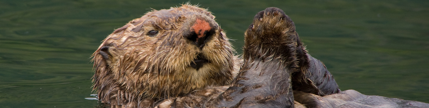
Sea otter populations have grown dramatically in the Central Coast since their re-introduction to B.C. in the early 1970s.
An adult sea otter pelt contains roughly 100,000 hairs per square centimetre, which is more hair than on an entire adult human head.
The B.C. sea kayaking sector generated $14.2 million in gross revenues in 2005 with sea kayaking tourists spending $11 million in the province that year. (Tourism BC Research Services Report 2007)
The world’s tallest totem pole, at 173 feet, is Kwakwaka’wakw and is located in Alert Bay.
B.C.’s largest marine park is Broughton Archipelago Marine Provincial Park, which can only be accessed by boat.
The general management directions of the Haida Gwaii Marine Use Plan include proposed strategies and objectives to support and build upon cooperative compliance and enforcement efforts.
Approximately half of the global population of ancient murrelets breeds on Haida Gwaii.
The Gwaii Haanas Pacific herring stock is one of five major herring stocks in B.C. As a key forage species, herring is critical to marine ecosystems.
244 known shipwrecks occurred around Haida Gwaii between 1786 and 1998. 144 have been recorded and their locations mapped.
Haida Gwaii is made up of over 150 islands that stretch approximately 250 kilometers north to south.
Haida Gwaii’s Graham Island is home to eight of northern B.C.’s top 10 coastal waterbird wetlands.
An estimated 1.5 million seabirds breed on Haida Gwaii.
Haida eddies that form off the west coast of Haida Gwaii and around Cape St. James, carry pockets of nutrient- and plankton-rich surface water to the north Pacific and the Gulf of Alaska. The Cape St. James eddy carries fish larvae all the way to Bowie Seamount.
MaPP sub-regional plans include objectives and strategies to increase the economic value of seafood products and promote local processing activities for the benefit of First Nations and coastal communities.
Depths range from 10 metres to 2,500 metres in the MaPP planning area.
Cruise ships, ferries and other passenger craft make up 18 per cent of marine traffic in the MaPP planning area.
Towboats and tugboats account for 40 per cent of all marine traffic in the MaPP planning area.
The MaPP planning area includes two commercial ports, two cruise ship ports, 19 ferry terminals, 41 public wharves, 150 resorts and marinas and 28 small craft harbours.