Collaboration at its finest: Frederick Arm cleanup

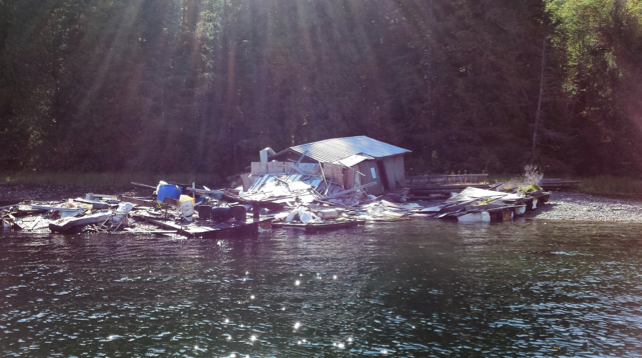
Debris on the shoreline. Photo credit: Rupert Gale.

Debris on the shoreline. Photo credit: Rupert Gale.

At a meeting in early December 2017, members of the North Vancouver Island (NVI) Marine Plan Advisory Committee heard a good news story about the collaborative effort of 10 local organizations to remove 600 cubic yards of debris from Frederick Arm, near Stuart Island northwest of Campbell River.

Strathcona Regional District Area C Director Jim Abram explained that, several years ago, a floating restaurant and docks network tethered to the shoreline at Frederick Arm was abandoned by its owners. The structures fell apart, leaving piles of debris on the beach and in the water.

The Stuart Island Community Association had been monitoring the situation and decided to take action by contacting their regional director with a request that the debris be removed. Director Abram worked with the Ministry of Forests, Lands, Natural Resource Operations and Rural Development to confirm that the site was abandoned and constituted a trespass on Crown land. Rupert Gale of the Ritchie Foundation then stepped in to engage companies and organizations to donate their services for a collaborative cleanup effort. The cleanup was successfully conducted Oct. 10-12, 2017, with the roles played by the different companies and organizations outlined as follows:

  • Project initiated by Director Abram of the Strathcona Regional Districtand Stuart Island Community Association
  • Ritchie Foundation helped to managethe project and provided labour and general support
  • C. Ministry of Forests, Lands, Natural Resource Operations and Rural Development, Compliance and Enforcement Branch provided legal and government oversight and funding
  • Seymour Pacific Developments provided equipment and labour
  • Progressive Waste Solutions provided the waste containers
  • Marine Link Transportation barged and offloaded the collected debris
  • Campbell River Marine Terminal waived the terminal fee at the request of Director Abram
  • Pacific Wood Waste trucked debris to the landfill and recycling centre
  • Campbell River Waste Management Centre waived the landfill fee through the efforts of Director Abram and the Comox Valley Regional District

Director Abram said “I am extremely pleased at the level of support that we received from all parties. This avoided serious degradation to our marine environment that we are all working so hard to protect through the planning processes we are involved in. I have always operated as the regional director on the assumption that local government in collaboration with communities, business and other levels of government can accomplish just about anything at the lowest possible price with the absolute best result. This exercise is a perfect example of that philosophy working!”

John Bones, Nanwakolas Council co-lead for the MaPP NVI Plan, stated,  “This project is a fantastic example of government, organizations and the private sector working together to benefit the marine environment. To me, it demonstrates the power of utilizing local knowledge and skills to address issues that might otherwise have been overlooked. I hope this inspires others to greater collaborative solutions to local marine environmental issues.”

Andy Witt, B.C. government MaPP co-lead for NVI, added, “Director Abram is to be commended for this successful operation. It demonstrates the power of collaboration and co-operation at a local level and the resources that can be marshalled by provincial and local governments, concerned citizens, and businesses. It also provides a useful ‘how to’ example for the future.”

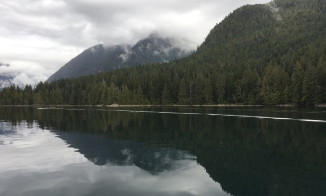
After two days of work, the shoreline is restored to its natural state. Photo credit: Rupert Gale.

After two days of work, the shoreline is restored to its natural state. Photo credit: Rupert Gale.

MaPP panel presents at Resilience 2017 conference in Sweden

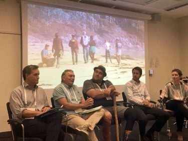
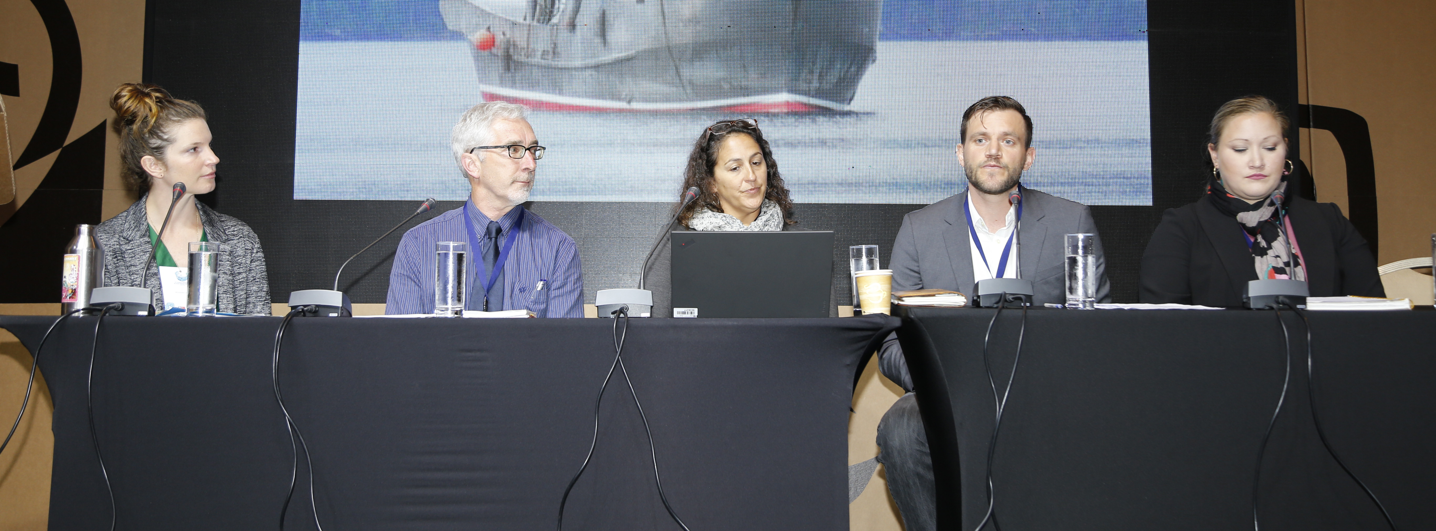
Steve Diggon, John Bones, Dallas Smith, Charlie Short and Meaghan Calcari-Campbell participated in a panel discussion about the Marine Plan Partnership at the international Resilience Conference 2017 in Stockholm. Photo credit: Mary Turnipseed.

Steve Diggon, John Bones, Dallas Smith, Charlie Short and Meaghan Calcari-Campbell participated in a panel discussion about the Marine Plan Partnership at the international Resilience Conference 2017 in Stockholm. Photo credit: Mary Turnipseed.

Four representatives of the Marine Plan Partnership (MaPP) attended the international Resilience 2017 conference in Stockholm, held Aug. 20-23. In a panel discussion chaired by Meaghan Calcari-Campbell of the Gordon and Betty Moore Foundation, they recounted the MaPP planning process in a session titled The Story of How Eighteen Governments Came Together with Marine Spatial Plans that Achieve Stewardship, Social, and Economic Goals.

John Bones, marine co-ordinator for the Nanwakolas Council, member of the MaPP Secretariat and co-chair of the North Vancouver Island planning team, spoke about how science, local knowledge and First Nations traditional knowledge were integrated to develop the marine plans.

President of the Nanwakolas Council and member of the MaPP Marine Working Group, Dallas Smith, addressed lessons learned from the planning process and the international relevance and inspiration of the co-led partnership to other countries and nations.

Charlie Short, executive director of Strategic Projects – Coast Area, Ministry of Forests, Lands, Natural Resource Operations and Rural Development, Province of B.C. described the components of the MaPP planning process.

Regional marine planning co-ordinator for Coastal First Nations-Great Bear Initiative and member of the MaPP Secretariat, Steve Diggon, described the move from planning to implementation of the marine plans and the immediate benefits of the plans.

Audience members provided congratulatory comments about the achievements of MaPP and asked questions about how the planning team established the B.C.-First Nations partnership and how external partnerships were managed.

The theme of this fourth triennial meeting of academics, artists and practitioners was Resilience Frontiers for Global Sustainability. Resilience research is about developing the capacity to sustain development as both slow expected and rapid surprising changes occur in a system. This is accomplished through a diversity of development strategies supported by an understanding of the connections between the strategies.

Reflecting on his experiences at the conference, Steve Diggon said, “The resilience approach lays out seven principles of a resilient system (add link: http://www.stockholmresilience.org/research/research-videos/2016-05-22-how-to-apply-resilience-thinking.html ), such as the health of the ecosystem, governance processes, social structures and how they are linked together to respond to changes. In the implementation of the MaPP plans, our work on EBM indicators aligns well with resilience research, especially with our cutting-edge stakeholder, governance, and management processes. There are also opportunities for us to make some adjustments to how we measure ecosystem health.”

John Bones attended a session about Aboriginal involvement in applying resilience research. “I realized that MaPP accomplished ground-breaking work during the planning phase. Compared to other parts of the world that are attempting to start co-led processes, MaPP has already achieved it,” he said.

Charlie Short added, “The resilience field is quite evolved, forward thinking and has a unique ‘lingo’ amongst academics. Interestingly, MaPP has incorporated much of the resilience thinking core principles and foundations and these are inherent in the plans themselves. We just didn’t label it that way. It was refreshing to see the many other jurisdictions taking this approach and applying it to real world situations.”

More information about the Resilience Conference is available on the conference website (http://resilience2017.org/ ) and Facebook page (https://www.facebook.com/stockholmresilience/ )

A Marine Management Board for Haida Gwaii

The Council of the Haida Nation and the Province of British Columbia established a new governance structure that will oversee the implementation of the CHN – BC Haida Gwaii Marine Plan Implementation Agreement (2016). The Marine Management Board is a senior-level joint decision-making body with roles and responsibilities that include providing direction to a joint Haida Gwaii Marine Implementation Technical Team, reviewing annual work plans and budgets, evaluating progress and addressing implementation challenges.

The Haida Gwaii Marine Management Board met for the first time in June 2017 at the CHN office in Skidegate, and will continue to meet on a quarterly basis. Stay tuned for more information on Haida Gwaii Marine Plan implementation on the MaPP Facebook page!

Haida Gwaii Marine Management Board

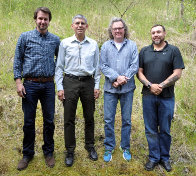
Members of the Marine Management Board (l-r): Charlie Short, Executive Director of Regional Projects (Ministry of Forests, Lands, Natural Resource Operations and Rural Development); Russ Jones, Manager – Marine Planning (Council of the Haida Nation); Len Munt, District Manager of Haida Gwaii (Ministry of Forests, Lands, Natural Resource Operations and Rural Development); and Trevor Russ, Vice President (Council of the Haida Nation).


Haida Gwaii Integrated Advisory Committee Established

Haida Gwaii Integrated Advisory Committee

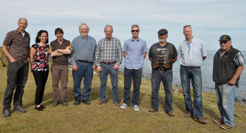
Members of the Haida Gwaii Integrated Advisory Committee, L-R: Scott Wallace, Tanya Wahbe, Leandre Vigneault, Doug Daugert, John McCulloch, Grant Dovey, Mike McGuire, Jim McIsaac and Captain Gold. Missing from the photo: Lindsey Doerkson, Sabine Jessen, Rosaline Canessa. Photo: Terri J. Bell, CHN Marine Planning

The Haida Gwaii Integrated Advisory Committee (IAC) met for the first time this June in Skidegate. The IAC was established by the Haida Gwaii Marine Steering Committee* to advise and inform planning and the implementation of plans on Haida Gwaii, with a focus on marine planning. The establishment of this committee is consistent with the approach being taken by MaPP across all sub-regions and region respecting stakeholder participation in marine plan implementation.

The primary responsibilities of the IAC include providing advice on Marine Protected Area Network planning for the Northern Shelf Bioregion** and implementation of the Haida Gwaii Marine Plan. The committee is also responsible for providing advice on implementing the Pacific North Coast Integrated Management Area (PNCIMA) plan as it relates to Haida Gwaii.

The IAC has 13 members with a range of backgrounds and expertise, including: conservation, marine transportation, commercial fishing, recreational fishing, marine tourism, marine sciences, and Haida marine knowledge. The committee will meet approximately twice a year.

* The Haida Gwaii Marine Steering Committee includes representatives of: CHN; Ministry of Forests, Lands, Natural Resource Operations and Rural Development; Fisheries and Oceans Canada; and Parks Canada (Gwaii Haanas). The Steering Committee provides strategic direction on marine planning and management initiatives on Haida Gwaii and ensures efforts are co-ordinated among various processes.

** The Northern Shelf Bioregion extends from the middle of Vancouver Island and reaches north to the Canada – Alaska border.

MaPP representatives present at the International Marine Protected Areas Congress 2017 in Chile

(L-R): Meaghan Calcari Campbell, Gordon and Betty Moore Foundation; Allan Lidstone, Forests, Lands, Natural Resource Operations and Rural Development; Christie Chute, Department of Fisheries and Oceans, Canada; Gord McGee, Central Coast Indigenous Resource Alliance; and Danielle Shaw, Wuikinuxv Nation. Photo by IISD/ENB | Angeles Estrada

Allan Lidstone, Gord McGee and Danielle Shaw represented the Marine Plan Partnership (MaPP) at the International Marine Protected Areas Congress 2017 (IMPAC4) in La Serena-Coquimbo, Chile, held Sept. 4-8 and organized by the Government of Chile and the International Union for the Conservation of Nature’s (IUCN) World Commission on Protected Areas.

The congress allowed international participants to discuss how the management of marine protected areas (MPAs) contributes to progress toward the UN Sustainable Development Goal on the conservation and sustainable use of the oceans, seas and marine resources.

The MaPP representatives, along with Christie Chute of Fisheries and Oceans Canada, took part in a panel discussion chaired by Meaghan Calcari-Campbell of the Gordon and Betty Moore Foundation, titled Indigenous, Provincial, and Federal Governments Integrating Marine Spatial Plans and Marine Protected Areas in Canada. In a wide-ranging discussion, they addressed the benefits of the First Nations-B.C. partnership, the development of the marine plans, the features of the protection management zone designation, stakeholder engagement, integration of traditional knowledge and science, and what comes next as the MaPP partners implement the marine spatial plans, while at the same time working with the federal government to advance a MPA network on the B.C. coast. The audience posed questions about the role of Coastal Guardian Watchmen, how monitoring, compliance and enforcement activities were integrated with the three levels of government, and how Indigenous title and rights influence the planning process and align with legislative or policy tools used to create marine protection by the federal and provincial governments.

Gord McGee, Marine Planner with the Central Coast Indigenous Resources Alliance (CCIRA) and member of the MaPP Central Coast Technical Team, also gave a separate presentation, Marine Planning Partnership in the North Pacific: Meeting 2020 Targets in Canada. He focused on three elements of successful marine plan development: collaboration between the Nations, the provincial government and local governments; the integration of traditional knowledge with scientific and stakeholder local knowledge; and the ability to create solutions for difficult issues as a result of the collaborative and integrative nature of the process. The audience asked questions about the MaPP governance structure and decision-making process, the cost, the advisory stakeholder process and how to engage stakeholders meaningfully, and how the Nations assert authority over three jurisdictions in Canada (federal, provincial and municipal) during planning and how they continue to assert their title and rights.

Allan Lidstone, MaPP Marine Working Group member and Director of the Resource Management Objectives Branch within the B.C. Ministry of Forests, Lands, Natural Resource Operations and Rural Development, and Danielle Shaw, Stewardship Director with the Wuikinuxv First Nation, presented Marine Spatial Planning, MPAs and Collaborative Management in the North Pacific Coast of BC as part of a panel discussion, Meeting the 2020 Targets in Canada: challenges, successes, opportunities and lessons learnt in developing a national network of MPAs over the past 25 years.

Commenting on his experience at the congress, Lidstone said, “I was surprised by the extent of work in progress and completed to put MPAs in place around the globe. The diversity and number of partnerships to support this work was also noteworthy including the important role of private foundations in promoting and funding this work. Other highlights included the rapid advances in technology to support monitoring, compliance and enforcement and distribution of information. Many presenters recognized the critical need of community participation and support to ensure viable MPAs. I noted that many of the commonly identified key factors for success in planning MPAs were consistent with the planning approach we took in MaPP.”

He added, “It was exciting to share our experiences and learning from MaPP. Although there is a lot happening around the globe, I felt our work here in coastal British Columbia elicited a lot of interest both in our presentations and in one-on-one conversations with other participants. This interest reflects that MaPP is at the forefront of marine planning and has established many innovative and effective approaches for sustainable coastal and ocean management.”

McGee commented, “It’s amazing how much work is being done at all scales around the globe. MPAs are really important structures being used effectively far out in the middle of great oceans all the way down to the level of small mangroves or coves.” He felt it was important that the work of MaPP was shared at the conference because it is a strong example of collaborative planning with First Nations and the use of traditional ecological knowledge to drive planning processes along with science. In fact, there was an entire day devoted to Indigenous engagement and the planning process.

One presentation that stood out for McGee was a lecture by a native Hawaiian planner. McGee said, “The planner described how they had designed their planning process to merge with their Indigenous world view, and he sang a song that spoke about each of the different parts of their ocean, the birds, the marine mammals, shellfish and how important each is to their way of life. He went on to describe how they were collaboratively building their marine planning process itself in a radically different way from a traditional western scientific approach. People were really touched by his presentation. It was obvious that the connection to their environment was so important to them on different levels.”

McGee feels same way about his work at home. “In MaPP, there are people, communities, and Nations who are so deeply rooted to this coast for thousands of years, and as a result we are working towards creating meaningful ways of stewarding together, among governments, across cultures in ways that, after being at IMPAC4, I think are globally significant.”


For further information, visit the IMPAC4 website  and the International Institute for Sustainable Development (IISD) summary of meeting.


Lessons learned from MaPP discussed at an international marine spatial planning conference in Paris

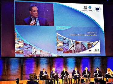
Steve Diggon (on screen) discusses lessons learned during the MaPP process at the 2nd International Conference on Marine Maritime Spatial Planning. Photo credit: Steve Diggon.

Steve Diggon (on screen) discusses lessons learned during the MaPP process at the 2nd International Conference on Marine Maritime Spatial Planning. Photo credit: Steve Diggon.

Steve Diggon, regional marine planning coordinator for Coastal First Nations-Great Bear Initiative, was a panel speaker at the 2nd International Conference on Marine Maritime Spatial Planning in Paris, France from March 15-17, 2017. Steve joined other experts from Europe, Africa, Asia and Latin America to share their practical experience of marine spatial planning.

Steve said, “The audience had heard about MaPP and was very interested in learning more about the process. This was an important opportunity to take the MaPP initiative and achievements to the international community and create understanding. My presentation focused on the successful integration of bottom-up and top-down planning during the development of the MaPP marine plans. I described how the key to our success was the collaboration between First Nations and the provincial government as well as robust engagement of stakeholders and local governments in developing comprehensive marine plans that included spatial and aspatial components. I emphasized the value of working together and the importance of developing good relationships that continue into the plan implementation phase.”

The conference was also a valuable learning opportunity for Steve. “It was especially interesting to hear about the complexity of marine spatial planning processes in the Baltic States with the number of international borders and security issues. The MaPP process did not have to deal with those considerations,” he said.

Steve added, “Overall, by attending the meeting, hearing all the presentations and talking with experts and practitioners from around the world, I got a lot of validation that the MaPP process is solid and on-track.”

The main objective of the conference, which was hosted by UNESCO and the European Commission, was to review the status of marine spatial planning – one decade after the first International MSP Conference – and to identify a path forward that addressed multiple global challenges from 2017 onwards.

The outcome of the Conference is the Joint Roadmap to accelerate Maritime/Marine Spatial Planning processes worldwide. The roadmap was presented to the UN Conference on Sustainable Development Goals 14 held in New York from June 5-9, 2017.

MaPP team presents at the fourth International Marine Conservation Congress

MaPP delegation IMCC4

Jo Smith, Dallas Smith, Rich Chapple, Kristin Worsley, Maya Paul, Cathy Rigg and Karen Topelko respond to questions following their presentations during the MaPP session at the IMCC4. Photo credit: Ian Byington.

A delegation from MaPP presented a two-hour session at the fourth International Marine Conservation Congress (IMCC4) held in St. John’s, Newfoundland from July 30 to Aug. 3, 2016. The biannual meeting drew together 690 marine conservation professionals and students from 50 countries who exchanged information and ideas related to the overall conference theme, making marine science meaningful.

The session, Marine planning in Canada: Results and lessons from the Marine Plan Partnership for the North Pacific Coast (MaPP), was chaired by former MaPP science coordinator, Jo Smith, now the marine spatial planning science manager with The Nature Conservancy, and featured six presentations and a panel discussion to an audience of 125 people.

Dallas Smith, then President of the Nanwakolas Council, spoke about how the MaPP planning process integrated First Nations culture and governance with science and policy.

Kristin Worsley, manager, Marine and Coastal Resources, B.C. Ministry of Forests, Lands and Natural Resource Operations, described zoning in a multi-jurisdictional marine space – a spatial framework for integrated marine resource management in Canada’s North Pacific Coast.

Rich Chapple, President of the Central Coast Indigenous Resources Alliance, addressed the role of traditional and place-based knowledge in marine planning on the Central Coast.

Maya Paul, cumulative effects coordinator with the North Coast-Skeena First Nations Stewardship Society, spoke about planning for the North Coast and navigating marine management amidst a surge in industrial development.

Cathy Rigg, socio-economic planner with the Council of the Haida Nation, described how the Haida Gwaii marine planning process utilized community connections and cross-scale linkages.

Karen Topelko, marine planner, Marine and Coastal Resources, B.C. Ministry of Forests, Lands and Natural Resource Operations, addressed successes, lessons learned and implementing the MaPP marine plans and reflected on the marine spatial planning process in B.C.

The presentations were followed by a 30-minute question and answer session. Audience members posed questions about the importance of relationship-building and developing trust with government agencies, about traditional methods of resource management by First Nations before colonization, about federal government involvement in the marine planning process, and about how out-of-scope sectors were addressed in the marine plans.

Members of the audience also viewed display copies of the marine plans and received copies of the plan overviews.

That evening, Green Fire Productions aired a video, Great Bear Sea – First Nations & British Columbia Partner on Marine Plans, to a standing room-only crowd of 120 people. Following the screening, producer Karen Anspacher-Meyer moderated a question and answer session with a panel of MaPP participants including Dallas Smith; Russ Jones, manager, Marine Planning with the Council of the Haida Nation; and Karen Topelko. Topics addressed included the importance of relationship-building, advice for the new marine planning process in Hudson Bay, how community and stakeholder support for the plans was gained and the next steps for MaPP.

The MaPP delegation was pleased to have the opportunity to present to colleagues about marine planning in B.C. They noted the substantial interest generated by their presentations, references to MaPP heard in other presentations from B.C. delegates, and they look forward to continued contact with others doing similar marine planning work around the world.

First Nations and Province sign marine plan implementation agreements

NEWS RELEASE
For Immediate Release
2016FLNR0156-001388
Aug. 3, 2016
Ministry of Forests, Lands and Natural Resource Operations
Central Coast Indigenous Resource Alliance,
Coastal First Nations-Great Bear Initiative
Council of the Haida Nation
Nanwakolas Council
North Coast-Skeena First Nations Stewardship Society

First Nations and Province sign marine plan implementation agreements

VICTORIA – Today, the Province and 17 coastal First Nations signed implementation agreements for four Marine Planning Partnership (MaPP) marine plans, collaboratively developed for the North Pacific Coast.

Completed in 2015, the plans foster a balance between stewardship and economic development using an ecosystem-based management approach that includes recommendations for marine management, uses and activities. Plans have been completed for four sub-regions: the Central Coast, Haida Gwaii, North Coast, and North Vancouver Island. In addition to the sub-regional marine plans, the Regional Action Framework, released this spring, outlines actions related to marine management that the Province and First Nations agree will be most effectively implemented on a regional scale. These actions are consistent with and support implementation of the sub-regional marine plans.

Taken together, these plans will inform First Nation and provincial decision-making in the respective sub-regional coastal and marine areas. The marine plans do not address management of uses and activities that the Province considers to be federal government jurisdiction. First Nations and the Province commit to working with the federal government on those issues.

In signing the implementation agreements, the partners agree to co-lead implementation of the marine plans, including ongoing engagement with communities, local governments, and stakeholders. The agreements describe how the Province and First Nations will work together and how implementation activities will be prioritized and managed. Example priorities include continuing collaborative governance arrangements; implementation of marine zoning; fostering marine stewardship, monitoring and compliance; and facilitating sustainable economic development opportunities to support healthy communities.

Implementation of the four marine plans will complement related plans and planning activities, such as the Pacific North Coast Integrated Marine Area Initiative, and the development of a Marine Protected Area Network for the Northern Shelf Bioregion, in addition to other MaPP partner initiatives within the sub-regions.

Quotes:

 Steve Thomson, Minister of Forests, Lands and Natural Resource Operations –

“I’m pleased that we are able to formally begin implementation of these important marine plans. These plans chart a long-term vision for our northern maritime areas and provide a useful set of recommendations to help facilitate the review, assessment and referral processes for marine use applications.”

John Rustad, Minister of Aboriginal Relations and Reconciliation –

“The implementation of these plans signals an important step forward in our efforts to improve relationships with First Nations on governance and management issues.”

kil tlaats ‘gaa, Peter Lantin, President of the Haida Nation –

“The Haida Gwaii Marine Plan is an important addition to the work the Haida Nation has completed on the land, working collaboratively with the Province for the well-being of Haida Gwaii. We look forward to working on the implementation of shared priorities that will sustain healthy oceans and an abundance of marine life for generations to come.”

Don Roberts, Chief Kitsumkalum Nation, chair of the North Coast-Skeena First Nations Stewardship Society –

“Implementation of the recommendations in the MaPP North Coast Marine Plan is a priority to the member and partner Nations of the North Coast-Skeena First Nations Stewardship Society. Signing this agreement means we will have a stronger working relationship with the Province of B.C. This will result in the protection of our resources and a healthy marine ecosystem.”

Doug Neasloss, governance representative, Central Coast Indigenous Resource Alliance –

“The Heiltsuk, Kitasoo/Xai’Xais, Nuxalk and Wuikinuxv Nations take responsibility for all the resources in our territories. While there is still much work to do to ensure our indigenous laws are reflected in all marine management decisions, working with the Province to implement the Central Coast Marine Plan represents an important step in our continued effort to ensure responsible stewardship and management in these areas. ”

Dallas Smith, President, Nanwakolas Council –

“The Nanwakolas Council is pleased to confirm an official implementation agreement with the Province that commits to our continued co-leadership in implementing the North Vancouver Island Marine Plan in our member First Nation territories. We jointly developed this marine plan with B.C. and signed it last year, on the condition of a formal implementation agreement. We now look forward to accelerating projects that will increase our governance and influence over marine uses and activities in our territories, as well as projects to achieve our goals for improved community economic health and ecosystem health.”

Kelly Russ, chair, Coastal First Nations – Great Bear Initiative –

“The implementation of marine plans ensures strategic, forward-looking planning for regulating, managing and protecting the marine environment. These plans include addressing the multiple, cumulative, and potentially conflicting uses of the ocean. The Coastal First Nations believe the marine plans are an important tool to balance existing and new ocean uses with protection, conservation and restoration of ecologically important ocean and coastal habitats.”

Learn More:

A backgrounder follows.

Media Contact:           

Media Relations
Ministry of Forests, Lands and Natural Resource Operations
250 356-5261

Russ Jones
Manager, Marine Planning
Council of the Haida Nation
250 559-4468

Ken Cripps
Program Director
Central Coast Indigenous Resource Alliance
250 739-0740

Robert Grodecki
Executive Director
North Coast-Skeena First Nations Stewardship Society
250 624-8614

John Bones
Marine Planning Coordinator
Nanwakolas Council
250 652-4002

Kelly Russ
Chair
Coastal First Nations – Great Bear Initiative
604 828-4621

Connect with the Province of B.C. at: www.gov.bc.ca/connect

 

BACKGROUNDER

Marine planning partnership regions


Central Coast Sub-Region

The Central Coast plan area extends from Laredo Channel and the northern tip of Aristazabal Island in the north to the southern limit of Rivers Inlet and Calvert Island. Moving from the west, the area includes the shelf waters of Queen Charlotte Sound, hundreds of islands, and exposed rocky headlands which meet an intricate shoreline in the eastern portion of the plan area. The shoreline is cut by narrow channels and steep-walled fjords that contain ecologically complex estuaries, calm inlets and pocket coves. Its main communities include Bella Coola, Bella Bella, Ocean Falls, Wuikinuxv, Shearwater and Klemtu. First Nations partners participating in the Central Coast Marine Plan include the Heiltsuk, Kitasoo/Xai’Xais, Nuxalk and Wuikinuxv Nations.

Haida Gwaii Sub-Region

Xaadaa Gwaay, Xaaydag̱a Gwaay.yaay, or Haida Gwaii (“Islands of the people”) is an archipelago on the edge of the continental shelf off the north coast of British Columbia. It is surrounded by several large bodies of water – Hecate Strait separates Haida Gwaii from the mainland, and the islands are bounded by Dixon Entrance in the north, Queen Charlotte Sound to the south and the Pacific Ocean to the west. The chain of islands extends roughly 250 kilometres from its southern tip to its northernmost point and includes the communities of G̱aaw (Old Massett), Masset, Gamadiis Llnagaay (Port Clements), Tll.aal Llnagaay (Tlell), Hlg̱aagilda (Skidegate), Daajing Giids (Queen Charlotte) and K’il Llnagaay (Sandspit). Boundaries for the Haida Gwaii plan area are defined by the Haida Statement of Claim (east/south), the international boundary with the United States (north), and the toe of the continental slope (west). Gwaii Haanas is included in the Haida Gwaii sub-region but spatial zoning for this area is being addressed through a separate planning process.

North Coast Sub-Region

The North Coast plan area includes an impressive stretch of coastline that is indented with deep fjords and dotted with thousands of islands. It is a region of profound beauty, significant ecological diversity and remarkable cultural richness. The North Coast plan area extends from Portland Inlet to the south end of Aristazabal Island, where it has an overlap with the northern boundary of the Central Coast plan area. The western edge of the North Coast plan area borders the Haida Gwaii plan area. Prince Rupert, Terrace and Kitimat are the largest communities in the North Coast plan area, and support an overall population of approximately 42,000 people. Participating First Nations in the North plan area include the Gitga’at, Gitxaala, Kitsumkalum, Kitselas, Haisla, and Metlakatla Nations, who are represented by the North Coast-Skeena First Nations Stewardship Society, in this planning process.

North Vancouver Island Sub-Region

The North Vancouver Island plan area is home to the Kwakw’ka’wakw First Nations and lies between northern Vancouver Island and B.C.’s mainland. There are many islands, inlets and fjords within the area, which is characterized by its natural beauty and biodiversity of species and ecosystems. Major water bodies include Queen Charlotte Sound, Queen Charlotte Strait, Johnstone Strait, Smith Inlet, Seymour Inlet, Knight Inlet and Bute Inlet. The plan area includes the communities of Port Hardy, Port McNeill, Alert Bay, Sayward and Campbell River. Members of the Nanwakolas Council and partners in the MaPP initiative are: Mamalilikulla-Qwe’Qwa’Sot’Em, Tlowitsis, Da’nakda’xw-Awaetlatla, Gwa’sala-‘Nakwaxda’xw, Wei Wai Kum, Kwiakah and the K’ómoks First Nations.


Media Contact:           

Media Relations
Ministry of Forests, Lands and Natural Resource Operations
250 356-5261

Russ Jones
Manager, Marine Planning
Council of the Haida Nation
250 559-4468

Ken Cripps
Program Director
Central Coast Indigenous Resource Alliance
250 739-0740

Robert Grodecki
Executive Director
North Coast-Skeena First Nations Stewardship Society
250 624-8614

John Bones
Marine Planning Coordinator
Nanwakolas Council
250 652-4002

Kelly Russ
Chair
Coastal First Nations – Great Bear Initiative
604 828-4621

Connect with the Province of B.C. at: www.gov.bc.ca/connect

MaPP Receives the Transformative Project Award at the 21st Annual Coastal Ocean Awards

Excellence in Aquatic Research and Conservation Celebrated at Coastal Ocean Awards

Vancouver, B.C. – Leaders in ocean science and conservation made waves this week at the Vancouver Aquarium Marine Science Centre, as British Columbia’s best and brightest gathered at the sold-out 21st Annual Coastal Ocean Awards.

First created in 1995, the awards program was created as a tribute to the Aquarium’s founding director, Dr. Murray A. Newman. It’s grown since then; the annual dinner now celebrates those at the forefront of marine science, conservation, art, technology, volunteerism, communication, and philanthropy.

“The award recipients illustrate that we’re international leaders in coastal ocean sustainability. We have an incredible amount to celebrate and share,” said Dr. Andrew Day, executive director of the Aquarium’s Coastal Ocean Research Institute. “With oceans everywhere under threat from overfishing, pollution, development, and climate change, and B.C. having one of the richest coastlines in the world, it’s heartening to see that we are leading the world in solutions.”

In total, nine awards were given out on Tuesday, Feb. 16.

  • The North Medal for Contribution to Research and Conservation was awarded to Ross and Trisha Beaty, for their longtime support of environmental initiatives. The family’s Sitka Foundation has contributed over $15 million dollars to environmental work in British Columbia.
  • The Murray A. Newman Award for Significant Achievement in Aquatic Research was awarded to Dr. Colin Brauner of UBC for his ground-breaking contributions to our understanding of how fish work and respond to environmental challenges.
  • The Murray A. Newman Award for Significant Achievement in Aquatic Conservation went to Canada’s Pacific Groundfish Trawl Habitat Agreement, a global precedent negotiated between fishermen and environmental groups to address the impact of bottom trawling on sensitive seafloor habitats. The award was accepted by Dr. Scott Wallace and Brian Mose.
  • The Conservation and Research Communication Award went to the book The Sea Among Us, the first book to present a comprehensive study of the Strait of Georgia – one of the world’s great inland seas. The award was accepted by authors Dr. Richard Beamish and Gordon MacFarlane.
  • The award for Innovative Use of Technology was given to Phil Nuytten, an internationally recognized pioneer in the diving and undersea exploration industry whose famous ‘Newt Suit’ promises to re-shape the future of diving by allowing individuals to explore extreme depths for long periods of time.
  • The Transformative Project Award was granted to The Marine Planning Partnership — a co-led partnership between the Province of B.C. and 18 Coastal Nations — for the development of marine plans for the North Pacific Coast. The award was accepted by Steve Thomson, Minister of Forests, Lands and Natural Resource Operations, and by Dallas Smith, President, Nanwakolas Council.
  • The award for Conservation Volunteer went to Catherine Smith, an outstanding and active volunteer observer for the Aquarium’s B.C. Cetacean Sightings Network, a citizen science project that collects sightings of whales, dolphins, porpoises and sea turtles across the coast of B.C.
  • Marina Piscitelli, a PhD student in Zoology at UBC, won the Michael A. Bigg Award for student research. Her research is already making profound contributions to our understanding of breathing in marine mammals and how it is affected by disease and environmental factors.
  • In addition to providing delicious seafood at the event, Chef Ned Bell was recognized with the BC Coastal Artist Award. Bell has been a champion of sustainable seafood for years, including starting Chefs for Oceans and biking across Canada to raise awareness of the importance of purchasing seafood that is sustainably caught. Chef Bell has also advocated for a National Sustainable Seafood Day.

The awards ceremony also featured songs by Haida lawyer and Canadian Aboriginal Music Awards winner Terri-Lynn Williams-Davidson.

Coastal Ocean Research Institute

Established to measure and monitor the health of coastal ecosystems, the Coastal Ocean Research Institute produces and communicates scientific knowledge and understanding about Canada’s West Coast. Established by the Vancouver Aquarium Marine Science Centre, the Research Institute is grateful for its generous founding partners the Sitka Foundation and North Growth Foundation.

Vancouver Aquarium Marine Science Centre

The Vancouver Aquarium Marine Science Centre is a non-profit society dedicated to the conservation of aquatic life. www.vanaqua.org.

Press release courtesy of the Vancouver Aquarium.

First Nations and Province complete marine plans

Marine management took a significant step forward, with the completion of plans under the Marine Plan Partnership (MaPP) for the North Pacific Coast; a co-led partnership between BC and 18 coastal Nations. Learn more: http://www.newsroom.gov.bc.ca/2015/04/first-nations-and-province-complete-marine-plans.html

Marine management took a significant step forward, with the completion of plans under the Marine Plan Partnership (MaPP) for the North Pacific Coast; a co-led partnership between BC and 18 coastal Nations.
Learn more: http://www.newsroom.gov.bc.ca/2015/04/first-nations-and-province-complete-marine-plans.html

NEWS RELEASE
For Immediate Release 2015
FLNR0074-000569
April 27, 2015
Central Coast Indigenous Resource Alliance,
Coastal First Nations-Great Bear Initiative
Council of the Haida Nation
Ministry of Forests, Lands and Natural Resource Operations
Nanwakolas Council
North Coast-Skeena First Nations Stewardship Society

First Nations and Province complete marine plans

VICTORIA – Marine management took a significant step forward today, with the completion of plans under the Marine Plan Partnership (MaPP) for the North Pacific Coast; a co-led partnership between the Province of B.C. and 18 coastal Nations.

The MaPP plans provide recommendations for key areas of marine management, including uses, activities and protection and will inform decisions regarding the sustainable economic development and stewardship of the coastal marine environment in the plan areas, which extend from Haida Gwaii to Campbell River on Vancouver Island.

The marine plans do not address management of uses and activities that the Province considers to be federal government jurisdiction. Issues requiring federal government involvement would be subject to consultations with the federal government. MaPP is comprised of four separate but complementary sub-regional marine plans – Central Coast, Haida Gwaii, North Coast, and North Vancouver Island – that were developed collaboratively by all partners and were shaped by robust stakeholder advisory processes and engagement with coastal residents and other members of the public. This included public town hall meetings, extensive consultation with stakeholders from a variety of marine sectors, and guidance from members of the marine science and technical communities.

The result is a set of innovative marine plans that will advance human wellbeing, economic opportunities and ocean conservation in a region boasting globally significant ecosystems. The MaPP marine plans include:

  • Management objectives and strategies that support positive change and reinforce our approach to decision-making, stewardship, economic development and healthy coastal communities.
  • Spatial zoning that identifies marine areas for special uses, protection and general use.
  • Plan implementation, monitoring and amendment information which describes how we will move forward with the plans and how changes can be made.

The Province and First Nations have been conducting resource planning in this area for many years, and extending this collaborative relationship to marine and coastal areas will improve consistency in the approach to resource management for the entire region. The partners are now focused on drafting implementation agreements for future action.

Quotes:

Steve Thomson, Minister of Forests, Lands and Natural Resource Operations –
“Today’s agreement between the Government of B.C. and 18 First Nations marks a milestone for the sustainable economic development and stewardship of British Columbia’s coastal marine environment. I look forward to working with First Nations as we move toward implementation. The marine planning process has been an opportunity to continue to build productive relationships with First Nations.”

John Rustad, Minister of Aboriginal Relations and Reconciliation –
“This collaboration recognizes the important role of coastal First Nations as stewards of the marine environment and as partners in supporting the health of coastal communities. The Marine Plan Partnership has engaged residents and stakeholders from Vancouver Island to Haida Gwaii, and is to the benefit of all British Columbians, now and for future generations.”

kil tlaats ‘gaa, Peter Lantin, President of the Haida Nation –
“The marine plans are a significant step forward in protecting the oceans around us for future generations and ensuring sustainable use. The ocean around us is experiencing many threats including marine development, climate change, and unprecedented changes in productivity of fisheries. The marine plans provide a blueprint for adapting to these changes. We congratulate the Province, our First Nation partners and our many supporters for their dedication and foresight in making this happen.”

Don Roberts, Chief Kitsumkalum Nation, Chair of the North Coast-Skeena First Nations Stewardship Society –
“The Marine Plan Partnership provides an opportunity for the Tsimshian and Haisla to work closely with the provincial government on managing marine activities and marine pressures in our territorial waters. We now look forward to working with the federal government on marine issues that are of interest to the Tsimshian and Haisla, the Government of Canada, and the Province of B.C.”

Doug Neasloss, Governance Representative, Central Coast Indigenous Resource Alliance
“MaPP is an excellent example of what different levels of government can achieve when they work collaboratively toward the protection and sustainable management of our territorial waters. The Heiltsuk, Kitasoo/Xai’Xais, Nuxalk and Wuikinuxv Nations look forward to the implementation of the Central Coast Marine Plan and the continued commitment of the governance partners.”

Dallas Smith, President, Nanwakolas Council –
“Over the years our Nations have worked together with the Province to build a common land use vision that will lead to certainty and sustainability. These Marine Plans are a vital step to including the marine environment into that common vision.”

Art Sterritt, Executive Director, Coastal First Nations – Great Bear Initiative –
“Our coast deserves the world’s best stewardship! This will take strong leadership. These plans are a reflection of our commitment to work with B.C. and stakeholders to secure a strong future for communities and ecosystems.”

Learn More:

A backgrounder follows.

Contacts:

Media Relations
Ministry of Forests, Lands and Natural Resource Operations
250 356-5261

Simon Davies, Program Manager, Communications
Council of the Haida Nation
250-559-4468

Ken Cripps, Program Director
Central Coast Indigenous Resource Alliance
250-739-0740

Craig Outhet, Marine Planning Coordinator
North Coast-Skeena First Nations Stewardship Society
250-624-8614

John Bones, Marine Planning Coordinator
Nanwakolas Council
250-652-4002

Steve Diggon, Regional Marine Planning Coordinator
Coastal First Nations – Great Bear Initiative
604-696-9889

Connect with the Province of B.C. at: www.gov.bc.ca/connect


BACKGROUNDER

NEWS RELEASE
For Immediate Release 2015
FLNR0074-000569
April 27, 2015
Central Coast Indigenous Resource Alliance,
Coastal First Nations-Great Bear Initiative
Council of the Haida Nation
Ministry of Forests, Lands and Natural Resource Operations
Nanwakolas Council
North Coast-Skeena First Nations Stewardship Society

Marine Plan Partnership Regions

Central Coast Sub-Region
The Central Coast plan area extends from Laredo Channel and the northern tip of Aristazabal Island in the north to the southern limit of Rivers Inlet and Calvert Island. Moving from the west, the area includes the shelf waters of Queen Charlotte Sound, hundreds of islands, and exposed rocky headlands which meet an intricate shoreline in the eastern portion of the plan area. The shoreline is cut by narrow channels and steep-walled fjords that contain ecologically complex estuaries, calm inlets and pocket coves. Its main communities include Bella Coola, Bella Bella, Ocean Falls, Wuikinuxv, Shearwater and Klemtu. First Nations partners participating in the Central Coast Marine Plan include the Heiltsuk, Kitasoo/Xai’Xais, Nuxalk and Wuikinuxv Nations.

Haida Gwaii Sub-Region
The Haida Gwaii plan area encompasses the archipelago of approximately 150 islands located 100 kilometres offshore, west of Spaḵsuut (the mouth of the Skeena River). The chain of islands extends roughly 250 kilometres from its southern tip to its northernmost point and includes the communities of G̱aaw (Old Massett), Masset, Gamadiis Llnagaay (Port Clements), Tll.aal Llnagaay (Tlell), Hlg̱aagilda (Skidegate), Daajing Giids (Queen Charlotte) and K’il Llnagaay (Sandspit). Boundaries for the Haida Gwaii planning area extent to around the middle of Hecate Strait and just south of Cape St. James (east/south), the international boundary with the United States (north), and the toe of the continental slope (west). The Gwaii Haanas National Park Preserve and Haida Heritage Site are included in the Haida Gwaii sub-region but spatial zoning for this area is being addressed through a separate planning process.

North Coast Sub-Region
The North Coast plan area includes an impressive stretch of coastline that is indented with deep fjords and dotted with thousands of islands. It is a region of profound beauty, significant ecological diversity and remarkable cultural richness. The North Coast plan area extends from Portland Inlet to the south end of Aristazabal Island, where it has an overlap with the northern boundary of the Central Coast plan area. The western edge of the North Coast plan area borders the Haida Gwaii plan area. Prince Rupert, Terrace and Kitimat are the largest communities in the North Coast plan area, and support an overall population of approximately 42,000 people. Participating First Nations in the North plan area include the Gitga’at, Gitxaala, Kitsumkalum, Kitselas, Haisla, and Metlakatla Nations, who are represented by the North Coast-Skeena First Nations Stewardship Society, in this planning process.

North Vancouver Island Sub-Region
The North Vancouver Island plan area is home to the Kwakw’ka’wakw First Nations and lies between northern Vancouver Island and B.C.’s mainland. There are many islands, inlets and fjords within the area, which is characterized by its natural beauty and biodiversity of species and ecosystems. Major water bodies include Queen Charlotte Sound, Queen Charlotte Strait, Johnstone Strait, Smith Inlet, Seymour Inlet, Knight Inlet and Bute Inlet The plan area includes the communities of Port Hardy, Port McNeill, Alert Bay, Sayward and Campbell River. Members of the Nanwakolas Council and partners in the MaPP initiative are: Mamalilikulla-Qwe’Qwa’Sot’Em, Tlowitsis, Da’nakda’xw-Awaetlatla, Gwa’sala-‘Nakwaxda’xw, Wei Wai Kum, Kwiakah and the K’ómoks First Nations.

MaPP progress update – extended to October 2014

The Marine Plan Partnership for the North Pacific Coast (MaPP) is an ambitious initiative with many significant outcomes. To date, the MaPP initiative has developed four sub-regional draft marine plans, three of which have completed public input periods. These are the Haida Gwaii, North Vancouver Island and North Coast sub-regional draft plans. The Central Coast draft Marine Plan is currently accepting public comments until July 11, 2014. The MaPP initiative is also in the process of completing a draft regional priorities plan, with a target date of August 2014.

In order to achieve these remaining outcomes, prepare for final sign-off of the plans by the partners and transition to the implementation phase, the completion date for the MaPP initiative has been extended to October 31, 2014. This extension will be accommodated within the original budget.

Once completed, the four MaPP sub-regional marine plans and the regional priorities plan will provide recommendations on marine uses and activities, marine protection and other key areas of marine management to inform decisions regarding the stewardship of British Columbia’s marine environment.

The MaPP Working Group appreciates the scope and complexity of the MaPP planning work and the stakeholder engagement accomplished to date. We are grateful to the advisory committee members, stakeholders, partners, supporters and the MaPP planning teams for their continued commitment to the MaPP initiative and its successful completion.

MaPP Marine Working Group

R. Mervyn Child – Nanwakolas Council
Robert Grodecki – North Coast-Skeena First Nations Stewardship Society
Allan Lidstone – Government of British Columbia, Ministry of Forests, Lands and Natural Resource Operations
Trevor Russ – Council of the Haida Nation
Doug Neasloss – Central Coast Indigenous Resource Alliance
Garry Wouters – Coastal First Nations-Great Bear Initiative

MaPP public review update – Comments now welcome on Central Coast Plan

The Central Coast draft Marine Plan is now available for public review and comment. To review the draft plan, learn about community meetings in Bella Coola and Shearwater and provide comments, please visit Central Coast Draft Plan for Input. The public review period runs to July 11, 2014.

The MaPP team extends thanks to all who participated in the public review of the North Vancouver Island, Haida Gwaii and North Coast draft Marine Plans. The public consultation periods for these three sub-regions are now closed.

More than 300 people have attended public meetings to date. In April, three public meetings were held on Vancouver Island and four on Haida Gwaii, in addition to meetings with interested stakeholder groups. Two North Coast public meetings were held in mid-May and two Central Coast meetings will take place on June 16 (Bella Coola) and June 18 (Shearwater). Participants who are unable to attend the Central Coast meetings or have comments on the Central Coast draft Marine Plan can provide input via online response forms, email and mail. Learn more.

Following the public and stakeholder consultation processes, sub-regional planning teams will review all the feedback and make changes to the plans where appropriate. The comments received from the public review have been documented, and a summary of the main themes of the comments will be made available on the MaPP website following completion of the final plan documents.


MaPP participates in 2014 Salish Sea Ecosystem Conference

MaPP marine coordination team members Charlie Short (Province of B.C.) and John Bones (Nanwakolas Council) represented MaPP at the Salish Sea Ecosystem Conference in Seattle from April 30-May 2, 2014. MaPP science advisor Jo Smith and indicators consultant Andrew Day joined them to present on three topics:

  • A collaborative approach to systematic marine protected area network planning in British Columbia.
  • Implementing ecosystem-based management in Canada’s Pacific: developing a marine zoning framework.
  • Marine protected area design for the North Pacific Coast, Canada.

About the conference Short said, “I was amazed at the amount of restoration research and rehabilitation the Salish Sea ecosystem is undergoing – something we just don’t see in the North Coast of B.C. It reinforced some of the reasons why we do comprehensive resource planning – to avoid costly restoration and remediation efforts in the future.”

Bones observed that in addition to contributing topic-specific presentations, the MaPP initiative reinforced the uniqueness of the MaPP governance structure. “MaPP is such a comprehensive and all-encompassing ecosystem-based management process that it brought a new model of coordinated effort to conference participants,” he said.


Haida Gwaii draft Marine Plan public review period extended to May 21, 2014

The public review period for the Haida Gwaii draft Marine plan has been extended to May 21, 2014.

The Haida Gwaii planning team appreciates the interest and feedback it received from all those who attended the public and stakeholder meetings held on Haida Gwaii from April 14-17, 2014.

The draft plan and supporting background documentation, including a shorter plan summary, continue to be available online. Learn more.

In addition, people can visit the MaPP marine planning portal to review the Haida Gwaii draft spatial plan and provide comments. The marine planning portal also allows users to explore the many data layers, learn about the ecology of the MaPP study area, and better understand the variety of uses and activities in this marine environment.

Learn more.

North Coast draft Marine Plan public review begins

The North Coast draft Marine Plan is now available for public review and comment. To review the draft plan, learn about community meetings in Prince Rupert and Kitimat and provide comments, please visit North Coast Draft Plan for Input. The public review period runs to June 3, 2014. To learn more about the Marine Plan Partnership, watch the MaPP video.

We also welcome comments on the Haida Gwaii and North Vancouver Island draft Marine Plans, which are available for public review until May 7, 2014 and May 15, 2014 respectively. A draft marine plan for the Central Coast MaPP sub-region will be made available for public review in the coming weeks.

North Vancouver Island draft Marine Plan public review begins

The North Vancouver Island draft Marine Plan is now available for public review and comment. To review the draft plan, learn about community meetings in Campbell River, Port McNeil and Port Hardy and provide comments please visit North Vancouver Island Draft Plan for Input. The public review period runs to May 15, 2014. To learn more about the Marine Plan Partnership, watch the MaPP video.

We also welcome comments on the Haida Gwaii draft Marine Plan, which is available for public review until May 7, 2014. Draft marine plans for the North Coast and Central Coast MaPP sub-regions will be made available for public review in the coming weeks.

Haida Gwaii draft Marine Plan public review begins

Share your thoughts on the Haida Gwaii draft Marine Plan.

The Haida Gwaii draft Marine Plan is now available for public review and comment. Draft plans for the other three MaPP sub-regions, North Vancouver Island, North Coast and Central Coast, will be available for public review in the coming weeks.

Comments to the proposed Haida Gwaii draft Marine Plan are welcome from members of the public and the Haida Nation from April 2 – May 21, 2014.

The draft plan was prepared by the Council of the Haida Nation (CHN) and the Government of British Columbia, as represented by the Ministry of Forests, Lands and Natural Resource Operations (BC-FLNRO), and reflects substantive input from both the Haida Marine Work Group and the Haida Gwaii Marine Advisory Committee.

Find the Haida Gwaii draft Marine Plan, a 12-page summary document, and supporting documentation on the MaPP and Council of Haida Nation websites.

Public and stakeholders are welcome to comment in one or all of the following ways:

Public Meetings

A series of public meetings will be held on Haida Gwaii to introduce the Haida Gwaii draft Marine Plan and to provide an opportunity for discussion and questions.

Times and Agendas

Chat and snacks/Open House: 5:30 – 7:00 pm
Presentation and questions: 7:00 – 8:00 pm
Small discussion groups (depending on interest): 8:00 – 9:00 pm

Dates and Locations

Sandspit – April 14, 2014
Community Hall, 411 Alliford Bay Road

Old Massett – April 15, 2014
Old Massett Community Hall, 348 Eagle Avenue

Skidegate – April 16, 2014
Skidegate Community Hall, Front Street

Port Clements – April 17, 2014
Community Hall, 120 Bayview Drive

Comments to the Haida Gwaii draft Marine Plan are welcome during the public review period April 2, 2014 to May 21, 2014.

Public consultation on MaPP draft marine plans

MaPP_FinalStandardColourLogoThe MaPP initiative will soon be releasing draft marine plans for public review. Following internal reviews by both partners, each of the MaPP sub-regions – Haida Gwaii, Central Coast, North Coast and North Vancouver Island – will seek public and stakeholder comments on its draft plans.

Once released, you will find downloadable copies of the draft plans, summaries of the plans, details of the public meetings and more background information on the MaPP website.

As a member of the public and/or a MaPP stakeholder, you will be welcome to comment in one or all of the following ways:

  • Attend a community public meeting
  • Fill out an online response form
  • Send an email

More details on the consultation process, including dates and locations of public meetings, will be available on the MaPP website and in subsequent newsletters. If you would like to be on any, or all, of the sub-region mailing lists, please let us know. For the latest information, please subscribe to the MaPP updates and to the MaPP newsletter.

New MaPP video released

Only have a couple of minutes? Discover the “Ten things you need to know about MaPP” in our new video.

[vimeo clip_id=88206954 byline=0 portrait=0 title=0 width=756 height=420]